Severe Cold, Wind & Ocean Effect Snow Coordination Message #2 (expired)

SKYWARN Logo
Hello to all…

….Wind Advisory Continues Through 6 PM Today over Cape Cod and the
Islands, the Greater Boston Metro Area, the Blue Hills Region, the higher
terrain of Worcester County and Block Island RI…
….Winter WX Advisory Posted for Outer Cape Cod for Ocean Effect Snow….
….Wind Chill Warning Continues Through Late Morning….
….Spotters are asked to report any wind damage to NWS Taunton. SKYWARN
Self-Activation May Be Needed if Wind Damage were widespread enough and
ARES/RACES Groups Should Monitor as any power outages that are widespread
enough coupled with the severe cold could result in activation for these
groups. Consult local ARES/RACES Leadership….

A Wind Advisory continues through 6 PM today over Cape Cod and the Islands,
the Boston Metro area, the Blue Hills region and the higher terrain of
Worcester County and Block Island RI. Wind gusts of 45-55 MPH are possible
with sustained winds of 25-35 MPH. This would be enough to cause some tree
and power line damage. Please report any wind damage to NWS Taunton as
needed. If wind damage is widespread enough, SKYWARN Self-Activation may be
needed.

A Winter WX Advisory is posted for Outer Cape Cod for Ocean Effect Snow. 1-3
inches of snow could occur from snow squalls over the Cape. Please report
snowfall every 2″ and final amounts to NWS.

A Wind Chill Warning Continues through late this morning. Low temperatures
ranged from -1 to -20 across much of the region with brutally cold wind
chills of -25 to -45 with some lower wind chills in the higher elevations.
Please allow extra time to warm up your vehicle and bundle up accordingly as
this will continue to be an extremely cold day with moderation occurring
this weekend. Those that have thermometers can report their lowest
temperature reading via email to me. Do not phone the spotter line with this
information since its not on our reporting criteria sheet.

As stated previously, SKYWARN Self-Activation may be needed if wind damage
were to become widespread enough. If enough wind damage were to occur over
vulnerable locations or over a widespread area, it could prompt ARES/RACES
groups to become active. Please consult local ARES/RACES leadership as
needed.

This will be the last coordination message. A roundup of below zero
temperatures will be sent out either tonight or Saturday Morning. Below is
the Wind Chill Warning/Winter WX Advisory, Wind Advisory and Hazardous WX
Outlook from NWS Taunton:FLUS41 KBOX 161159
HWOBOX

HAZARDOUS WEATHER OUTLOOK
NATIONAL WEATHER SERVICE TAUNTON MA
658 AM EST FRI JAN 16 2004

CTZ002>004-MAZ002>024-026-NHZ011-012-015-RIZ001>008-171159-
BARNSTABLE MA-BLOCK ISLAND RI-BRISTOL RI-CENTRAL MIDDLESEX MA-
CHESHIRE NH-DUKES MA-EASTERN ESSEX MA-EASTERN FRANKLIN MA-
EASTERN HAMPDEN MA-EASTERN HAMPSHIRE MA-EASTERN HILLSBOROUGH NH-
EASTERN KENT RI-EASTERN NORFOLK MA-EASTERN PLYMOUTH MA-HARTFORD CT-
NANTUCKET MA-NEWPORT RI-NORTHERN BRISTOL MA-NORTHERN WORCESTER MA-
NORTHWEST MIDDLESEX MA-NORTHWEST PROVIDENCE RI-
SOUTHEAST MIDDLESEX MA-SOUTHEAST PROVIDENCE RI-SOUTHERN BRISTOL MA-
SOUTHERN PLYMOUTH MA-SOUTHERN WORCESTER MA-SUFFOLK MA-TOLLAND CT-
WASHINGTON RI-WESTERN AND CENTRAL HILLSBOROUGH NH-WESTERN ESSEX MA-
WESTERN FRANKLIN MA-WESTERN HAMPDEN MA-WESTERN HAMPSHIRE MA-
WESTERN KENT RI-WESTERN NORFOLK MA-WESTERN PLYMOUTH MA-WINDHAM CT-
658 AM EST FRI JAN 16 2004

.DAY ONE…
WIND CHILL WARNINGS CONTINUE THROUGH ABOUT 10 AM FOR THE ENTIRE
FORECAST AREA THEN WILL PROBABLY BE DOWNGRADED TO THE LESS
THREATENING ADVISORY DURING MIDDAY. A WINTER WEATHER ADVISORY FOR THE
OUTER CAPE THIS MORNING IS FOR A COMBINATION OF SQUALLS…BLOWING AND
DRIFTING SNOW. A WIND ADVISORY CONTINUES THROUGH TONIGHT FOR SELECT
EXPOSURES ALONG THE SOUTH COAST…WORCESTER AND BOSTON FOR OCCASIONAL
SUSTAINED WINDS OVER 30 MPH WITH GUSTS 45 TO 55 MPH. PLEASE SEE THE
TWO PRIMARY STATEMENTS THAT REFERENCE DETAILS.

HARBOR ICE WILL CONTINUE TO EXPAND RAPIDLY THROUGH TONIGHT DESPITE
THE STEADY OR RISING TEMPERATURE TREND THAT BEGINS AROUND 8 AM THIS
MORNING AND CONTINUES THROUGH SATURDAY MID AFTERNOON.

THE AFTERMATH OF COLD RELATED ISSUES MAY CONTINUE WELL INTO NEXT WEEK
INCLUDING FROST HEAVES IN ROAD BEDS… AND ALSO EVENTUAL DEEP
PENETRATION OF FROST IN NON SNOWCOVERED AREAS OF THE I 95 CORRIDOR.

GALES CONTINUE ON THE COASTAL WATERS THROUGH TONIGHT.

.DAYS TWO THROUGH SEVEN…
THE ARCTIC AIRMASS WILL MODERATE THIS WEEKEND.

SNOW IS EXPECTED SUNDAY…RIGHT NOW NOT A BIG STORM BUT THIS NEEDS TO
BE WATCHED A BIT FOR A 1 TO 6 INCH ACCUMULATION…THAT MAY IMPACT
TRAVEL SAFETY CONDITIONS SUNDAY AFTERNOON. IT MAY BE WARM ENOUGH FOR
RAIN ON THE SOUTH COAST.

MUCH COLDER AIR WILL RETURN EARLY OR MIDDLE PART OF NEXT WEEK WITH
SUBZERO TEMPERATURES.

.SPOTTER CALL TO ACTION STATEMENT…
SPOTTER REPORTS ARE REQUESTED THURSDAY FOR SNOWFALL AMOUNTS 2 INCHES
AND GREATER.

$$

DRAG

WWUS41 KBOX 160909
WSWBOX

URGENT – WINTER WEATHER MESSAGE
NATIONAL WEATHER SERVICE TAUNTON MA
409 AM EST FRI JAN 16 2004

…DANGEROUSLY COLD WIND CHILL VALUES BETWEEN 25 AND 40 BELOW ZERO
WILL CONTINUE THROUGH 10 AM THEN EASE TO LESS THREATENING LEVELS
DURING MIDDAY…

.THE COLDEST WIND DRIVEN AIRMASS TO STRIKE OUR REGION SINCE CHRISTMAS
1980 HAS ALSO ESTABLISHED NEW RECORDS FOR THIS DATE IN BOSTON AND
PROVIDENCE. IT WILL SOON EASE ITS FRIGID GRIP ON OUR AREA…STARTING
AROUND 10 AM. HOWEVER…UNTIL THEN…FROSTBITE CAN STILL OCCUR TO
EXPOSED FLESH IN JUST 10 MINUTES THIS MORNING WITH THESE CONDITIONS!
IF YOU MUST VENTURE OUTDOORS…DRESS IN MANY LAYERS TO PROTECT
YOURSELF FROM THESE LIFE THREATENING CONDITIONS.

MAZ023-024-161515-
DUKES MA-NANTUCKET MA-
409 AM EST FRI JAN 16 2004

…WIND CHILL WARNING THIS MORNING FOR NANTUCKET AND MARTHAS
VINEYARD…

NORTHWEST WINDS OF 30 TO 40 MPH THIS MORNING COMBINED WITH ZERO AND
SUBZERO TEMPERATURES WILL CONTINUE CHILL VALUES IN THE 25 TO 40
BELOW ZERO RANGE. THEN THE SLOWLY RISING TEMPERATURES AFTER 10 AM
WILL ALLOW THE CHILL FACTOR TO SLOWLY DECREASE. HOWEVER…FOR MOST OF
THIS MORNING…THE FRIGID CHILL VALUES WILL MAKE IT DANGEROUS TO BE
OUTSIDE FOR MORE THAN A FEW MINUTES AT A TIME WITH PROPER PROTECTION.
EXPOSED SKIN MAY FREEZE IN AS LITTLE AS 10 MINUTES.

IF YOU MUST GO OUTDOORS…COVER ANY EXPOSED SKIN. WEAR A HAT…
MITTENS OR GLOVES…AND SEVERAL LAYERS OF LOOSE FITTING CLOTHING.
STAY TUNED TO NOAA WEATHER RADIO…OR YOUR FAVORITE MEDIA OUTLET…
FOR LATER INFORMATION.

$$

MAZ022-161515-
BARNSTABLE MA-
409 AM EST FRI JAN 16 2004

…WINTER WEATHER ADVISORY FOR OUTER CAPE COD THIS MORNING…
…WIND CHILL WARNING ALL OF CAPE COD THIS MORNING…

BANDS OF SNOW SHOWERS WILL DEPOSIT 1 TO 3 INCHES OF SNOW THIS MORNING
ON PARTS OF THE OUTER CAPE. THE STRONG WIND WILL CAUSE BLOWING AND
DRIFTING OF ANY SNOW THAT TRIES TO ACCUMULATE IN THIS ARCTIC
OUTBREAK.

IN ADDITION…NORTHWEST WINDS OF 30 TO 40 MPH THIS MORNING COMBINED
WITH ZERO AND SUBZERO TEMPERATURES WILL CONTINUE CHILL VALUES IN THE
25 TO 40 BELOW ZERO RANGE. THEN THE SLOWLY RISING TEMPERATURES AFTER
10 AM WILL ALLOW THE CHILL FACTOR TO SLOWLY DECREASE. HOWEVER…FOR
MOST OF THIS MORNING…THE FRIGID CHILL VALUES WILL MAKE IT DANGEROUS
TO BE OUTSIDE FOR MORE THAN A FEW MINUTES AT A TIME WITHOUT PROPER
PROTECTION. EXPOSED SKIN MAY FREEZE IN AS LITTLE AS 10 MINUTES.

IF YOU MUST GO OUTDOORS…COVER ANY EXPOSED SKIN. WEAR A HAT…
MITTENS OR GLOVES…AND SEVERAL LAYERS OF LOOSE FITTING CLOTHING.
STAY TUNED TO NOAA WEATHER RADIO…OR YOUR FAVORITE MEDIA OUTLET…
FOR LATER INFORMATION.

$$

MAZ002>010-014-026-NHZ011-012-015-161515-
CENTRAL MIDDLESEX MA-CHESHIRE NH-EASTERN ESSEX MA-
EASTERN FRANKLIN MA-EASTERN HAMPSHIRE MA-EASTERN HILLSBOROUGH NH-
NORTHERN WORCESTER MA-NORTHWEST MIDDLESEX MA-SOUTHEAST MIDDLESEX MA-
WESTERN AND CENTRAL HILLSBOROUGH NH-WESTERN ESSEX MA-
WESTERN FRANKLIN MA-WESTERN HAMPDEN MA-WESTERN HAMPSHIRE MA-
409 AM EST FRI JAN 16 2004

…WIND CHILL WARNING CONTINUES THIS MORNING…

NORTHERN MASSACHUSETTS AND SOUTHWEST NEW HAMPSHIRE WILL CONTINUE
EXPERIENCING SUSTAINED WINDS OF 20 TO 30 MPH WITH RIDGE TOP GUSTS OF
45 MPH THIS MORNING. THIS COMBINED WITH TEMPERATURES OF 5 TO 15 BELOW
ZERO WILL CONTINUE TO CREATE DANGEROUSLY COLD WIND CHILL VALUES OF
30 TO 40 DEGREES BELOW ZERO.

THE MOST SEVERE PORTION OF THE COLD WILL BEGIN EASING AFTER ABOUT
10 AM.

THESE FRIGID WIND CHILL VALUES…SELDOM OCCURRING IN RECENT TIMES
OVER OUR AREA…WILL MAKE IT DANGEROUS TO BE OUTSIDE. EXPOSED SKIN
MAY FREEZE IN AS LITTLE AS 10 MINUTES. IF YOU MUST GO OUTDOORS…
COVER ANY EXPOSED SKIN. WEAR A HAT…MITTENS OR GLOVES…AND SEVERAL
LAYERS OF LOOSE FITTING CLOTHING. STAY TUNED TO NOAA WEATHER RADIO…
OR YOUR FAVORITE MEDIA OUTLET…FOR LATER INFORMATION.

$$

CTZ002>004-MAZ011>013-015>021-RIZ001>008-161515-
BLOCK ISLAND RI-BRISTOL RI-EASTERN HAMPDEN MA-EASTERN KENT RI-
EASTERN NORFOLK MA-EASTERN PLYMOUTH MA-HARTFORD CT-NEWPORT RI-
NORTHERN BRISTOL MA-NORTHWEST PROVIDENCE RI-SOUTHEAST PROVIDENCE RI-
SOUTHERN BRISTOL MA-SOUTHERN PLYMOUTH MA-SOUTHERN WORCESTER MA-
SUFFOLK MA-TOLLAND CT-WASHINGTON RI-WESTERN KENT RI-
WESTERN NORFOLK MA-WESTERN PLYMOUTH MA-WINDHAM CT-
409 AM EST FRI JAN 16 2004

…WIND CHILL WARNING UNTIL 10 AM THIS MORNING…

AREAS OF NEW ENGLAND ALONG AND SOUTH OF THE MASSACHUSETTS TURNPIKE
WILL CONTINUE EXPERIENCING SUSTAINED WEST NORTHWEST WINDS OF 20 TO
30 MPH WITH GUSTS OF 45 MPH. THIS WIND COMBINED WITH SUBZERO
TEMPERATURES WILL CONTINUE TO CREATE DANGEROUSLY COLD WIND CHILL
VALUES OF AROUND 25 TO 35 BELOW ZERO IN RHODE ISLAND AND NORTHERN
CONNECTICUT AS WELL AS SOUTHEASTERN MASSACHUSETTS INCLUDING THE
BOSTON AREA.

THE MOST SEVERE PORTION OF THE COLD WILL BEGIN NOTICEABLY EASING
AFTER ABOUT 10 AM. HOWEVER STRONG WIND WILL CONTINUE ALL DAY.

THESE WIND CHILL VALUES WILL CONTINUE TO MAKE IT DANGEROUS TO BE
OUTSIDE FOR MORE THAN A FEW MINUTES AT A TIME…WITHOUT PROPER
PROTECTION. EXPOSED SKIN MAY FREEZE IN AS LITTLE AS 10 OR 15 MINUTES.
IF YOU MUST GO OUTDOORS…COVER ANY EXPOSED SKIN. WEAR A HAT…
MITTENS OR GLOVES…AND SEVERAL LAYERS OF LOOSE FITTING CLOTHING.
STAY TUNED TO NOAA WEATHER RADIO…OR YOUR FAVORITE MEDIA OUTLET…
FOR LATER INFORMATION.

$$

DRAG

Respectfully Submitted,

Robert Macedo (KD1CY)
ARES SKYWARN Coordinator
Southeast Massachusetts ARES District Emergency Coordinator
SEMARA ARES Emergency Coordinator
Pager #: (508) 354-3142
Home Phone #: (508) 994-1875 (After 6 PM)
Home/Data #: (508) 997-4503 (After 6 PM)
Work Phone #: 1-800-445-2588 Ext.: 72929 (8 AM-5 PM)
Email Address: rmacedo@rcn.com
http://users.rcn.com/rmacedo
ARECC Level III On-line Course Registration

ARCEP logoRegistration opens Monday, January 19, 12:01 AM Eastern Daylight Time (0501 UTC), for the Level III Emergency Communications on-line course (EC-003). Registration remains open through the January 24-25 weekend or until all available seats have been filled–whichever comes first. Class begins Tuesday, February 3.

Thanks to our grant sponsors–the Corporation for National and Community Service and the United Technologies Corporation–the $45 registration fee paid upon enrollment will be reimbursed after successful completion of the course. During this registration period, approximately 50 seats are being offered to ARRL members on a first-come, first-served basis.

To learn more, visit the ARRL Certification and Continuing Education (C-CE) Web page and the C-CE Links found there. For more information, contact Emergency Communications Course Manager Dan Miller, K3UFG, dmiller@arrl.org, 860-594-0340.

Handi-ham Radio Camp Openings Available

From the Handi-ham web site:

“There are still openings for beginners at Handi-ham Radio Camp in Malibu, California. We are looking for new campers who are getting started in amateur radio and want to earn their Technician tickets. Camp is open to any Handiham member with a disability, and we have a special deal for beginners this year—it is FREE! Well, almost free. We will pay your camp tuition except for a $45 registration/insurance fee, but that’s it.

Handiham logoCampers get picked up at the Los Angeles airport if necessary, get all of their food, lodging, and normal caregiving needs met through the week, ham radio classes and fun activities, and a VE session. Campers do have to pay their travel expense to Los Angeles, but we take care of almost everything else.

If you know a beginner who may benefit from this camp experience, please contact Handiham Student Coordinator Jerry Kloss, N0VOE, at his callsign at handiham.org or call Nancy toll-free at 1-866-426-3442.”

[Please share this with all Eastern MA clubs. The camps are a fantastic experience for any ham or would-be ham with a disability. – K9HI]

A Thought for Message Handlers

A Thought for Handlers.
Just a suggestion which may help a few of you:

When delivering a message to a non ham who doesn’t know you it’s
particularly important to give the info most important to the recipient
first. The mechanics of how the message got to him/her is secondary. Start
with:

I have a message from (name) in (place) for (name).

That way they know you’re not a telemarketer and they may want to hear more.
Then you can say that the message came via ham radio if the text doesn’t
have that info. You’re starting with a name they know and saying that you
have info from him/her. I have never gotten a negative response from this.
The mechanics of the transmission process is of interest to us but not to
our public. In the case of ham to ham spam, I agree with the prior comments
that blindly going from unedited lists of calls is not the best practice,
but how often do we hit a silent key? Also, perhaps the next of kin might
like the fact that somewhere, someone, has made note of the prior existence
of the loved one? And like it or not we do need the traffic during periods
of low activity of “real” messages. A traffic net can’t exist without
traffic.

In the”Sirens of Titan” it turns out that life and technology over the
course of 5000 years were speeded up by an alien whose intergalactic
spacecraft made a forced landing on Titan (a moon of Jupiter) and needed a
part which required a developed planetary technology. At the end we find
that his mission was the delivery of a message from the president of his
galaxy to the president of another. His route took him through our galaxy.
The content of the message proves to be trivial. Thus the medium is the
message. Even our spamgrams are of greater importance. But the fact remains
that delivering the message is an end in itself.

73 to all and may the New Year bring us urgent messages to handle.
David, K2VX

Winter WX Advisory Posted (expired)

SKYWARN Logo Hello to all….

….Winter WX Advisory Posted from 11 PM Tonight through 7 AM Monday Morning
for North-Central Rhode Island and Northern CT for 2-4″ of snow….
….Please report snowfall of 2″ or more and final amounts to NWS Taunton as
needed….

A Winter WX Advisory has been posted for tonight through early Monday
Morning for North Central Rhode Island and Northern CT for 2-4″ of snow.
Much of the rest of Southern New England will see 1-3″ of snow in their
area. Please allow a little extra time for travelling and cleaning off the
snow from your vehicle for the Monday Morning commute.

Following this small storm and a brief respite from the bitter cold/frigid
conditions. Artcic air will plow back into Southern New England on Tuesday
Night and could bring some of the worst cold in 20 years to Southern New
England late this week. There is also the outside chance of a significant
storm to affect parts of Southern New England late Wednesday to late
Thursday. This will need to be monitored and right now the greatest impact,
if any, will be felt over South Coastal Mass/RI and Cape Cod and the
Islands.

Please report any final snowfall amounts and snowfall of 2″ or more to NWS
Taunton as needed. This will be the only message on this event.

Below is the Winter WX Advisory Statement and Hazardous WX Outlook from NWS
Taunton:
WWUS41 KBOX 112032
WSWBOX

URGENT – WINTER WEATHER MESSAGE
NATIONAL WEATHER SERVICE TAUNTON MA
331 PM EST SUN JAN 11 2004

CTZ002>004-RIZ001>004-120330-
EASTERN KENT RI-HARTFORD CT-NORTHWEST PROVIDENCE RI-
SOUTHEAST PROVIDENCE RI-TOLLAND CT-WESTERN KENT RI-WINDHAM CT-
331 PM EST SUN JAN 11 2004

…A WINTER WEATHER ADVISORY IS IN EFFECT FROM 11 PM TONIGHT
UNTIL 7 AM MONDAY FOR NORTH CENTRAL CONNECTICUT AND NORTHERN
RHODE ISLAND…

THE ADVISORY INCLUDES HARTFORD…WILLIMANTIC…PROVIDENCE AND
WOONSOCKET.

SNOW WILL FALL BRIEFLY HEAVY DURING THE NIGHT…MOST OF IT IN
A 5 HOUR PERIOD BETWEEN 1 AM AND 6 AM.

THE MORNING COMMUTE IS LIKELY TO BE AFFECTED BY SNOW COVERED AND
SLIPPERY SIDE ROADS THAT REMAIN UNTREATED AND UNPLOWED.

SNOW WILL QUICKLY END BETWEEN 5 AM AND 7 AM.

TEMPERATURES ARE LIKELY RISE ABOVE FREEZING DURING MIDDAY MONDAY…
CAUSING SOME MELTING.

LIGHT WIND AND CLEARING SKIES MONDAY NIGHT WILL ALLOW FOR FROSTY
CONDITIONS AND SOME REFREEZING OF THE MELTING SNOW…RESULTING IN A
FEW SLIPPERY SPOTS LATE TOMORROW NIGHT.

STAY TUNED TO NOAA WEATHER RADIO AND OTHER LOCAL MEDIA FOR UPDATES…
INCLUDING A POSSIBLE EXPANSION OF THE ADVISORY INTO THE SPRINGFIELD
AND WORCESTER AREAS.

$$
DRAG

FLUS41 KBOX 112259
HWOBOX

HAZARDOUS WEATHER OUTLOOK
NATIONAL WEATHER SERVICE TAUNTON MA
558 PM EST SUN JAN 11 2004

CTZ002>004-MAZ002>024-026-NHZ011-012-015-RIZ001>008-121200-
BARNSTABLE MA-BLOCK ISLAND RI-BRISTOL RI-CENTRAL MIDDLESEX MA-
CHESHIRE NH-DUKES MA-EASTERN ESSEX MA-EASTERN FRANKLIN MA-
EASTERN HAMPDEN MA-EASTERN HAMPSHIRE MA-EASTERN HILLSBOROUGH NH-
EASTERN KENT RI-EASTERN NORFOLK MA-EASTERN PLYMOUTH MA-HARTFORD CT-
NANTUCKET MA-NEWPORT RI-NORTHERN BRISTOL MA-NORTHERN WORCESTER MA-
NORTHWEST MIDDLESEX MA-NORTHWEST PROVIDENCE RI-
SOUTHEAST MIDDLESEX MA-SOUTHEAST PROVIDENCE RI-SOUTHERN BRISTOL MA-
SOUTHERN PLYMOUTH MA-SOUTHERN WORCESTER MA-SUFFOLK MA-TOLLAND CT-
WASHINGTON RI-WESTERN AND CENTRAL HILLSBOROUGH NH-WESTERN ESSEX MA-
WESTERN FRANKLIN MA-WESTERN HAMPDEN MA-WESTERN HAMPSHIRE MA-
WESTERN KENT RI-WESTERN NORFOLK MA-WESTERN PLYMOUTH MA-WINDHAM CT-
558 PM EST SUN JAN 11 2004

.DAY ONE…
A WINTER WEATHER ADVISORY FOR 2 TO 4 INCHES OF SNOW IS POSTED FOR
NORTH CENTRAL CONNECTICUT AND NORTHERN RHODE ISLAND BETWEEN 11 PM
TONIGHT AND 7 AM MONDAY. ESLEWHERE 1 TO 3 INCHES WILL ACCUMULATE.
SPOT AMOUNTS OF 5 INCHES ARE POSSIBLE IN THE HIGH TERRAIN SOUTH OF
THE MASS PIKE AS THE SNOW FALLS HEAVILY FOR AN HOUR TWO OVERNIGHT.
THE FIRST PART OF THE MORNING COMMUTE IS LIKELY TO BE AFFECTED…
EVEN AS MOST OF THE SIGNIFICANT SNOW HAS TAPERED TO FLURRIES.

.DAYS TWO THROUGH SEVEN…
FROSTY CONDITIONS UNDER A PERIOD OF LIGHT WIND AND CLEAR SKIES MAY
CAUSE ICY STRETCHES OF PAVEMENT…BRIDGES AND OVERPASSES LATE
MONDAY NIGHT.

AN ARCTIC COLD FRONT WILL SWEEP ACROSS THE FORECAST AREA TUESDAY
EVENING. SCATTERED SNOW SHOWERS AND FLURRIES WILL OCCUR SOMETIME
LATE TUESDAY. GALE FORCE WINDS CAN BE EXPECTED OVER THE COASTAL
WATERS TUESDAY NIGHT AND WEDNESDAY. A WIND CHILL ADVISORY WILL LIKELY
BE NEEDED LATE TUESDAY NIGHT INTO WEDNESDAY MORNING. A WIND ADVISORY
IS ANTICIPATED FOR THE CAPE AND NANTUCKET LATE TUESDAY.

LOW PRESSURE DEVELOPING OVER THE LOWER OHIO VALLEY WILL TRACK OFF THE
MID ATLANTIC COAST MIDDAY THURSDAY. SNOW IS LIKELY ON THE SOUTH COAST
SOMETIME BETWEEN 3 AM AND 3 PM THURSDAY. AMOUNTS WILL DEPEND UPON
THE TRACK OF THE LOW. THIS IS A POTENT AND POTENTIALLY DANGEROUS
WEATHER MAKER THAT NEEDS TO BE WATCHED CAREFULLY. A SLIGHT SLOWING…
AND MORE NORTHERLY TRACK WOULD PLACE SOUTHEASTERN NEW ENGLAND IN
POSITION TO RECEIVE A FORMIDABLE SNOW…DRIFTING SNOW AND DANGEROUSLY
COLD WIND CHILL EVENT. RIGHT NOW…THE ODDS ARE LESS THAN 25 PERCENT
OF THIS OCCURING BUT ITS A LOW PROBABILITY OPTION.

OF MORE CONCERN IS THE PROBABLE COLDEST WEATHER FOR THE URBAN
CENTERS SINCE CHRISTMAS AROUND 1980 WHEN THE MERCURY DROPPED TO 7
BELOW ZERO IN BOSTON. CURRENTLY EXPOSED GROUND NEEDS A BLANKET OF
SNOW TO PREVENT THE FROST FROM FURTHER RAPID PENENTRATION. WIND
CHILL THURSDAY NIGHT SHOULD BE CLOSE TO THE MORE LIFE THREATENING
WARNING CRITERIA FOR A COUPLE OF HOURS…25 TO 35 BELOW ZERO.

THIS 3 DAY SEIGE OF UNUSUAL COLD MAY PUSH MORE HEATING AND POORLY
INSULATED PLUMBING SYSTEMS TO THE BRINK OF FAILURE. MARGINALLY
WORKING CAR BATTERIES ARE LIKELY TO FAIL. HOMELESS LIVING ON THE
STREET ARE EXTREMELY VULNERABLE TO INJURY FROM THIS NEXT BOUT OF
COLD. ADDITIONALLY FIRES FROM INAPPROPRIATE USE OF HEATING DEVICES
COULD BE A PROBLEM.

THE COLD RELEASE ITS INTENSE GRIP THIS WEEKEND.

.SPOTTER CALL TO ACTION STATEMENT…
SPOTTER REPORTS MAY BE REQUESTED EARLY MONDAY FOR SNOW AMOUNTS OF 2
INCHES OR GREATER.

$$

DRAG

Respectfully Submitted,

Robert Macedo (KD1CY)
ARES SKYWARN Coordinator
Southeast Massachusetts ARES District Emergency Coordinator
SEMARA ARES Emergency Coordinator
Pager #: (508) 354-3142
Home Phone #: (508) 994-1875 (After 6 PM)
Home/Data #: (508) 997-4503 (After 6 PM)
Work Phone #: 1-800-445-2588 Ext.: 72929 (8 AM-5 PM)
Email Address: rmacedo@rcn.com
http://users.rcn.com/rmacedo
Attention Allston/Brighton Hams: Community Meeting With U.S. Rep. Mike Capuano

KA1MOM@aol.com writes:

This e-mail is being sent to [amateurs] who happen to live in the Rep. Capuano’s district; please do not pass it along to hams in other congressional districts. 


From the Allston-Brighton TAB, 1/9/04:

On Sunday, Jan. 11 from 1 to 2:30  p.m., U.S. Representative Mike Capuano, D-8th, will host a community meeting at the Brighton Marine Health Center, 77 Warren St.  All are encouraged to attend.

 “Since I took office, I’ve hosted similar meetings throughout the 8th Congressional District.  They are excellent opportunities to hear directly from constituents.  If you have something on your mind, or if you would simply like to hear what others are thinking, please join us.  I look forward to seeing you,” said Capuano.

Residents will have the opportunity to ask Capuano questions about the issues that most concern them.  For additional information, please contact the district office at 617-621-6208.


As mentioned on the ARRL Web, this is our chance to let our congressman know that there are reasons he should support H.R. 713 (the Amateur Radio Spectrum Protection Act) and H.R. 1478 (the Amateur Radio Emergency Communications Consistency Act).

I will be there with data on hams in the MA congressional districts, ARES and homeland security, etc.

-= Bill McIninch, Jr. KA1MOM =-

PIO, Metro Boston

DHS Lowers Threat to Elevated (Yellow)

As of 11:51 [1/9/04], story posted at 11:46 / 5 minutes ago

By JOHN J. LUMPKIN, Associated Press Writer

WASHINGTON – The Bush administration lowered the national terror alert level
Friday as Homeland Security Secretary Tom Ridge said that an urgent threat
had passed.

“I know we are all thankful that nothing happened,” said Ridge, announcing
the lowering of the threat level at a news conference. However, airports and
airlines will keep their high alert status, said a government official
speaking on condition of anonymity.

ARRL Division Cabinet Meeting Notes

Tom Frenaye, K1KIThe ARRL New England Division cabinet meeting was held on January 4, 2004 in Springfield. Eastern Massachusetts was well represented—six club presidents or representatives attended along with Section Manager K9HI.

The meeting is convened by Director Tom Frenaye, K1KI and Vice Director Mike Raisbeck, K1TWF shortly before each bi-annual ARRL Board of Directors meeting so that K1KI can obtain input on important issues that come up for discussion and votes.

K1TWF has made available his notes from that meeting.

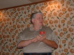
[Pictured above: Tom Frenaye, K1KI.]

Ham Radio Demo Volunteers Needed, January 10, 2004

USS Salem ARCW1AI writes:

“The USS Salem will be hosting its first group of scouts for 2004 on Saturday, January 10, 2004, from 3 to 6 p.m. I need 4+ volunteers so we can do the Morse code presentations and Radio 5 demos. Your help is needed, whether or not you have previous experience. We can show you everything you need to know.

I have to let the USS Salem know whether we have enough volunteers, so please let me know ASAP whether I can count you in! The only other weekend in January that the USS Salem has scouts scheduled is 1/31.

I am also still seeking a replacement volunteer coordinator. Please let me know if you might be interested.”

Thanks,

JC, W1AI

USS Salem K1USN Radio Club scouting program volunteer coordinator
W1AI@hamtestonline.com

UHF Repeater Test (2nd request)

EMa ARES Logo We request that you gather signal reports from the list of repeaters listed below. It should be fun, and take about a half hour.

Please list:

Your location and date/time
Whether home or mobile
List of repeaters worked
Power on input
Antenna type
Other comments (i.e. unusually good or bad location, weather, etc.)

Please send reports to w1mpn@ema.arrl.org

[Note: “446.725 is off the air at this instant. That will probably change in a day
or so”, per K1KWP 19 Jan 04 – W1MPN].

List of repeaters: (please press read more link button>>>)443.450-Westport Repeater PL: 88.5 Hz

443.700-Gloucester Repeater No PL Listed

444.200-Bourne Repeater PL: 118.8 Hz

445.175-Newton Repeater PL: 141.3 Hz

446.575-Boston Repeater PL: 88.5 Hz

449.925-Marlborough Repeater PL: 88.5 Hz Part of
MMRA System

446.725-Stoneham Repeater PL: 88.5 Hz Part
of MMRA System

447.075-Kingston Repeater PL: 88.5 Hz

447.175-Boston Repeater PL: 110.9 Hz

447.325-Truro Repeater PL: 88.5 Hz

447.575-Concord Repeater PL: 110.9 Hz

447.975-North Attleboro Repeater PL: 88.5 Hz

448.125-Framingham Repeater PL: 88.5 Hz

448.975-Walpole Repeater PL: 141.3 Hz

449.075-Waltham Repeater PL: 88.5 Hz

The following repeaters were considered Good location, good local coverage,
may have extended coverage and has linking capability (to either other
repeaters, IRLP, Echolink or a combination of each):

442.450-Westford Repeater PL: 88.5 Hz

443.350-Pack Monadnock, NH PL: 110.9 Hz

443.500-Dennis Repeater PL: 141.3 Hz Part
of Cape Cod Link Sys.

443.800-Dartmouth Repeater PL: 88.5 Hz

444.200-North Truro Repeater PL: 141.3 Hz

444.250-Falmouth Repeater PL: 141.3 Hz Part
of Cape Cod Link Sys.

445.175-Barnstable Repeater PL: 141.3 Hz Part
of Cape Cod Link Sys.

447.875-Brookline Repeater PL: 88.5 Hz Part
of MMRA/Has Echolink

446.675-Marlborough Repeater PL: 88.5 Hz Algonquin

The following repeaters have good location but unknown or questionable
coverage. Some of these repeaters may have IRLP or Echolink coverage:

441.075-Chelmsford Repeater PL: 100.0 Hz

441.400-Assonet Repeater PL: 192.8 Hz

441.400-Plymouth Repeater PL: 100.0 Hz

441.500-Medfield Repeater PL: 88.5 Hz

441.750-Seekonk Repeater PL: 192.8 Hz

441.850-Bradford Repeater PL: 127.3 Hz

442.250-Marlborough Repeater PL: 88.5 Hz -Has Echolink
capability

442.500-Braintree Repeater PL: 118.8 Hz

442.800-Danvers Repeater PL: 136.5 Hz

442.900-Pepperell Repeater PL: 100 Hz

443.200-North Andover Repeater PL: 88.5 Hz

443.600-Norwell Repeater PL: 88.5 Hz -Has Echolink
capability

444.100-Wilmington Repeater PL: 123.0 Hz

444.300-Saugus Repeater PL: 123.0 Hz

443.350-Fall River Repeater PL: 88.5 Hz

444.550-Bridgewater Repeater PL: 88.5 Hz

444.600-Newton Repeater PL: 88.5 Hz

444.700-Boston Repeater PL: 88.5 Hz

446.525-Reading Repeater PL: 151.4 Hz

446.875-North Reading Repeater PL: 88.5 Hz

446.925-Medford Repeater PL: 88.5 Hz

447.025-Peabody Repeater PL: 110.9 Hz

447.275-Haverhill Repeater PL: 88.5 Hz

447.625-Lawrence Repeater PL: 88.5 Hz

447.675-Natick Repeater PL: 203.5 Hz -RACES?

449.650-Belmont Repeater PL: 67.0 Hz

449.725-Cambridge Repeater PL: 114.8 Hz

449.825-Woburn Repeater PL: 136.5 Hz

Thanks in advance for your help.

Michael P. Neilsen, W1MPN, EMa SEC
978.562.5662 Voice
978.389.0558 FAX/Secondary Voice
http://ares.ema.arrl.org
w1mpn@ema.ares.org

Ahhh!!! Embarrassing Typo

K9HIMany of you spotted that embarrassing typographical error in my outgoing email to the ARRL Members List describing the Morse code survey. Lest everyone come away with the impression that their Section Manager is an ignoramus, I actually do know the difference between “partition” and “petition.” 😉

That’s what happens when you fire off email at midnight without properly proofing it.

73,

Phil Temples, K9HI

ARRL Section Manager,
Eastern Massachusetts Section

The Future of NTS/ARES

Hello everyone:

There are some comments in Gil’s letter below that I find very disturbing.
In particular, the comment about “handing the whole show to ARES.” Having
served as an EC, NM, STM, and SEC, as well as having dealt with ARES and
RACES organizations from the other side of the fence (as a Professional
Emergency Manager), I feel I have a fairly unique perspective.

On one hand, I agree that there is no harm integrating the Internet and
automated digital protocols into ARES and NTS. This is simply evolution and
progress. It needs to be done. However, it should be noted that these are
simply additional communications tools, whereas NTS is a methodology.
Please bear with me while I illustrate with an example:

During a recent bioterrorism response exercise in Central Michigan, the ARES
group repeatedly entered the Emergency Operations Center requesting
etiological information and other data from State and Federal public health
officials. In each case, the served agency representative asked some very
simple questions:

* “How’s requesting this information”
* “What time did he request it?”
* “What facility is he located at”
……..and on and on.

Finally, the local Emergency Manager walked into the ARES room, handed them
a book of radiogram blanks, and demanded they use them. He’s not a radio
amateur. As an exercise evaluator, I asked him what his reasons were for
doing so. The response was straightforward: “NTS format will insure we get
all of the necessary information in a consistent manner.”

As one who has had to rely on ARES and RACES groups to send messages at
HAZMAT scenes, during major disasters, and so forth, I can say without
equivocation that Amateur Radio has serious deficiencies. These may be
summarized as follows:

1. Most ARES groups are equipped (trained) only to handle informal tactical
communications in which they are the direct recipient of the information or
instructions. Many such organizations “fall apart” in net configuration
because the majority of members haven’t the least familiarity with proper
radiotelephone net procedures.

2. Most ARES groups are incapable of utilizing a standard message format for
accurately transmitting third party traffic. As such, important service
data is often lacking. A message recipient needs to know from whom and
where a message was originated. He needs to know when it was drafted. This
information is almost never available through ARES.

For over 30 years, I have seen numerous ARES groups and ARRL Sections bypass
NTS by creating ad-hoc “ARES Nets” to facilitate cross jurisdictional
message flow. Sometimes this is necessary to serve a unique, specialized
purpose, such as linking a number of Skywarn Nets. However, in most cases,
these nets serve only to avoid the use of a standard message format, which
many ECs and AECs are simply afraid to admit they don’t know.

If NTS were entirely supplanted by WINLINK and Internet message delivery
tomorrow, I am willing to bet my retirement income that the very same
problems will exist with message accuracy and content. Furthermore, new
problems will arise in that specific arrangements will not be made for
addressees to regularly check e-mail to accept messages in a timely fashion.
Isolated failures to the local telephone systems and ISPs would also result
in messages “disappearing” in time of emergency.

The simple fact is, ARES has repeatedly failed in a variety of message
handling tasks. Now, NTS is being blamed. We are told we aren’t keeping up
with the times. I say this is simple “bull.” If we want to get to the
bottom of this problem, I suggest the following, somewhat rhetorical
question: “Did the NTS fail the League, or did the League fail the NTS.”

Consider this:

———————-

For years the League has offered many recommendations for ARES
organizations, but has promulgated few, if any, minimum requirements for
member training and basic organizational capabilities. If your local
volunteer fire departments were run like many ARES groups, some would have
adequate hose, others wouldn’t. Some would have SCBA, others wouldn’t.
Some would have a few sets of turn-out gear, others would have too many.
This is why groups like the Red Cross, CAP, and even the Boy Scouts require
field units to meet certain basic requirements to maintain their Charter.
We do nothing of the kind, and the customer (served agencies) pays the price
in many cases.

——————-

For years, the League has done nothing to promote NTS or standard message
format. There are articles in QST on everything from collecting antique
radios and AM phone to the latest data modes, yet, rarely is NTS even
mentioned. When it is, it is usually about the nuts and bolts of layered
nets and how the various cycles work, as opposed to articles explaining how
NTS was applied to an actual ecom problem. One can’t help but ask how an
invisible organization can recruit or interest potential new members?

————————–

In Michigan, we have spent tens of thousands of dollars developing Packet
and PACTOR infrastructure. The result: Several Detroit area ECs told me,
“We don’t want anything to do with your g-d d–ned message handling
procedures.” They view any outside requirement as a threat to their power
and control. Nothing can be done to enforce standards because none exist.

So, this begs the question; Whether via WINLINK, packet, CW, or FM, how is a
message going to flow between a major Detroit Metropolitan Area hospital and
our State Public Health Department or State EMA in the abscence of
commercial/government infrastructure? My bet….it isn’t. If it does, it
will be incomplete, confusing, and perhaps even garbled.

In my opinion, the League failed NTS as opposed to the other way around.
The current NTS situation is simply a display of symptoms caused by an
underlying disease affecting the ARRL community. If the ARRL wants to do
something about the disease, they need to take some serious actions that
have little to do with NTS. Some steps may include:

1. Develop an ARES Certification Program. A local ARES group would have to
meet certain minimum standards to be “certified.” This might include:

* a specific percentage of individuals properly trained (ARRL CCE courses
or??).
* mandatory annual participation in SET on the standard date specified.
* daily NTS liaison.
* specific communications capabilities above and beyond two-meter FM.

The audit would be performed by an independent third party or someone
appointed by the SM or SEC.

2. Further implement the ARESMAT process so that “weak” ARES programs could
be supplemented with outside skills and capabilities. Require ARESMAT
capabilities be available throughout all Sections.

3. While integrating WINLINK and similar automated systems, recognize the
fact that messages may have to leave these systems to be transferred to a
manual method for ultimate delivery. Keep a framework for maintaining
“traditional” mode nets, such as NTS CW, SSB, and FM nets. In addition,
maintain a standard format for all official communications, regardless of
the mode utilized.

4. Recognize the fact that for digital methods to work reliably in time of
emergency, some things have to be standardized, such as mode and baud rate,
terminal software, and so forth. It will therefore be necessary to insist
that each ARES group develop a capability to utilize a standard digital mode
and deploy standardized software before developing additional capabilities.
This may be part of the certification process.

3. When the Field Organization Management Structure is revised, enforce it
for a change! More than likely, had NTS nets been utilized as intended and
defined in the Field Organization management chart (to facilitate message
flow between ARES groups), NTS would have likely grown and evolved to meet
current demands. Because the management structure was consistently
undermined, NTS was never pressured by demand into a state of natural
evolution.

As a side note….does anyone think that an employee of a business or
government agency of a size and budget similar to the ARRL has the same
discretion as an SM to violate and bypass the basic structure of the
business organization? Case in point: Look at the SMs currently
eliminating the STM position without the Board having yet approved the VRC
recommendations!

4. The continued existence of NTS is not incompatible with the development
of additional digital capabilities. It should be kept and encouraged to
function. However, it must work with ARES. Therefore, if the SEC or SM is
placed in charge of Section message handling capabilities, then he/she
better insure that the ARES programs and a cadre of members have minimal
familiarity with it.

In conclusion, and I’ve said it before: Some may think NTS is obsolete, but
the “shadow” is dead as well. The days of the radio amateur shadowing an
official at a disaster scene with a two-meter HT and shouting inaccurate,
unrecorded communications across a command post or an EOC is heading the way
of the passenger pigeon far more quickly than NTS.

Individuals can blame NTS all they want, but they should be forewarned; a
failure to deal with basic training and preparedness issues at the local
level will kill Amateur Radio emergency communications just as quickly as a
failure to address NTS issues.

73,
Jim Wades, WB8SIW

School Clubs Seek Ham Equipment Donation

Two school clubs are seeking donations of ham equipment, according to “Skip” Denault, KB1CNB. “There are two school radio clubs with 20 or so potential new hams that would really benefit from the loan or donation of your unused equipment.” The school clubs are: the TBC (Third Baptist Christian) ARA (KB1KLG) and the New Testament Knights ARC (KB1KLE). The clubs are located in Fall River and Norton, respectively.

KB1CNB explains that 2-meter and HF radios, power supplies, coax, code keys and oscillators are most welcome. “Anything else that you have will be useful as well. Items in working condition are preferred, but ‘d.o.a.’ is okay.”

Denault reminds everyone that equipment donations to the school clubs are tax deductable. Skip Denault can be contacted at skip@newtestamentschool.org.

Items may be dropped off at a Bristol County RA meeting.

Kids Day Operation January 4

NC1N writes on the framinghamara-l:

Tomorrow (Sunday, January 4, 2004) features the semi-annual Kids Day operating event from 1800-2400Z.

If you have a few moments to get on HF, there will be kids around the country looking for a taste of ham radio. Typically, the kids are unlicensed and young, operating under the watchful guidance of a proud parental control operator.

If you have a few moments from 1 to 7 PM tomorrow, consider firing up the rig and giving out a Q.

NC1N will be on the air from time to time during the event with my two sons at the microphone.

Suggested Frequencies: 28350 to 28400 kHz, 21380 to 21400, 14270 to 14300 kHz and 2-meter repeater frequencies with permission from the repeater sponsor. Suggested exchange: Name, age, location and favorite color. You are encouraged to work the same station again if an operator has changed. Full rules can be found at http://www.arrl.org/FandES/ead/kd-rules.html.

New England Area Ham-Electronics Flea Market 01/01/2004

New England Area   Ham - Electronic  Flea Market  ***  DATES  *** 2004 P 1 of 2
All events are Ham Radio/ Electronic related except ~_____~
*******************************************************************************
2004 Contact Source
~~~~~~~~~~~~~~~~~~~~~~~~~~~~~~~~~~~~~~~~~~~~~~~~~~~~~~~~~~~~~~~~~~~~~~~~~~~~~~~
17 Jan Nashua NH NE Antique RC $15/T@7 $2@9 @StStan's Marty 603 938 5051 F

7 Feb Windsor CT VintgeR Museum @33MechanicsSt $12/T@8AM John 860 673 0518 +

14 Feb Marlboro MA AARC @MS $3@9 $15/T@7 Ann KA1PON 508 481 4988

14 Feb Chelsea ME AARA Bill K1NIT 207 623 9075 A+

15 Feb Westford MA GBARC Radio35 Antique @Regency $8@8 Pat ARC 866 371 0512 F+

28 Feb Milton VT RANV+ARRL Vt Conv @HS $10@6:30 $5@8 Mitch W1SJ 802 879 6589 W

29 Feb Hicksville NY LIMARC @LevitHall $6@9 $25/T@8 Diane K2DO 631 286 7562 W

20 Mar Pomfret CT ECARC @ComSch Rt169+101 $2@8 $10/T Paul KE1LI 860 928 2456

27,28 Mar Timonium MD GBARC @FG Doug N3VEJ 410 256 0257 F

27 Mar Lewiston MA AARC @Ramada $5@8 $8/T Rick N1WFO 207 784 1266 A+

28 Mar Henniker NH CVRC @CommSch $3@8 $10/T@7 Jim NS1E 603 428 7436 +17 April Nashua NH NE Antique RC $15/T@7 $2@9 @StStan's Marty 603 938 5051 F

17 April S Portland ME PAWA @AmLeg $5@8 $10/T Bryce K1GAX 207 799 1116 W+

17 April Montreal PQ MARC @RCLeg $4@7:30 $8/T@7:30 James VE2VE 514 697 7205 W+

18 April Cambridge MA FLEA at MIT Nick 617 253 3776 F
Third Sunday April thru October

24-25 April Waltham MA Photographica @HS ~photo~ Ed Shaw 617 965 0807 +

25 April Southington CT SARA @HS $5@9 $18@6:30 Alex KB7HCO 860 214 3013 F

30 Ap, 1 May Hopkinton NH HossTraders @FG x7 I89 Joe K1RQG 207 469 3492

16 May Cambridge MA FLEA at MIT Nick 617 253 3776 F

4-6 June Rochester NY Atlantic Div Conv Harold K2HC 585 424 7184 A

5 June Windsor CT VintgeR Museum @33MechanicsSt $10/S@6AM John 860 673 0518 +

5 June Herman ME PSARC Roger KA1TKS 207 848 3846 A+

6 June Bethpage NY LIMARC Brian WB2YMC 631 286 7562 A

13 June Queens NY HoSARC Stephen WB2KDG 718 898 5599 A+

20 June Cambridge MA FLEA at MIT Nick 617 253 3776 F

17 July Nashua NH NE Antique RC $15/T@7 $2@9 @StStan's Marty 603 938 5051 F

18 July Cambridge MA FLEA at MIT Nick 617 253 3776 F

~~~~~~~~~~~~~~~~~~~~~~~~~~~~~~~~~~~~~~~~~~~~~~~~~~~~~~~~~~~~~~~~~~~~~~~~~~~~~~~
LAST UPDATE 1-1-04 de W1GSL http://mit.edu/w1gsl/Public/ne-fleas P 1 of 2
*******************************************************************************
Additions/ Corrections via e-Mail w1gsl@mit.edu ***
Page 3 Electronic distribution only. This page has the overflow if any P3
from the paper version.
*******************************************************************************
2004 Contact Source
~~~~~~~~~~~~~~~~~~~~~~~~~~~~~~~~~~~~~~~~~~~~~~~~~~~~~~~~~~~~~~~~~~~~~~~~~~~~~~~
~~~~~~~~~~~~~~~~~~~~~~~~~~~~~~~~~~~~~~~~~~~~~~~~~~~~~~~~~~~~~~~~~~~~~~~~~~~~~~~
LAST UPDATE 1-1-04 de W1GSL P 3
List is normally updated twice a month - look for the latest version
Additions/ Corrections via Internet w1gsl@mit.edu
US Mail W1GSL POB 397082 MIT Br Cambridge MA 02139
(c)2004 W1GSL SASE for updated copy as issued.
unlimited reproduction permitted in entirety
*******************************************************************************

This list has been posted... as a service of the individual home page
owners, to the following WWW sites.

http://flealist.senie.com/
http://mit.edu/w1gsl/Public/ne-fleas
http://www.k1ttt.net/flea.html
http://www.connix.com/~wz1v/ne-fleas.html
http://www.k1dwu.net/flealist.html
http://www.mmra.org/~mmra/flealist.htm
http://www.qsl.net/vhfnews/ne-fleas.html
http://uhavax.hartford.edu/~newsvhf/ne-fleas.html

List is normally updated twice a month - look for the latest version

Be sure to check for the latest version as updating is under the control
of the page owner.

* You can have the list e-mailed directly to you as it is updated. *
* Just send a request to be added to the distribution to w1gsl@mit.edu *

73 Steve F
W1GSL

***********************************************************************
New England Area Ham - Electronic Flea Market *** DATES *** P4
Links to New England Hamfest Web Sites (c) 2004 W1GSL
***********************************************************************
This section is only included in the electronic distribution.

Cambridge MA Flea at MIT http://www.swapfest.us +

Hopkinton NH Hosstraders http://www.qsl.net/k1rqg/

Amherst MA Mt. Tom ARC http://www.mtara.org/hamfest/flea.html

Adams MA N BerkshireARC http://www.nobarc.org/hamfest

Boxborough MA NE ARRL Conv http://www.boxboro.org/

Framingham MA FARA http://www.fara.org/

Newton MA Waltham ARA Auction http://www.wara64.org/auction/

S Dartmouth MA SEMARA http://www.semara.org/flea/fleamkt.htm +

Whately MA FranklinCARC http://www.fcarc.org/flea.html

Enfield CT VHF/UHF Conf http://www.newsvhf.com +

Southington CT SARA http://www.chetbacon.com/sara.htm

Wallingford CT Nutmeg CT Conv http://www.qsl.net/nutmeghamfest/

Lewiston ME AARC http://www.dlois.com/mainearrl/convent.htm

Portland ME PAWA http://www.qsl.net/pawa/fleamarket.html +

Henniker NH CVRC http://www.qsl.net/k1bke/ +

Bergen NJ BARA http://www.bara.org/

Lake Placid NY NNY ARA http://www.geocities.com/nnyara/

Lindenhurst NY ToB ARES http://www.tobares.org/hamfest.html +

Long Island NY LIMARC http://www.limarc.org/fest.htm +

Massapequa NY GSB ARA http://www.gsbarc.org/flyermay03.pdf +

Queens NY Hall of Science http://www.qsl.net/hosarc/hamfest.html

Rochester NY AWA http://www.antiquewireless.org/

Greenwich RI Fidelity ARC http://users.ids.net/~newsm/dates.html

Essex Junction VT Burlington ARC http://www.vtstetson.net/fest02.pdf

Milton VT RANV VT Conv http://www.ranv.org/milton.html

Montreal PQ MARC http://www.marc.qc.ca/fest/fest.html +

Montreal PQ WIARC http://www.pubnix.net/wiarc/hamfest.htm

Montreal PQ MS-SARC http://www.ve2clm.ca/hamfesta.htm

Sorel-Tracy PQ CRAS-T http://www.hamfest.qc.ca/

St Therese PQ CRALL http://www.ve2crl.qc.ca/hamfest2002.htm

Canada RAC List http://rac.eton.ca/data/racfleas.taf?function=form

Phila. Area VARA List http://www.qsl.net/w2vtm/hamfest.html +

USA ARRL List http://www.arrl.org/hamfests.html