Traffic Handling Training on the Air!

A new traffic handling training net will begin on Thursday evenings at 8 p.m., beginning February 13th, on the Falmouth repeater (146.655, no tone).
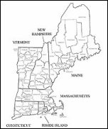
 This is an excellent method to learn about traffic handling. It’s also excellent training for RACES/ARES groups. Many thanks to Mark, W2EAG for leading this effort, and to the Falmouth Amateur Radio Association for hosting the net.

——————————————————————–
ARRL Eastern Massachusetts Section
Section Manager: Phillip Temples, K9HI
k9hi@arrl.org

“Marconi Work Party”

Marconi work partyK1VV writes:

We were at Coast Guard Beach all day on Sunday the 12th … final work on the antennas … jacked up the H.F. masts … installed the 160 & 80 meter dipoles … set up the R8 and 2 meter antennas …… networking computers .. IRLP … Satellite …. Packet …

Watch the W1AA web page for more photos to be posted over the next few days …. http://personal.tmlp.com/k1vv/w1aa/w1aa_1001.htm . Most will be on page 8 ….

Bob Doherty K1VV

HF Nets now part of Monthly RACES Net – From N1CPE

Hello and Happy New Year to All!

I’d like to announce formally that we have been and plan to continue to operate HF nets in conjunction with our monthly First Monday RACES nets across the state.

These Nets convene at 7pm local time on or about 3.943 MHz, and 7.245 MHz LSB on the first Mondays of every month for those stations or communities that wish to test their HF equipment regularly. In addition these frequencies may be activated during RACES or ARES activations in Massachusetts.

At times, noise and other conditions may interfere with these nets. Our team of HF Net control stations will do their best to convene the nets, and pass any official or other traffic as needed.

Thanks to our team of HF net control stations: Marc WA1R, Chatmon WA1FIR, Steve W3EVE and Jerry AA2T.

Tomorrow night, January 6 at 7pm these nets will convene, as will local VHF nets at their appointed times.

73,

-Tom Kinahan N1CPE

Winter ARES Exercise Call for Players

ARES logo
***** Winter Exercise Scheduled for Saturday February, 8, 2003 *****
***** Announcing a Call for Players from the ARES community,
and from Clubs in the Section *****
***** Proposed Play for the Exercise *****

Happy New Year to all of you, and I hope that the year brings happiness and prosperity to you and your family.

The ARES leadership has scheduled a Winter Quarter exercise for Saturday February 8, 2003. The exercise will be an EOC to EOC emergency communications exercise using a similar approach as the November exercise, but implementing improvements suggested in critique sessions. We will also use a major winter storm scenario to add realism and purpose.Due to the time of the year, the field component prominent in the November SET will not be exercised. Additionally, the relatively quick follow on was in response to many of you who suggested doing a similar exercise as soon as possible.

ARES members, ARESMAT teams, Club Emergency response teams, town and city RACES officers, and individuals are invited to play in this exercise. Official RACES participation is not expected, but always welcome.

** Concept **

Teams and clubs are asked to set up a physical EOC and operators for the exercise. Ideally, several of these will be set up in each district. Due to the time of year, all exercise activities will be carried out in these locations. Obviously, EOC’s must be heated and lighted, and available for amateur use that day. Public Service Agencies are welcome to participate to any extent they wish. Please remember that most EMA personnel may not choose to participate because as it is a Saturday. They are, however, most welcome to participate if they so desire.

The exercise will consist of establishing contact with other EOC’s within and without your district, and then passing various traffic. Most traffic will be from simulated agency officials in each EOC, and some will consist of urgent traffic. We will “pick up” where we left off in November. Most importantly, we will strive to improve our ability to establish communications, set up effective net controls, and efficiently pass NTS traffic. We will implement many of the suggestions you forwarded such as revising the frequency plans with more local emphasis, setting up more planned activities during the day (i.e. “envelopes” or timed activities), and allowing use of some repeater assets. There was some discussion about adding more complexity and extending the exercise period, but no decision has been made as of yet.

** Schedule **

Please discuss participation with your clubs and interested individuals as soon as possible during the month. If you have any suggestions, please forward them as soon as you can. If you would like your DEC or me to answer questions at your meeting, please don’t hesitate to ask.

The DEC’s and I meet a week from Saturday on January 11 to finalize plans. An exercise plan will then be available about a week later. The district frequency plan will appear separately about a week before the exercise.

I will send an update shortly after the staff meeting on the 11th. Let’s work together toward a successful exercise!

s/Michael P. Neilsen

Michael P. Neilsen, W1MPN
Section Emergency Coordinator
Eastern Massachusetts Section
Pager: 1-800-759-8888 PIN 1155084
Admin: w1mpn (symbol for at) arrl.net
978-562-5662 Primary/Voice Mail
978-389-0558 FAX/ EFax Voice Mail

Coastal Flood Warning

COASTAL FLOOD WARNING
NATIONAL WEATHER SERVICE TAUNTON MA
505 AM EST SAT JAN 04 2003

…A COASTAL FLOOD WARNING HAS BEEN ISSUED FOR EAST COASTAL MASSACHUSETTS…

FOR EAST COASTAL MASSACHUSETTS THIS INCLUDES GLOUCESTER HARBOR…BOSTON
HARBOR…SCITUATE…PROVINCETOWN…CHATHAM OUTER HARBOR.

GALE FORCE NORTHEAST WINDS CONTINUE EARLY THIS MORNING. THE PERSISTANT EAST TO NORTHEAST WINDS HAVE CAUSED THE OCEAN WATERS TO PILED UP ALONG THE EAST COAST OF MASSACHUSETTS AND TIDES THIS MORNING ARE RUNNING UP TO TWO AND ONE HALF FOOT ABOVE NORMAL. TIDES WILL CONTINUE TO RUN FROM TWO TO TWO AND ONE HALF FEET ABOVE NORMAL THROUGH TODAYS MID DAY HIGH TIDE. THE ABOVE NORMAL TIDE COMBINED WITH 15
FOOT WAVES CRASHING ONSHORE…WILL LIKELY RESULT IN MINOR COASTAL FLOODING. A FEW OF THE MORE VULNERABLE LOCATIONS COULD EXPERIENCE MODERATE FLOODING.

THE FOLLOWING IS LIST OF THE MOST LIKELY LOCATIONS TO EXPERIENCE COASTAL FLOODING.

&&

STORM TIDE FORECASTS FOR THE FOLLOWING LOCATIONS ARE IN FEET MEAN LOWER LOW
WATER. TIME OF HIGH TIDE HAS BEEN ROUNDED TO THE NEAREST HOUR.
SITE FLOOD TIME OF FORECAST
STAGE HIGH TIDE STORM TIDE

EAST COASTAL MASSACHUSETTS
GLOUCESTER HARBOR 11.5 12 PM SAT 11.9
BOSTON HARBOR 13.5 12 PM SAT 13.5
SCITUATE 12.5 12 PM SAT 12.6
PROVINCETOWN 12.0 12 PM SAT 12.4
CHATHAM OUTER HARBOR 9.0 12 PM SAT 9.5

OTHER LOCATIONS ALONG THE EAST COAST OF MASSACHUSETTS THAT
COULD EXPERIENCE MINOR COASTAL FLOODING OR SPLASH OVER.

NEWBURYPORT 10.5 12 PM SAT 9.6
MARBLEHEAD 12.8 12 PM SAT 12.6
PLYMOUTH 14.3 12 PM SAT 13.3
SANDWICH 12.0 12 PM SAT 11.0

A COASTAL FLOOD WARNING MEANS THAT THE COASTAL FLOODING IS IMMINENT. ANYONE
WITH INTERESTS ALONG THE COAST INCLUDED IN THIS WARNING MUST TAKE ACTION NOW TO
PROTECT PROPERTY. THE COMBINATION OF LARGE SURF AND HIGH TIDES WILL RESULT IN
FLOODING OF ROADWAYS AND ALTERNATE ROUTES MAY BE NEEDED.

$$

Winter Storm Warning, Again!

URGENT – WINTER WEATHER MESSAGE
NATIONAL WEATHER SERVICE TAUNTON MA
618 PM EST FRI JAN 3 2003

CTZ002-003-MAZ002>005-008>012-NHZ011-012-040441-
CHESHIRE NH-EASTERN FRANKLIN MA-EASTERN HAMPDEN MA-
EASTERN HAMPSHIRE MA-HARTFORD CT-HILLSBOROUGH NH-
NORTHERN WORCESTER MA-SOUTHERN WORCESTER MA-TOLLAND CT-
WESTERN FRANKLIN MA-WESTERN HAMPDEN MA-WESTERN HAMPSHIRE MA-
WESTERN MIDDLESEX MA-
618 PM EST FRI JAN 3 2003

..WINTER STORM WARNING THROUGH SAT AFTERNOON FOR S. NEW HAMPSHIRE THE WEST & CENTRAL PORTION OF MASSACHUSETTS & NORTH
CENTRAL CONNECTICUT…

A MAJOR WINTER STORM IS IN PROGRESS ACROSS INTERIOR S. NEW ENGLAND.

THE FIRST BAND OF HEAVY SNOW DUMPED BETWEEN 3 & 8 INCHES OF SNOW IN ABOUT 4 HOURS THIS AFTERNOON.

THE NEXT BATCH OF HEAVY SNOW IS ON ITS WAY & WILL POUND THE AREA BETWEEN 730 PM & 330 AM. TEN TO 20 INCHES IS FORECAST TO COVER MUCH OF THE WARNING AREA BY MORNING WITH HEAVIEST FROM THE
MONADNOCKS INTO THE NW HALF OF MASSACHUSETTS.

STORM TOTALS OF 10 TO POSSIBLY 15 INCHES ARE EXPECTED FROM LOWELL TO SPRINGFIELD & NORTHAMPTON IN MASSACHUSETTS DOWN INTO THE NW CORNER OF HARTFORD COUNTY.

THE MIXED PRECIPITATION ZONE FROM HARTFORD TO STURBRIDGE &
WORCESTER WILL SEE SNOW CHANGE TO SLEET FOR A TIME BETWEEN 8 PM &
11 PM. THIS WILL LIMIT AMOUNTS TO SOMEWHERE BETWEEN 6 & 12 INCHES
TONIGHT ALONG & JUST NORTH OF THIS INTERSTATE 84 CORRIDOR.

AMOUNTS IN S. HARTFORD COUNTY & S. TOLLAND COUNTY
SHOULD REMAIN BETWEEN 5 & 7 INCHES…AS SLEET & FREEZING RAIN
BECOME PREDOMINANT THIS EVENING.

INCREASING WINDS WILL CAUSE BLOWING & DRIFTING SNOW…ALONG WITH
LOW VISIBILITIES. SCATTERED POWER OUTAGES ARE EXPECTED TOWARD
MIDNIGHT AS WINDS STRENGTHEN & COMBINE WITH ICE OR WET SNOW
ACCUMULATION TO BREAK SOME TREE BRANCHES.

BACKLASH SNOW TOMORROW WILL BRING AN ADDITIONAL 1 TO 5 INCHES BUT
THE WORST OF THIS STORM IS OCCURRING TONIGHT.

CONSIDER POSTPONING TRAVEL UNTIL CONDITIONS IMPROVE SOMETIME
TOMORROW. IF YOU MUST BE OUT ON THE ROADS…ALLOW PLENTY OF TIME TO
REACH YOUR DESTINATION.

$$

CTZ004-MAZ006-007-013>016-RIZ001-040443-
EASTERN ESSEX MA-EASTERN NORFOLK MA-NORTHWEST PROVIDENCE RI-
SOUTHEAST MIDDLESEX MA-SUFFOLK MA-WESTERN ESSEX MA-
WESTERN NORFOLK MA-WINDHAM CT-
618 PM EST FRI JAN 3 2003

..WINTER STORM WARNING THROUGH SAT AFTERNOON…

AN INTENSIFYING NOREASTER HAS BROUGHT A SHORT PERIOD OF HEAVY SNOW
TO NE CONNECTICUT & THE HILLS OF NW RHODE ISLAND
WITH 2 TO 4 INCHES THERE. THE IMMEDIATE BOSTON AREA HAS YET TO SEE
SUBSTANTIAL SNOW BUT THAT SHOULD CHANGE FOR A FEW HOURS LATE THIS
EVENING.

THE WARM OCEAN AIR MAY KEEP AMOUNTS LESS THAN FORECAST IN BOSTON &
CAPE ANN BUT PRECIPITATION IS EXPECTED TO CHANGE BACK TO A PERIOD OF
HEAVY WET SNOW THIS EVENING BEFORE CHANGING TO SLEET OR RAIN
OVERNIGHT.

SOME BACKLASH SNOW IS EXPECTED TOMORROW SO THAT STORM TOTALS SHOULD
BE SOMEWHERE BETWEEN 4 & 8 INCHES IN THE REGION FROM BOSTON TO
WOONSOCKET & WILLIMANTIC.

MOTORISTS ARE URGED TO PAY SPECIAL ATTENTION TO THE CHANGING ROAD
CONDITIONS…AND BE AWARE OF SLIPPERY ROADS DUE TO THE WIDE VARIETY
OF WEATHER IN THE AREA.

$$

MAZ017>019-RIZ002>004-040443-
EASTERN KENT RI-EASTERN PLYMOUTH MA-NORTHERN BRISTOL MA-
SOUTHEAST PROVIDENCE RI-WESTERN KENT RI-WESTERN PLYMOUTH MA-
618 PM EST FRI JAN 3 2003

..WINTER WEATHER ADVISORY THIS EVENING FOR THE PROVIDENCE AREA INTO
SOUTHEAST MASSACHUSETTS…

PRECIPITATION MAY CHANGE BACK TO SNOW OR SLEET AGAIN FOR A COUPLE OF
HOURS THIS EVENING BRINGING A QUICK 1 TO 4 INCHES SLUSHY
ACCUMULATION.

IF IT DOESNT CHANGE BACK TO SNOW BY 10 PM…THEN SNOWFALL WILL BE
LESS THAN FORECAST. THE MOST LIKELY AREA TO RECEIVE ADVERSE WINTRY
WEATHER THIS EVENING IS IMMEDIATE N. & WESTERN SUBURBS OF
PROVIDENCE TO NEAR BROCKTON & HINGHAM.

A WINTER WEATHER ADVISORY IS ISSUED FOR A VARIETY OF WINTER WEATHER
CONDITIONS…INCLUDING SNOW OR SLEET ACCUMULATING NEAR 4 INCHES…OR
COMBINED WITH SOME FREEZING RAIN.

$$
DRAG


To make changes to your email profile or to unsubscribe
Go to….
http://www.emergencyemailnetwork.com
or…
http://www.emergencye.com

High Wind Warning and Flood Advisory Coastal Areas

WWUS71 KBOX 032040
NPWBOX

URGENT – WEATHER MESSAGE
NATIONAL WEATHER SERVICE TAUNTON MA
338 PM EST FRI JAN 3 2003

MAZ007-015-016-019-040229-
EASTERN ESSEX MA-EASTERN NORFOLK MA-EASTERN PLYMOUTH MA-SUFFOLK MA-
338 PM EST FRI JAN 3 2003

…HIGH WIND WARNING FROM 9 PM TO 5 AM SATURDAY MORNING FOR EASTERN COASTAL MASSACHUSETTS REMAINS IN EFFECT…

A DEVELOPING NOREASTER WILL BRING SEVERAL HOURS OF SUSTAINED WINDS NEAR 40 MPH…WITH GUSTS TO 50 TO 60 MPH…TO PORTIONS OF THE EASTERN MASSACHUSETTS COAST TONIGHT.

THIS WARNING INCLUDES THE CITY OF BOSTON…ALONG WITH THE TOWNS OF NEWBURYPORT…GLOUCESTER…MARBLEHEAD…REVERE…HINGHAM…MARSHFIELD AND PLYMOUTH.

THE STRONGEST WIND IS LIKELY TO OCCUR BETWEEN 9 PM AND 4 AM.

THE WIND COMBINED WITH WET SNOW CHANGING TO HEAVY SLEET OR RAIN IS LIKELY TO CAUSE SCATTERED POWER OUTAGES DURING THE NIGHT.

STRONG AND GUSTY WINDS WILL MAKE IT DIFFICULT TO DRIVE…ESPECIALLY
HIGH PROFILE VEHICLES SUCH AS VANS…RECREATIONAL VEHICLES AND
TRACTOR TRAILERS. BE CAREFUL WHEN DRIVING OVER BRIDGES OR OVERPASSES.

$$

MAZ004>006-012>014-017-018-020>024-RIZ001>007-040229-
BARNSTABLE MA-BRISTOL RI-DUKES MA-EASTERN KENT RI-NANTUCKET MA-
NEWPORT RI-NORTHERN BRISTOL MA-NORTHERN WORCESTER MA-
NORTHWEST PROVIDENCE RI-SOUTHEAST MIDDLESEX MA-
SOUTHEAST PROVIDENCE RI-SOUTHERN BRISTOL MA-SOUTHERN PLYMOUTH MA-
SOUTHERN WORCESTER MA-WASHINGTON RI-WESTERN ESSEX MA-WESTERN KENT RI-
WESTERN MIDDLESEX MA-WESTERN NORFOLK MA-WESTERN PLYMOUTH MA-
338 PM EST FRI JAN 3 2003

…WIND ADVISORY THIS EVENING THROUGH EARLY SATURDAY MORNING FOR
EASTERN AND CENTRAL MASSACHUSETTS AND ALL OF RHODE ISLAND REMAINS IN
EFFECT…

A DEVELOPING NOREASTER WILL BRING SEVERAL HOURS OF SUSTAINED
NORTHEAST WINDS BETWEEN 25 AND 35 MPH WITH SCATTERED GUSTS OF 45 MPH.

THE NORTHEAST WIND COMBINED WITH HEAVY WET SNOW FROM THE MERRIMACK
VALLEY TO WORCESTER COUNTY AND INTERIOR EASTERN MASSACHUSETTS IS
LIKELY TO CAUSE SCATTERED POWER OUTAGES.

THE STRONGEST WIND ALONG THE SOUTH COAST IS EXPECTED BETWEEN 8 PM
AND MIDNIGHT WHERE IT WILL BE RAINING HEAVILY…AND ELSEWHERE
BETWEEN MIDNIGHT AND 5 AM WHERE OCCASIONALLY HEAVY SNOW MAY BE MIXED
WITH SLEET.

TRAVEL TONIGHT IS GOING TO BE VERY DIFFICULT ESPECIALLY FROM BOSTONS
WESTERN SUBURBS TO WORCESTER AND LOWELL.

ANY BOATERS OR FISHERMEN MIGHT CONSIDER POSTPONING THEIR OUTINGS DUE
TO THE HIGH WINDS…OR PLEASE USE EXTREME CAUTION ON THE WATERS.

$$

NOCERA


SKYWARN Ops Possible

—–Original Message—–
From: weather@ndws.com [mailto:weather@ndws.com]On Behalf Of
rmacedo@rcn.com
Sent: Friday, January 03, 2003 10:12
To: Mike Neilsen
Subject: [coordinators-box] Possible Formal SKYWARN Activation With
Ops???? {01}

Hello to all…

Latest AFD from NWS Taunton may prompt formal SKYWARN Activation with Ops
at NWS Taunton due to the high wind warning and coastal flood watch. Again,
it might be a staggered operation with ops late this afternoon and tonight
and then reconvene operations Saturday Morning into early afternoon. If
current AFD plans hold, will call NWS to determine our plan.

Winter Exercise Call for Players

***** Winter Exercise Scheduled for Saturday February, 8, 2003 *****
***** Announcing a Call for Players from the ARES community,
and from Clubs in the Section *****
***** Proposed Play for the Exercise *****

Happy New Year to all of you, and I hope that the year brings happiness and prosperity to you and your family.

The ARES leadership has scheduled a Winter Quarter exercise for Saturday February 8, 2003. The exercise will be an EOC to EOC emergency communications exercise using a similar approach as the November exercise, but implementing improvements suggested in critique sessions. We will also use a major winter storm scenario to add realism and purpose. Due to the time of the year, the field component prominent in the November SET will not be exercised. Additionally, the relatively quick follow on was in response to many of you who suggested doing a similar exercise as soon as possible.

ARES members, ARESMAT teams, Club Emergency response teams, town and city RACES officers, and individuals are invited to play in this exercise. Official RACES participation is not expected, but always welcome.

** Concept ** Teams and clubs are asked to set up a physical EOC and operators for the exercise. Ideally, several of these will be set up in each district. Due to the time of year, all exercise activities will be carried out in these locations. Obviously, EOC’s must be heated and lighted, and available for amateur use that day. Public Service Agencies are welcome to participate to any extent they wish. Please remember that most EMA personnel may not choose to participate because as it is a Saturday. They are, however, most welcome to participate if they so desire.

The exercise will consist of establishing contact with other EOC’s within and without your district, and then passing various traffic. Most traffic will be from simulated agency officials in each EOC, and some will consist of urgent traffic. We will “pick up” where we left off in November. Most importantly, we will strive to improve our ability to establish communications, set up effective net controls, and efficiently pass NTS traffic. We will implement many of the suggestions you forwarded such as revising the frequency plans with more local emphasis, setting up more planned activities during the day (i.e. “envelopes” or timed activities), and allowing use of some repeater assets. There was some discussion about adding more complexity and extending the exercise period, but no decision has been made as of yet.

** Schedule ** Please discuss participation with your clubs and interested individuals as soon as possible during the month. If you have any suggestions, please forward them as soon as you can. If you would like your DEC or me to answer questions at your meeting, please don’t hesitate to ask.

The DEC’s and I meet a week from Saturday on January 11 to finalize plans. An exercise plan will then be available about a week later. The district frequency plan will appear separately about a week before the exercise.

I will send an update shortly after the staff meeting on the 11th. Let’s work together toward a successful exercise!

s/Michael P. Neilsen

Michael P. Neilsen, W1MPN
Section Emergency Coordinator
Eastern Massachusetts Section
Pager: 1-800-759-8888 PIN 1155084
Admin: w1mpn (symbol for at) arrl.net
978-562-5662 Primary/Voice Mail
978-389-0558 FAX/ EFax Voice Mail

WPI WA License Class Begins January 9, 2003

WPI Wireless Assn
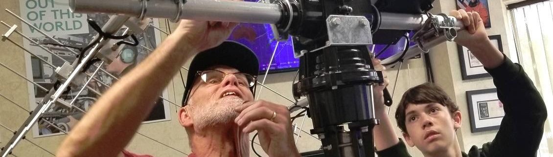
The Worcester Polytechnic Institute Wireless Association is offering a Ham Radio class to help you prepare for the examination to earn your beginner-level Ham Radio license. Join us and learn what Amateur Radio is all about!

When:

Wednesday & Thursday evenings from 6:30 to 8:30PM
from Thursday, January 9th, 2003 until
Thursday, February 20th, 2003

Where:

WPI’s Kaven Hall

Cost:

$25 for textbook and materials

Contact:

John Ruggiero, WPI Wireless Association
Phone: (508) 831-5446
E-Mail: hamclass@wpi.edu

Please Register by January 3, 2003!

73’s
Rob
KB1GNC
http://kb1gnc.vze.com