CCARES Weekend Exercise

Frozen Canal

Operation Artic Chill

[Frozen Cape Cod Canal photo courtesy of W1MPN
Click on photo to enlarge in your browser window.]

Happy WQ1O 
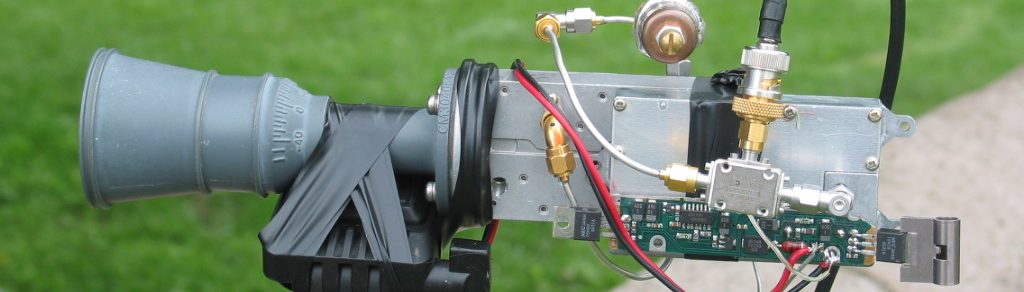
A happy WQ1O, CCARES DEC, presided over his “Operation Arctic Chill” exercise on Sat 1/31. Based at the Sandwich EOC, team members established comms around the entire Cape Cod district (including Martha’s Vinyard and Nantucket Islands) using pre-planned 2m, 6m, and HF frequencies. NVIS quick deploy antenna systems were used for HF comms.

Please press “Read More” button to read the after action report and view some pictures. [Work on this piece is in progress – W1MPN] [WQ1O photo courtesy of W1MPN
Click on photo to enlarge in your browser window.] CCARES Exercise #18 “Operation Arctic Chill” After Action Report

The exercise began at 10am will the following EOC stations:

1. CCARES EOC Hyannis

2. Sandwich EOC

3. Falmouth EOC

4. Martha’s Vineyard EOC

5. Nantucket EOC

The CCARES primary operations Net was established on the RACES repeater 146.955. A resource Net was established on the Falmouth Repeater 146.655. An NVIS callup was started on 7232khz. NTS mesages were initialized just after 10am. Many messages were passed between EOC stations. Several home stations were used for relay and liaison purposes. 6m FM was established for backup long range district wide operations. Operations ended about 12:15pm as stated goals were met.

Sandwich EOC Evacuation and Field Operations

At just after 11am, a simulated evacuation was begun at the Sandwich EOC. Vehicles were designated for 30 minute intervals to be used for cold weather rehab. Temperatures were in the low to mid 20s. A trailer was used for field NVIS operations and 2m operations. Another vehicle was used to support 6m operations. Both vehicles had expedient vertical antennas for vhf usage.

NVIS Operations

NVIS contact was established with Hyannis and with Nantucket. Band conditions were very poor, but signal from Nantucket was good. Contact with Hyannis was in close proximity and was somewhat weak.

VHF and 6m Operations

VHF repeater communications were nominal as expected. Our control operator simulated repeater failure of the RACES 146.955 Dennis machine by shutting the repeater on and off without notice. Operator did not know the repeater status from one moment to the other. Simplex emergency communications on the output of the repeater were successfully implemented. Signals were excellent. 6m FM continued to prove a star performer. Its range and clarity have made it a continued favorite for district wide usage.

Messaging

NTS messaging continues to improve with each exercise. This is especially true of “message fills” and corrections. Operators are moving messages with increased efficiency.

What Worked/or Not/Lessons Learned

1. Appropriate cold weather clothing cannot be over emphasized It can never be too much!

2. Adequate spacing for RF interference is a must if vehicles are operating simultaneously on VHF

3. A rehab vehicle can significantly ease the burden of the Operators in cold conditions

4. All metallic masts and accessories must be handled with gloves (re-emphisized from last year)

5. A simplex 2m or 440 local field operations frequency is a must if using seperate vehicles

We wish to thank Dick Farrar W1RBF and the Town of Sandwich for hosting the field operations team. We also wish to thank the Nantucket, CCARES and Martha’s Vineyard ARES groups for their participation. The following operators participated in the exercise.

Frank Olaughlin WQ1O
George Allen N1NBQ
Brad Fligor KB1QL
Jim Bradbury WA1KCC
Bob Courtemanche N1WAT
Henry Brown K1WCC
Ben Carnevale W1VZT
Dan Howard K1DYO
Kent Bradshaw KB1ESG
Ritchey Guild KB1EAJ
Jim Leavitt KC1KM
Ron Trainor KC8CEV
Ross LLoyd KB1IMO
Paul Finnegan WA1JSE
Trenor Goodell N1PIV
Nick Norton K1NGJ
Ken Blackshaw W1NQT
Andy Bullington W1AWB
Jon Thayer KB1ILC
Phil Raneri W1PJR

Our special thanks to SEC Mike Neilsen for taking the time out of his busy schedule to visit us. Other visitors included Laura Neilsen, Rob Macedo KD1CY, Tony Duarte N1XRS. good to see everyone.

Preparations are already underway for the Section execise on 02/21/04

Respectfully submitted,
Frank Olaughlin WQ1O
Cape&Islands ARES District DEC

New England Flea Markets 02/07/2004

New England Area   Ham - Electronic  Flea Market  ***  DATES  *** 2004 P 1 of 2
All events are Ham Radio/ Electronic related except ~_____~
*******************************************************************************
2004 Contact Source
~~~~~~~~~~~~~~~~~~~~~~~~~~~~~~~~~~~~~~~~~~~~~~~~~~~~~~~~~~~~~~~~~~~~~~~~~~~~~~~
7 Feb Windsor CT VintgeR Museum @33MechanicsSt $12/T@8AM John 860 673 0518 +

14 Feb Marlboro MA AARC @MS $3@9 $15/T@7 Ann KA1PON 508 481 4988

14 Feb Chelsea ME AARA Bill K1NIT 207 623 9075 A+

15 Feb Westford MA GBARC Radio35 Antique @Regency $8@8 Pat ARC 866 371 0512 F+

28 Feb Milton VT RANV+ARRL Vt Conv @HS $10@6:30 $5@8 Mitch W1SJ 802 879 6589 W

29 Feb Hicksville NY LIMARC @LevitHall $6@9 $25/T@8 Diane K2DO 631 286 7562 W

14 Mar New Windsor NY OCARC Ed N2XJI 845 534 3492 A+

20 Mar Pomfret CT ECARC @ComSch Rt169+101 $2@8 $10/T Paul KE1LI 860 928 2456

27,28 Mar Timonium MD GBARC @FG Doug N3VEJ 410 256 0257 F

27 Mar Lewiston MA AARC @Ramada $5@8 $8/T Rick N1WFO 207 784 1266 A+

28 Mar Henniker NH CVRC @CommSch $3@8 $10/T@7 Jim NS1E 603 428 7436 +

28 Mar Framingham MA FARA Bev N1LOO 508 626 2012 A+

3 April Waterford CT RASON Auction Gary WT1SND 860 884 4218 A+

17 April Nashua NH NE Antique RC $15/T@7 $2@9 @StStan's Marty 603 938 5051 F

17 April S Portland ME PAWA @AmLeg $5@8 $10/T Bryce K1GAX 207 799 1116 W+

17 April Montreal PQ MARC @RCLeg $4@7:30 $8/T@7:30 James VE2VE 514 697 7205 W+

18 April Cambridge MA FLEA at MIT Nick 617 253 3776 F
Third Sunday April thru October

24-25 April Waltham MA Photographica @HS ~photo~ Ed Shaw 617 965 0807 +

25 April Southington CT SARA @HS $5@9 $18@6:30 Alex KB7HCO 860 214 3013 F

30 Ap, 1 May Hopkinton NH HossTraders @FG x7 I89 Joe K1RQG 207 469 3492

10 May Whately MA FCARC Monday PM Bill N1EWK 413 774 4669 A+

16 May Cambridge MA FLEA at MIT Nick 617 253 3776 F

29 May Vernon CT NARC Wayne N1GUS 860 487 1921 A+

4-6 June Rochester NY Atlantic Div Conv Harold K2HC 585 424 7184 A

5 June Windsor CT VintgeR Museum @33MechanicsSt $10/S@6AM John 860 673 0518 +

5 June Herman ME PSARC Roger KA1TKS 207 848 3846 A+

6 June Queens NY HoSARC Stephen WB2KDG 718 898 5599 A+
~~~~~~~~~~~~~~~~~~~~~~~~~~~~~~~~~~~~~~~~~~~~~~~~~~~~~~~~~~~~~~~~~~~~~~~~~~~~~~~
LAST UPDATE 2-2-04 de W1GSL http://mit.edu/w1gsl/Public/ne-fleas P 1 of 2
*******************************************************************************
Additions/ Corrections via e-Mail w1gsl@mit.edu ***
Page 3 Electronic distribution only. This page has the overflow if any P3
from the paper version.
*******************************************************************************
2004 Contact Source
~~~~~~~~~~~~~~~~~~~~~~~~~~~~~~~~~~~~~~~~~~~~~~~~~~~~~~~~~~~~~~~~~~~~~~~~~~~~~~~
~~~~~~~~~~~~~~~~~~~~~~~~~~~~~~~~~~~~~~~~~~~~~~~~~~~~~~~~~~~~~~~~~~~~~~~~~~~~~~~
LAST UPDATE 2-2-04 de W1GSL P 3
List is normally updated twice a month - look for the latest version
Additions/ Corrections via Internet w1gsl@mit.edu
US Mail W1GSL POB 397082 MIT Br Cambridge MA 02139
(c)2004 W1GSL SASE for updated copy as issued.
unlimited reproduction permitted in entirety
*******************************************************************************

This list has been posted... as a service of the individual home page
owners, to the following WWW sites.

http://flealist.senie.com/
http://mit.edu/w1gsl/Public/ne-fleas
http://www.k1ttt.net/flea.html
http://www.connix.com/~wz1v/ne-fleas.html
http://www.k1dwu.net/flealist.html
http://www.mmra.org/~mmra/flealist.htm
http://www.qsl.net/vhfnews/ne-fleas.html
http://uhavax.hartford.edu/~newsvhf/ne-fleas.html

List is normally updated twice a month - look for the latest version

Be sure to check for the latest version as updating is under the control
of the page owner.

* You can have the list e-mailed directly to you as it is updated. *
* Just send a request to be added to the distribution to w1gsl@mit.edu *

73 Steve F
W1GSL

***********************************************************************
New England Area Ham - Electronic Flea Market *** DATES *** P4
Links to New England Hamfest Web Sites (c) 2004 W1GSL
***********************************************************************
This section is only included in the electronic distribution.

Cambridge MA Flea at MIT http://www.swapfest.us +

Hopkinton NH Hosstraders http://www.qsl.net/k1rqg/

Amherst MA Mt. Tom ARC http://www.mtara.org/hamfest/flea.html

Adams MA N BerkshireARC http://www.nobarc.org/hamfest

Boxborough MA NE ARRL Conv http://www.boxboro.org/

Framingham MA FARA http://www.fara.org/

Newton MA Waltham ARA Auction http://www.wara64.org/auction/

S Dartmouth MA SEMARA http://www.semara.org/flea/fleamkt.htm +

Whately MA FranklinCARC http://www.fcarc.org/flea.html

Enfield CT VHF/UHF Conf http://www.newsvhf.com +

Southington CT SARA http://www.chetbacon.com/sara.htm

Wallingford CT Nutmeg CT Conv http://www.qsl.net/nutmeghamfest/

Lewiston ME AARC http://www.dlois.com/mainearrl/convent.htm

Portland ME PAWA http://www.qsl.net/pawa/fleamarket.html +

Henniker NH CVRC http://www.qsl.net/k1bke/ +

Bergen NJ BARA http://www.bara.org/

Lake Placid NY NNY ARA http://www.geocities.com/nnyara/

Lindenhurst NY ToB ARES http://www.tobares.org/hamfest.html +

Long Island NY LIMARC http://www.limarc.org/fest.htm +

Massapequa NY GSB ARA http://www.gsbarc.org/flyermay03.pdf +

Queens NY Hall of Science http://www.qsl.net/hosarc/hamfest.html

Rochester NY AWA http://www.antiquewireless.org/

Greenwich RI Fidelity ARC http://users.ids.net/~newsm/dates.html

Essex Junction VT Burlington ARC http://www.vtstetson.net/fest02.pdf

Milton VT RANV VT Conv http://www.ranv.org/milton.html

Montreal PQ MARC http://www.marc.qc.ca/fest/fest.html +

Montreal PQ WIARC http://www.pubnix.net/wiarc/hamfest.htm

Montreal PQ MS-SARC http://www.ve2clm.ca/hamfesta.htm

Sorel-Tracy PQ CRAS-T http://www.hamfest.qc.ca/

St Therese PQ CRALL http://www.ve2crl.qc.ca/hamfest2002.htm

Canada RAC List http://rac.eton.ca/data/racfleas.taf?function=form

Phila. Area VARA List http://www.qsl.net/w2vtm/hamfest.html +

USA ARRL List http://www.arrl.org/hamfests.html

---------------------------------------------------------------------------
Nashua Area Radio Club General Reflector. Open to members and
non-members of the Nashua Area Radio Club.

Subscribe or unsubscribe yourself at: http://www.n1fd.org/mlm
If you have received this message then you have an account. You can
get your password by entering your email id and checking the
"email me my password" box on the login page. You can also unsubscribe
by sending email to members-owner@n1fd.org. This may take a little
longer because it has to be done by hand.

Storm Coor Msg #3 (expired)

SKYWARN Logo Hello to all…

….All Winter Storm Warnings and Watches Have Been Changed to a Winter Weather Advisory. A Winter Weather Advisory is in effect for Western andmCentral Massachusetts, Interior Northeast Massachusetts, Southern New Hampshire, Northern CT and Northwest RI for 2-6″ of snow and icing up to 1/4″ across the region Today through Saturday Morning. Potential still exists for damage to trees and power lines from snow and ice….
….Winter Weather Advisory Continues for This Afternoon and Evening for Southeast Massachusetts and the Rest of RI including the Boston and Providence Metropolitan areas to the South Coast and also includes the North Shore of Massachusetts. Precipitation Still Expected to Change to Rain in These Areas…
….SKYWARN Formal Activation Will Most Likely Still Occur for 3 PM This Afternoon Barring Any Further Downgrade to the Storm Situation. We will be looking for Snow/ice reports, the changeover line in precipitation and tree and power line damage from the wet snow and ice. If Formal Activation Does Not Occur, An Email Will Be Sent Out By 9 PM This Evening….
….The Chance for Enough Infrastructure Damage to Cause Major Issues as Decreased since the Last Forecast, however, ARES/RACES Groups should continue to monitor the situation. Some Infrastructure Damage Remains Possible North and West of the I-495 Corridor Tonight into Early Saturday….

Taunton WA Summary The Winter Storm Watches and Warnings issued last night have been changed to Winter Weather Advisories. A Winter Weather Advisory is now in effect for Western and Central Massachusetts, Interior Northeast Massachusetts, Southern NH, Northern CT and Northwest RI. Total storm snowfall will be 2-6″ with the highest amounts in Western Massachusetts and Southwest New Hampshire. Icing is still expected tonight but with lesser amounts of 1/4″ expected. Some localized higher icing amounts could still occur. The reason for less icing is that weather models are calling for less precipitation than previously forecasted. Despite less precipitation occuring than what was expected last night, statements from NWS Taunton are still calling for the potential for damage to trees and power lines in these areas. This is due to the snow being very heavy and wet combined with the radial icing amounts that are expected. Given that the threat for infrastructure damage still exists, SKYWARN Formal Activation will still occur at 3 PM for this region unless the situation is downgraded further. Also, if previous model runs with higher precipitation amounts verifies, there could be a greater risk of infrastructure damage. If SKYWARN formal activation does not occur with Ops at NWS Taunton, an email will be sent by 9 PM this evening.

A Winter WX Advisory continues for the North Shore of Massachusetts to the Boston-Providence Metropolitan area to the South Coasts of Rhode Island and Massachusetts. Snow will accumilate 1-3″ before a changeover to sleet and freezing rain and then to plain rain by tonight. Rain will beheavy at times overnight with minor urban and poor drainage flooding possible.

Across Cape Cod and the Islands, most of the precipitation will fall as rain and it will be heavy at times with the possibility of minor urban and poor drainage flooding.

Once again, SKYWARN Activation status for today has not been changed. SKYWARN will activate with Ops at NWS Taunton at 3PM today based on the current forecast. If the forecast is downgraded further, then this status will be changed and an email sent by 9 PM. While the threat for widespread significant infrastructure damage has lessened, the current forecast still states the potential for some damage to trees and power lines tonight, therefore, the SKYWARN Activation with Ops at NWS Taunton will continue. We will be looking for snow and ice reports, where the changeover line in precipitation is, and any tree and power line damage from snow and ice. The threat for ARES/RACES Groups to activate for this damage has lessened but these groups should continue to monitor future forecasts and consult their leadership for further information.

This will be the last coordination message on this situation unless a downgrade to the forecast occurs causing NWS Taunton SKYWARN Ops to be cancelled. Below is the latest Winter Weather Advisory Statement and Hazardous WX Outlook from NWS Taunton:

Respectfully Submitted,

Robert Macedo (KD1CY)
ARES SKYWARN Coordinator
Southeast Massachusetts ARES District Emergency Coordinator
SEMARA ARES Emergency Coordinator
Pager #: (508) 354-3142
Home Phone #: (508) 994-1875 (After 6 PM)
Home/Data #: (508) 997-4503 (After 6 PM)
Work Phone #: 1-800-445-2588 Ext.: 72929 (8 AM-5 PM)
Email Address: rmacedo@rcn.com
http://users.rcn.com/rmacedoFLUS41 KBOX 061126
HWOBOX

HAZARDOUS WEATHER OUTLOOK
NATIONAL WEATHER SERVICE TAUNTON MA
625 AM EST FRI FEB 6 2004

CTZ002>004-MAZ002>024-026-NHZ011-012-015-RIZ001>008-071200-
BARNSTABLE MA-BLOCK ISLAND RI-BRISTOL RI-CENTRAL MIDDLESEX MA-
CHESHIRE NH-DUKES MA-EASTERN ESSEX MA-EASTERN FRANKLIN MA-
EASTERN HAMPDEN MA-EASTERN HAMPSHIRE MA-EASTERN HILLSBOROUGH NH-
EASTERN KENT RI-EASTERN NORFOLK MA-EASTERN PLYMOUTH MA-HARTFORD CT-
NANTUCKET MA-NEWPORT RI-NORTHERN BRISTOL MA-NORTHERN WORCESTER MA-
NORTHWEST MIDDLESEX MA-NORTHWEST PROVIDENCE RI-
SOUTHEAST MIDDLESEX MA-SOUTHEAST PROVIDENCE RI-SOUTHERN BRISTOL MA-
SOUTHERN PLYMOUTH MA-SOUTHERN WORCESTER MA-SUFFOLK MA-TOLLAND CT-
WASHINGTON RI-WESTERN AND CENTRAL HILLSBOROUGH NH-WESTERN ESSEX MA-
WESTERN FRANKLIN MA-WESTERN HAMPDEN MA-WESTERN HAMPSHIRE MA-
WESTERN KENT RI-WESTERN NORFOLK MA-WESTERN PLYMOUTH MA-WINDHAM CT-
625 AM EST FRI FEB 6 2004

THIS HAZARDOUS WEATHER OUTLOOK IS FOR NORTH CENTRAL AND NORTHEAST
CONNECTICUT…MASSACHUSETTS EAST OF BERKSHIRE COUNTY…SOUTHWEST NEW
HAMPSHIRE AND ALL OF RHODE ISLAND.

.DAY ONE (TODAY AND TONIGHT)…
WINTER WEATHER ADVISORIES ARE IN EFFECT FOR THE REGION EXCEPT FOR
CAPE COD AND THE ISLANDS. SNOW WILL DEVELOP EARLY THIS MORNING
ACROSS THE REGION…THEN WILL MIX WITH SLEET…FREEZING RAIN AND
RAIN BY MIDDAY. THE MIXED PRECIPITATION WILL CHANGE OVER TO RAIN
ACROSS CAPE COD AND THE ISLANDS BY AFTERNOON.

MIXED PRECIPITATION WILL CONTINUE TONIGHT ACROSS MOST OF THE
REGION. A TOTAL OF 2 TO 6 INCHES OF SNOW AND SLEET WILL FALL…AND
UP TO ONE QUARTER OF AN INCH OF ICE ACCRETION COULD ALSO OCCUR WITH
THE MIXTURE. ACROSS SOUTHERN RHODE ISLAND AND SOUTHEASTERN
MASSACHUSETTS…THE RAIN COULD FALL HEAVILY AT TIMES.

THE ICING AND WET SNOW COULD CAUSE PROBLEMS WITH DOWNED TREES AND
POWER LINES ESPECIALLY LATE THIS AFTERNOON AND TONIGHT BEFORE THE
PRECIPITATION TAPERS OFF TOWARD MORNING.

.DAYS TWO THROUGH SEVEN…
ANY LEFTOVER MIXED PRECIPITATION WILL CHANGE OVER TO SNOW BEFORE
ENDING AROUND MIDDAY ON SATURDAY. CLOUDS WILL REMAIN ACROSS THE
REGION AS LOW PRESSURE DEEPENS QUICKLY OVER THE CANADIAN MARITIMES.
NORTHWEST WINDS WILL INCREASE SATURDAY NIGHT AND SUNDAY. GALE
WARNINGS MAY BE NEEDED FOR THE OUTER COASTAL WATERS SATURDAY NIGHT.

AN AREA OF SNOW WILL PUSH INTO THE REGION DURING FRIDAY MORNING…
THEN WILL MIX WITH SLEET AND FREEZING RAIN BY THE EVENING RUSH
HOUR…ESPECIALLY IN THE HARTFORD AND WORCESTER AREAS.

THE NEXT THREAT OF PRECIPITATION WILL OCCUR ON TUESDAY NIGHT AND
WEDNESDAY WITH A CHANCE OF RAIN…FREEZING RAIN AND SNOW AS LOW
PRESSURE MOVES THROUGH THE GREAT LAKES TOWARD SOUTHERN NEW ENGLAND.

.SPOTTER CALL TO ACTION STATEMENT…
SPOTTER ACTIVATION WILL BE NEEDED THIS AFTERNOON INTO SATURDAY FOR
SNOW AMOUNTS OF 2 INCHES OR MORE AND/OR GLAZE OF ONE QUARTER INCH OR
GREATER THICKNESS.

$$

EVT

WWUS41 KBOX 061026
WSWBOX

URGENT – WINTER WEATHER MESSAGE
NATIONAL WEATHER SERVICE TAUNTON MA
506 AM EST FRI FEB 6 2004

…A COMPLEX WINTER STORM TRACKING ACROSS SOUTHERN NEW ENGLAND
TONIGHT WILL BRING A VARIETY OF WINTRY PRECIPITATION TO SOUTHERN NEW
ENGLAND INTO EARLY SATURDAY…

CTZ002-003-MAZ002-003-008>011-061800-
EASTERN FRANKLIN MA-EASTERN HAMPDEN MA-EASTERN HAMPSHIRE MA-
HARTFORD CT-TOLLAND CT-WESTERN FRANKLIN MA-WESTERN HAMPDEN MA-
WESTERN HAMPSHIRE MA-
506 AM EST FRI FEB 6 2004

…WINTER STORM WARNING IS CANCELED…
…WINTER WEATHER ADVISORY IN EFFECT UNTIL 7 AM EST SATURDAY…

SNOW IS EXPECTED TO BEGIN BETWEEN 6 AND 9 AM THIS MORNING…CHANGING
TO SLEET AND FREEZING RAIN LATE IN THE DAY. FREEZING RAIN AND SLEET
WILL CONTINUE TONIGHT…POSSIBLY CHANGING BACK TO SNOW BEFORE ENDING
EARLY SATURDAY. THERE COULD BE UP TO A QUARTER OF AN INCH OF ICE
BUILD UP AS A RESULT OF THE FREEZING RAIN. TOTAL SNOW ACCUMULATIONS
WILL GENERALLY RANGE FROM 2 TO 4 INCHES IN THE HARTFORD AREA TO
PERHAPS AS MUCH AS 5 OR 6 INCHES IN THE FOOTHILLS OF THE BERKSHIRES.

THE ICING COULD CAUSE SOME POWER OUTAGES…AND DAMAGE TO TREES AND
POWER LINES. HAVE FLASHLIGHTS AND BATTERIES READY IN CASE YOU LOSE
POWER. IN ADDITION…ICING ON ROADWAYS WILL SEVERELY HAMPER TRAVEL
ACROSS THE AREA…ESPECIALLY ON UNTREATED SURFACES THIS AFTERNOON AND
TONIGHT.

STAY TUNED TO NOAA WEATHER RADIO OR YOUR LOCAL MEDIA FOR THE LATEST
INFORMATION ON THIS STORM. A WINTER WEATHER ADVISORY IS ISSUED FOR A
VARIETY OF WINTER WEATHER CONDITIONS…INCLUDING SNOW OR SLEET
ACCUMULATING 4 TO 6 INCHES…OR FOR FREEZING RAIN OR FREEZING
DRIZZLE.

$$

CTZ004-MAZ004>006-012-026-NHZ011-012-015-RIZ001-061000-
CENTRAL MIDDLESEX COUNTY MA-CHESHIRE NH-EASTERN HILLSBOROUGH NH-
NORTHERN WORCESTER MA-NORTHWEST MIDDLESEX COUNTY MA-
NORTHWEST PROVIDENCE RI-SOUTHERN WORCESTER MA-
WESTERN AND CENTRAL HILLSBOROUGH NH-WESTERN ESSEX MA-WINDHAM CT-
506 AM EST FRI FEB 6 2004

…WINTER WEATHER ADVISORY FROM 9 AM THIS MORNING INTO EARLY SATURDAY
REMAINS IN EFFECT…

THIS ADVISORY AND WATCH INCLUDES NORTHEAST CONNECTICUT AND NORTHWEST
RHODE ISLAND…AS WELL AS MUCH OF CENTRAL AND INTERIOR NORTHEAST
MASSACHUSETTS AND SOUTHWEST NEW HAMPSHIRE.

SNOW IS EXPECTED TO BEGIN DURING THE MORNING…AND WILL ACCUMULATE 2
TO 4 INCHES BEFORE CHANGING TO SLEET AND FREEZING RAIN LATE IN THE
DAY. SLEET AND FREEZING RAIN WILL CONTINUE TONIGHT INTO EARLY
SATURDAY…WITH THE POTENTIAL FOR AROUND ONE QUARTER INCH OF ICING.

THIS AMOUNT OF ICING…IF IT MATERIALIZES…COULD CAUSE POWER
OUTAGES…AS WELL AS DAMAGE TO TREES AND POWER LINES. NOW IS THE
TIME TO BE PREPARED FOR THE STORM. HAVE FLASHLIGHTS AND BATTERIES
READY IN CASE YOU LOSE POWER. IN ADDITION…SNOW AND ICING ON
ROADWAYS WILL SEVERELY HAMPER TRAVEL ACROSS THE AREA…ESPECIALLY ON
UNTREATED SURFACES DURING THE LATE AFTERNOON AND EVENING HOURS.

STAY TUNED TO NOAA WEATHER RADIO OR YOUR LOCAL MEDIA FOR UPDATED
INFORMATION ON THIS DEVELOPING STORM. A WINTER WEATHER ADVISORY IS
ISSUED FOR A VARIETY OF WINTER WEATHER CONDITIONS…INCLUDING SNOW OR
SLEET ACCUMULATING 4 TO 6 INCHES…OR FOR FREEZING RAIN OR FREEZING
DRIZZLE.

$$

MAZ007-013>021-RIZ002>007-061800-
BRISTOL RI-EASTERN ESSEX MA-EASTERN KENT RI-EASTERN NORFOLK MA-
EASTERN PLYMOUTH MA-NEWPORT RI-NORTHERN BRISTOL MA-
SOUTHEAST MIDDLESEX MA-SOUTHEAST PROVIDENCE RI-SOUTHERN BRISTOL MA-
SOUTHERN PLYMOUTH MA-SUFFOLK MA-WASHINGTON RI-WESTERN KENT RI-
WESTERN NORFOLK MA-WESTERN PLYMOUTH MA-
506 AM EST FRI FEB 6 2004

…WINTER WEATHER ADVISORY THIS AFTERNOON AND EVENING FROM
PROVIDENCE AND BOSTON TO THE SOUTH COAST…

SNOW IS EXPECTED TO BEGIN BETWEEN 10 AM AND NOON TODAY…AND
1 TO 3 INCHES BEFORE CHANGING TO SLEET AND FREEZING RAIN THIS
AFTERNOON. THE MIXED PRECIPITATION WILL TO CHANGE TO ALL RAIN
THIS EVENING…FIRST ALONG THE SOUTH COAST AND LAST ALONG THE
INTERSTATE 95 CORRIDOR.

THE EVENING COMMUTE WILL LIKELY BE AFFECTED BY A COMBINATION
OF SNOW…SLEET AND FREEZING RAIN WHICH WILL MAKE UNTREATED ROADS
SLIPPERY.

RAIN MAY BE HEAVY AT TIMES FRIDAY NIGHT…CAUSING MINOR FLOODING OF
POOR DRAINAGE AREAS.

STAY TUNED TO NOAA WEATHER RADIO OR YOUR LOCAL MEDIA FOR THE LATEST
INFORMATION ON THIS STORM.

A WINTER WEATHER ADVISORY IS ISSUED FOR A VARIETY OF WINTER WEATHER
CONDITIONS…INCLUDING SNOW OR SLEET ACCUMULATING 4 TO 6 INCHES…OR
FOR FREEZING RAIN OR FREEZING DRIZZLE.

$$

“I Wanna Be A Ham!”

Falmouth ARA logoThe Falmouth Amateur Radio Association invites the general public to its “License in a Weekend Class” on April 16-18, 2004 at the Barnstable County Fairgrounds classroom on Route 151.

The course will utilize the ARRL “Technician Q&A, 3rd Edition.” A $50.00 course fee includes the texbook, lunch on Saturday and Sunday, the fee for the ARRL volunteer exam, and a 1-year membership in the Falmouth Amateur Radio Association. For additional information and on-line registration, please visit http://www.falara.org/CrashnBurn/announce.html.

New Radio at Marlborough Emergency Management

The Marlborough Emergency Management Agency has purchased a new dual-band 2-meter/440 MHz transceiver, power supply, coax and portable antenna, according to the Algonquin Amateur Radio Club. The Icom IC-208H is also capable of receiving the 800 MHz local police and fire frequencies. The equipment gives Marlborough EMA 440 MHz capability as well as the ability to operate from portable locations. The Algonquin ARC works closely with Marlborough Emergency Management. —Thanks, AARC QRZ, February 2004

EM2MN Traffic Net Change

EMA ARRL NTS logoEastern Massachusetts Section Traffic Manager Jim Ward, N1LKJ has requested the Eastern Mass. Two Meter Net Manager, N1TPU, to move the net, which meets daily at 8:00 pm ET on the Boston 145.23 repeater to the Waltham 146.64 repeater until further notice.

“We all are aware of the problems with the Boston repeater,” commented N1LKJ. “The window washing equipment is blocking [the repeater] antenna. All the far away stations have been unable to get into the repeater.” Ward added, “Let’s us hope the winter passes quickly, and things get back to normal.” [Full story]

From the Section Traffic Manager

Jim Ward, N1LKJHello to all. I want to bring to your attention some of what’s going on with the Traffic Nets.

First off, we want to welcome N1OTC back to the Net’s. Jack Boles underwent Heart surgery in December which was very successful. Jack is now back up and running again on the phone and CW Nets. It is good news.

We also want to welcome KC1ML Mark Loring to the Traffic Nets. Mark has been on the local VHF Nets and just recently joined the CW Nets under the tutelage of Marcia KW1U and Jack N1OTC.

We also welcome Marino Coppoleti N1PVP into the Traffic ranks. Marino will be working the CW Nets and will certainly be a welcomed there to fill a big need.

Also rejoining the Traffic Nets will be NG1A, Fred Butts a seasoned Traffic handler who
took some time off to visit Germany and move into a new house. Good to have Freddy
back. Freddy is also a member of the CW Nets and VHF Nets.

We all are aware of the problems with the Boston Repeater. The window washing equipment blocking our antenna. Since this has happened all the far out stations have not been able to get into the repeater, myself included. I have suggested to Jack N1TPU to move the net to the Waltham repeater until further notice. The Waltham repeater is having some problems too, but I think it will be better than Boston for the time being. Let us hope the winter passes quickly and things will get back to normal.

Jim Ward N1LKJ STM EMA

RC Comm Activity Tonight

AM Red Cross Hello to all…

The Red Cross Communications Test is Wednesday February 4th, 2004 at 7 PM on both 47.42 MHz and 3943 KHz (75 Meters). Please stake out the 3943 KHz frequency approximately 20 minutes prior to the net start time of 7 PM.

Respectfully Submitted,

Robert Macedo (KD1CY)
ARES SKYWARN Coordinator
Southeast Massachusetts ARES District Emergency Coordinator
SEMARA ARES Emergency Coordinator
Pager #: (508) 354-3142
Home Phone #: (508) 994-1875 (After 6 PM)
Home/Data #: (508) 997-4503 (After 6 PM)
Work Phone #: 1-800-445-2588 Ext.: 72929 (8 AM-5 PM)
Email Address: rmacedo@rcn.com
http://users.rcn.com/rmacedo

===========================

William D’Agostino of CT ARES writes:

K1ARC Red Cross Net Wednesday, Feb. 4, 8 PM EST

Hi Everyone,

The next K1ARC American Red Cross Emergency Training Net meets on Wednesday, February 4th at 8 PM (Eastern) on approximately 3.915 MHz plus or minus 5 kHz.

Please Note: If the band conditions are extremely crowded, then sometime the Net has to look for a clear frequency in excess of plus or minus 5 kHz.

All Amateur Radio operators who have a genuine interest in volunteer emergency communications are welcome to check into the K1ARC training nets.

The normal frequency for K1ARC is approximately 3.915 MHz plus or minus 5 kHz (Lower Side Band), however, this frequency may change during an emergency if necessary.

In addition to 3.915 MHz, please make a note of some of the other common Red Cross frequencies which include 7.280 MHz (LSB) and 147.42 (FM-Simplex). Typically, if 3.915 MHz is unusable due to poor daylight propagation during an actual emergency, then look for K1ARC to be on 7.280 MHz (+/- 5 kHz) during the day, and 3.915 MHz (+/- 5 kHz) from late afternoon to morning.

6m SSB Net Feb 27th

K1RMS Jim – K1RMS writes:

Please mark your calendar and join us on Feb 27th at 7pm for the Quaboag Valley Amateur 6meter Net on 50.165 USB. This will be the first net which will be held monthly on the last Friday of every month. This is the perfect time to check the operation of your antenna, radio and ability on 6meters.

Quaboag Valley Amateur 6meter Net
Feb. 27th @ 7p
50.165 USB
Net Control: Jim – K1RMS

Hope to hear you and please tell your friends, this is the only 6meter Emegency Net in progress for Central MA on USB. This Net is sponsored by the Quaboag Valley Amateur Radio Club.

[Photo courtesy of K1RMS site]

N1VUX’s SKYWARN Interview

One of our own, N1VUX interview appears in Metro Sunday Globe today 2/1, and is written up at our section website. If this link has expired, please find under “SKYWARN” in column to the left.

N1VUX [Bill, N1VUX, is Primary NCS for Northeastern SKYWARN operating primarily on the Waltham repeater. He is also a regular contributor of information on VHF/UHF ducting, using his predictive model. He will also occasionally comment on other unusual atmospheric phenomena affecting communications – W1MPN]

N1VUX Photo courtesy K9HI

N1VUX Featured in Boston Globe SKYWARN Article

Bill Ricker, N1VUX“Bill Ricker of Dorchester maintains the computer system of a Boston financial institution. But whether at work, or at home, or on the road, he always has one eye on the sky, watching for danger.”

The February 1, 2004 Boston Globe features a well-written article about Bill Ricker, N1VUX and his SKYWARN activities. Entitled Low-tech spotter scans the skies, alert to danger the article talks about Bill’s involvement with the SKYWARN program and how Amateur Radio plays a pivotal role in confirming severe weather. Glenn Field (KB1GHX) of the National Weather Service, who is also interviewed is paraphrased, saying, “[Hams] are essential for verifying what radar images make meteorologists suspect, and for helping increase the lead time residents can be given of dangerous weather.”

“Ricker adds that his radio network can communicate during storms that knock out other communication systems, such as telephones. So he makes a point of trying to keep his radio with him wherever he goes. Basically, says Ricker, ‘I spot wherever I am.'”

Exceptionally Cold January

PUBLIC INFORMATION STATEMENT

National Weather Service Taunton MA
955 PM EST Sat Jan 31 2004

It was an exceptionally Cold January across much of Southern New England

If you think January 2004 was exceptionally cold across Southern New England, you are correct. Average temperature readings were amongst the top ten coldest at the four major climatological sites. in addition, January 2004 was much colder in contrast to just two years ago.The polar jet stream was dominant during much of January 2004. a nearly persistent northwest flow of very cold and dry air covered the region during the month. January Monthly melted precipitation totals were well below normal since the airmass was very dry.

The following is a list and ranking of January temperature averages and precipitation totals across Southern New England.

Average temperature in degrees fahrenheit

Jan 2004 Departure rank

Worcester 15.3F -8.3F 2Nd coldest January

Boston 20.7F -8.6F Tied 2nd coldest January

Hartford 18.7F -7.0F Tied 5th coldest January

Providence 21.2F -7.5F 6Th coldest January

Melted precipitation in inches

Jan 2004 Departure rank

Worcester 1.43″ -2.64″ 9Th driest January

Boston 1.01″ -2.91″ 6Th driest January

Hartford 1.47″ -2.37″ 11Th driest January

Providence 1.52″ -2.85″ 9Th driest January

Worcester, official records since 1892

– The January 2004 average temperature of 15.3 degrees made it the second coldest January on record.

– It is the coldest January in 34 years (since January 1970).

– January 1970 Is the coldest January with an average temperature of 14.9 degrees.

– January 2004 Is the coldest month since December 1989 when the average temperature was 15.1 degrees.

– January 2004 Is the fourth coldest month on record behind 14.4 degree average Feb 1934, 14.9 degree average Jan 1970, 15.1 degree average Dec 1989.

Significant January temperature departure since just years ago,

Month/year average temperature departure rank
Jan 2004 15.3 degrees -8.3F 2nd coldest
Jan 2003 17.7 degrees -5.9F tied 7th coldest
Jan 2002 31.8 degrees +8.2F 6th warmest

Net change in January average temperature since 2002 -16.5F.
– January 2004 Was the ninth driest on record with 1.43 inches of precipitation.

– It is the driest January in 15 years (since 1989) when 1.18 inch of melted precipitation was recorded.

– It is the driest month since February 2002 when 1.43 inches was recorded.

Boston, official records since 1872

– The January 2004 average temperature of 20.7 degrees tied January 1893 as the second coldest January on record.

– It is the coldest January in 111 years (since January 1893).

– January 1888 And 1875 are the coldest januarys, both with an average temperature of 20.1 degrees.

– January 2004 Is the coldest month in approximately 70 years (since February 1934) when the average temperature was 17.5 degrees.

– January 2004 Is tied for the fourth coldest month on record with 1893 and behind the following months, 17.5 degree average Feb 1934, 20.1 degree average Jan 1888 and Jan 1875, 20.6 degree average Feb 1885.

Significant January temperature departure since just years ago,

Month/year average temperature departure rank
Jan 2004 20.7 degrees -8.6F tied 2nd coldest
Jan 2003 24.1 degrees -5.2F
Jan 2002 36.8 degrees +7.5F 5th warmest

Net change in January average temperature since 2002 -16.1F.
– January 2004 Was the sixth driest on record with 1.01 inches of precipitation.

– It is the driest January in 15 years (since 1989) when 0.61 inch of melted precipitation was recorded.

– It is the driest month since November 2001 when 0.73 inch was recorded.

Hartford, official records since 1904

– The January 2004 average temperature of 18.7 degrees tied the 5th coldest on record.

– It is the coldest January in 27 years (since January 1977).

– Other colder januarys include 16.8 degrees in 1970, 16.9 degrees in 1961, 17.4 degrees in 1918, 17.8 degrees in 1981, (tied) 18.7 degrees in 1977.

– January 1970 Is the coldest January on record with an average temperature of 16.8 degrees.

– January 2004 Is the coldest month in approximately 14 years (since December 1989) when the average temperature was 18.1 degrees.

– January 2004 Is tied for the eighth coldest month on record behind 16.5 degrees Feb 1934, 16.8 degrees Jan 1970, 16.9 degrees Jan 1961, 17.4 degrees Jan 1918, 18.0 degrees Feb 1979, 18.1 degrees Dec 1989, (tied) 18.7 degrees Jan 1977.

Significant January temperature departure since just years ago,

Month/year average temperature departure rank
Jan 2004 18.7 degrees -7.0F tied 5th coldest
Jan 2003 20.9 degrees -4.7F
Jan 2002 33.9 degrees +8.2F 8th warmest

Net change in January average temperature since 2002 -14.2F.
– January 2004 Was the eleventh driest on record with 1.47 inches of precipitation.

– It is the driest January since just last year when 1.26 inches of melted precipitation was recorded.

– It is the driest month since January 2003 when 1.26 inches was recorded.

Providence, official records since 1904

– The January 2004 average temperature of 21.2 degrees is the sixth coldest on record.

– It is the coldest January in 23 years (since January 1981).

– Other colder januarys include 19.6 degrees in 1970, 20.3 degrees in 1981 and 1918, 20.7 degrees in 1912, 20.8 degrees in 1920, 20.9 degrees in 1977.

– January 1970 Is the coldest January with an average temperature of 19.6 degrees.

– January 2004 Is the coldest month in 23 years (since January 1981) when the average temperature was 20.3 degrees.

– January 2004 Is the eighth coldest month on record behind 17.4 degrees Feb 1934, 19.6 degrees Jan 1970, 19.7 degrees Feb 1979, 20.3 degrees Jan 1981 and Jan 1918, 20.7 degrees Jan 1912, 20.8 degrees Jan 1920, 20.9 degrees Jan 1977.

Significant January temperature departure since just years ago,

Month/year average temperature departure rank
Jan 2004 21.2 degrees -7.5F 6th coldest
Jan 2003 25.1 degrees -3.6F
Jan 2002 35.2 degrees +6.5F tied 8th warmest

Net change in January average temperature since 2002 -14.0F.
– January 2004 Was the ninth driest on record with 1.52 inches of precipitation.

– It is the driest January in 15 years (since 1989) when 1.17 inches of melted precipitation was recorded.

– It is the driest month since July 2002 when 0.39 inch was recorded.

Strauss