

 Rob Macedo, KD1CY, writes:
Need to keep an eye on the severe weather potential for the entire timeframe of Field Day Weekend but especially the Saturday Afternoon/Evening timeframe and the Sunday Afternoon/evening timeframe. While we don’t have many “traditional” Field Day sites setup, there are a few and also those that have home station field setups that will want to monitor the severe weather potential. I’ll be updating the Amateur Radio Field Day/Severe Weather Coordination Message in the next couple of hours. I’ve elected to copy EMA ARRL Staff for their awareness as well.
Regards,
Rob M.
———- Forwarded message ———
From: BOX Operations – NOAA Service Account <box.operations@noaa.gov>
Date: Fri, Jun 26, 2020 at 2:31 PM
Subject: [2020-06-26 PM] NWS Boston EM Briefing – Scattered Strong to Severe Storms Possible This Weekend
To:
From: BOX Operations – NOAA Service Account <box.operations@noaa.gov>
Date: Fri, Jun 26, 2020 at 2:31 PM
Subject: [2020-06-26 PM] NWS Boston EM Briefing – Scattered Strong to Severe Storms Possible This Weekend
To:
Good afternoon everyone,
Severe thunderstorms are possible Saturday and Sunday across parts of Southern New England. With the weekend ahead of us, we wanted to get this heads-up e-mail out early for your awareness.
Saturday
Rain during the first part of the day gives way to thunderstorms in the afternoon and early evening.
Timing: Mid-afternoon to early Saturday evening.
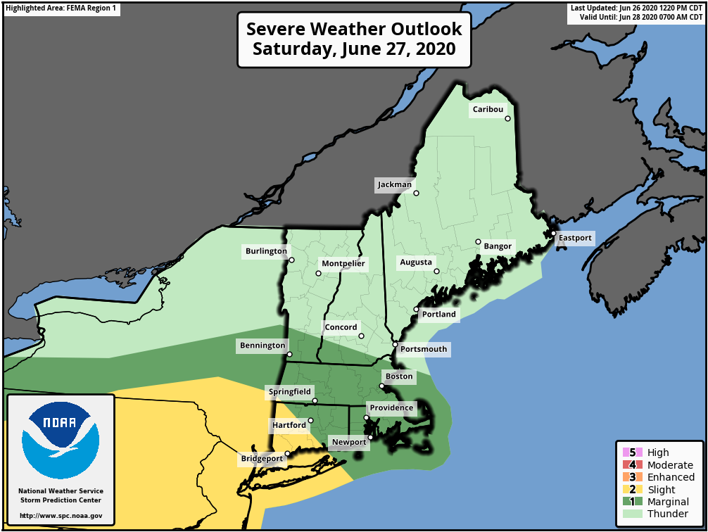
Locations: Possible anywhere, but the best chance is near and south of the Massachusetts Turnpike/I-90.
Severe Thunderstorm Threats: Primarily damaging straight-line winds and hail up to 1″ in diameter. While the overall risk is very low, an isolated tornado is possible.
Confidence: Moderate. How much Southern New England can warm up will greatly impact the severe thunderstorm potential.
The severe thunderstorm outlook for Saturday from the Storm Prediction Center is highlighted below:
Sunday
A few severe thunderstorms are possible later in the day Sunday ahead of a cold front.
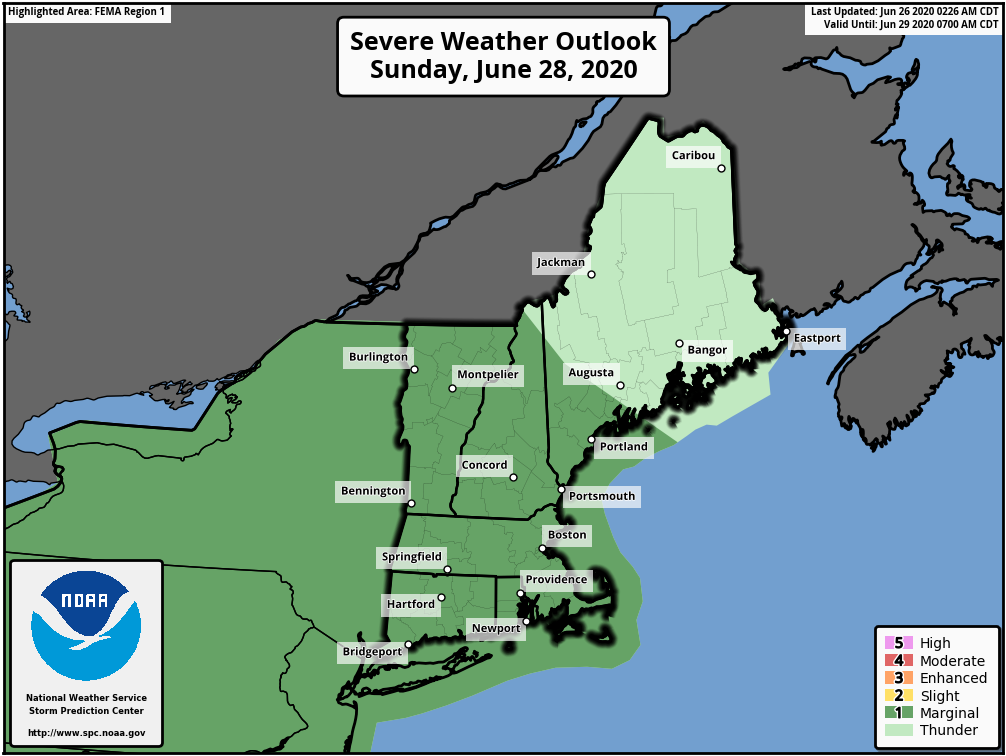
Timing: Best chance is late-afternoon to mid-evening Sunday; isolated storms possible between early to mid-afternoon.
Locations: Possible anywhere, but the best chance is western and central Massachusetts, northern Rhode Island and much of northern Connecticut.
Severe Thunderstorm Threats: Damaging straight-line winds and hail up to 1″ in diameter.
Confidence: Moderate. Isolated strong/severe storms could be possible before late in the day but the best chance is with the cold front arriving later in the day into mid-evening.
The severe thunderstorm outlook for Sunday is highlighted below:
Thank You!
Meteorologists Andrew Loconto and Rodney Chai
If you have any questions or would like more information, don’t hesitate to contact us via this email address, on NWSChat, or at the following:
National Weather Service Boston/Norton, MA
46 Commerce Way
Norton, MA 02766
508.622.3280