 Rob Macedo, KD1CY, writes on the SKYWARN_Announce list:
Hello to all..
On behalf of the entire Amateur Radio Group at WX1BOX, the Amateur Radio station for NWS Boston/Norton Massachusetts, and the forecaster staff at NWS Boston/Norton, we would like to take this opportunity to wish everyone a Merry Christmas, Happy New Year and Happy Holiday season. 2019 was another interesting year for weather across the region. Some of the highlights included a relatively quiet winter season that did have a brief period of active weather with a damaging wind event on February 25th, 2019, a significant winter storm Sunday Evening March 3rd into Monday Morning March 4th, rain, thunderstorms, and strong to damaging winds on April 15th for the Boston Marathon, the July 23rd Cape Cod Tornado event, several other active severe weather events in the spring to summer season, a significant nor’easter that brought hurricane force wind gusts and many power outages to Southern New England on October 16th-17th 2019 followed by another potent damaging wind event on October 31st through November 1st. The year ended with an active first half of 2019 with several winter storms bringing heavy snowfall including the 3-day storm of December 1st through December 3rd 2019, the Monday December 9th-10th heavy rainfall event, Wednesday December 11th winter storm and December 17th icing event. A complete slate of SKYWARN training classes were completed largely by Amateur Radio Operator instructors with some assistance from NWS forecasters. On Monday May 6th, 2019, members of Rhode Island and Eastern Massachusetts ARES and SKYWARN and other Amateur Radio SKYWARN spotters from around Southern New England participated in the 2019 Hurricane Awareness Tour from Quonset State Airport in North Kingstown, RI. Amateur Radio Operators supported event logistics and had a special event station that made contact with WX4NHC, the Amateur Radio station at the National Hurricane Center in Miami Florida who came on the air to support his event.
As has been the case for the last several years, many of you provided critical reports, pictures and videos that supported and resulted in the protection of life and property and timely warnings being issued based on the surface reporting and ground truth that is so critical in confirming what the radar is or is not seeing. This information was then shared with the media, local, state and federal emergency management and non-governmental organizations (NGOs) that are always looking for situational awareness and disaster intelligence to gauge the level of response and recovery required for an incident. They remain extremely impressed with all the work that all of you do and they extend their appreciation. That appreciation of the weather and damage reports is highly recognized by many of the media outlets as well who thank SKYWARN Spotters and Amateur Radio Operators on television and over social media such as Facebook and Twitter. This mission could not be done without all of your support.
The winter season of 2019 was quiet for most of the season with very small snowstorms and below average winter storms. That said, there was one active week between February 25th and March 4th. It started on February 25th with widespread pockets of wind damage with trees and wires down, power outages and wind gusts over 60 MPH in many locations across Southern New England. After a couple of smaller winter storms, a coastal storm, responsible for a significant severe weather outbreak in the Southeast United States, would affect the region with a widespread 6-12″ of snow and a band of 12-18″ of snow across portions of interior Southern New England. The snow was heavy and wet but the lack of stronger winds precluded a more damaging event. Nonetheless, the heavy wet snow caused pockets of tree and power line damage in the areas that received the most snow across interior and coastal Southern New England.
In April, a storm system brought thunderstorms with heavy rainfall impacting the morning of the 2019 Boston Marathon with the lightning over the area causing some minor contingencies to be invoked for the start of the race. Some of the thunderstorms were severe with wind gusts of around 60 MPH causing pockets of tree and wire damage. These severe thunderstorms stayed just south of the race route that morning with wind gusts of up to 48 MPH in Wrentham, Massachusetts while Hopkinton, Mass at the start line of the race only had wind gusts to 30 MPH. The race was largely dry after thunderstorms that morning but later in the day, some rain showers with gusty winds and wind gusts 40-50 MPH moved through the area including along the race route but towards the end of the race with only minor race impacts.
Severe thunderstorm events started up in late May and extended into June and July. Several notable events included thunderstorms with hail that affected numerous Amateur Radio Field Day sites on Saturday June 22nd. Several Amateur Radio Field Day sites across Rhode Island and Eastern Massachusetts were affected by these thunderstorms until the thunderstorms cleared out during the early evening. The following weekend, two days of severe weather affected portions of Southern New England. On Saturday June 29th, Golf Ball Sized hail affected locations such as Lincoln RI, Cumberland, RI and Attleboro and North Attleboro, Massachusetts. On Sunday June 30th, another round of severe thunderstorms affected the region with Quarter to half-dollar sized hail and larger affecting the Warwick, RI area. On both days pockets of tree and wire damage also occurred.
As we moved into July, several flood and severe weather events occurred during the month. On July 22nd, several tornado warnings were issued for Cape Cod but no tornado occurred. Wind damage with numerous trees down occurred in a section of Harwich, Mass but it was determined to be from straightline winds.
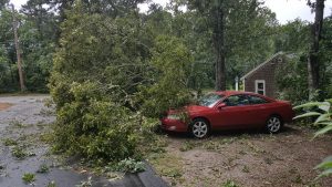
On July 23rd, 2019, a meso-low pressure system with a ring of severe thunderstorms caused significant straightline wind damage and 3 tornadoes, effectively doubling the number of tornadoes on record for Cape Cod in one day with wind damage and wind gusts over 60 MPH recorded on Martha’s Vineyard. Straightline wind gusts as high as over 90 MPH were recorded on Cape Cod. Many trees, wires and utility poles were downed along with structural damage to a few structures. SKYWARN Spotters and Amateur Radio Operators along with several automated weather stations around Cape Cod were the first to report the significant severe weather conditions in the region. Within a few hours, Cape Cod ARES and SKYWARN produced over 100 pictures of the damage in the region. At the height of the storm, over 53,000 were without power across Cape Cod and parts of Marthas Vineyard. Cape Cod ARES was active with shelter and support of the Barnstable County Emergency Operations Center (EOC) and Multi Agency Coordination Center (MACC) in Barnstable, Massachusetts. The Amateur Radio and SKYWARN Spotter efforts drew media attention with 2 phone interviews with FOX-25 TV in Boston as well as an article on the ARRL web site. The ARRL web story can be seen at the following link:
On July 31st, 2019, a potent severe weather event affected much of interior Southern New England all the way into the Metro Boston area with wind gusts of 73 MPH recorded at Boston Logan Airport. Pockets of tree and wire damage and hail up to Quarter to Half Dollar sized occurred across interior Southern New England. Straightline wind damage in more numerous pockets occurred across parts of Winthrop and Boston, Massachusetts along with areas further west in parts of Southern Worcester County Massachusetts and along the Massachusetts and Rhode Island border. This was one of the more notable severe weather events of the summer season.
As we moved into August, several flood and hail, wind damage events occurred over the course of the month. The most notable event was on August 19th where reports of hail up to Golf Ball and 2″ diameter in the Agawam and Springfield, Mass area with pockets of wind damage in this area and across portions of the remainder of interior Southern New England. As we moved into September, there were several weather events in the first week of September, the most notable of which was on Wednesday September 4th, 2019, where severe thunderstorms occurred across portions of Western Massachusetts and Connecticut with the fourth tornado of the severe weather season occurring in Coventry to Mansfield, Connecticut. Dorian would then make a pass close enough to Cape Cod and the Islands to produce tropical storm force conditions across this area with wind gusts to around 40 MPH into other parts of Southeast Coastal Massachusetts. Severe weather season was quiet until Wednesday October 2nd where a few severe thunderstorms in Rhode Island caused pockets of straightline wind damage and a weak, brief EF0 Tornado in Portsmouth, RI bringing the total tornado count for 2019 to 5 for the season. The 5 tornadoes were above normal for the season but well below the 11 tornadoes that occurred in the 2018 severe weather season.
As we moved into October and November, wind events and coastal storms were scattered about these months. The most notable events was the coastal storm of October 16th and 17th 2019 which had widespread pockets of tree and power line damage and power outages and widespread rainfall of 2-4″ with isolated higher amounts. Several hundred thousand people were without power in Southern New England including over 250,000 in Massachusetts alone. Hurricane force wind gusts occurred in portions of Southern New England with widespread wind gusts of 58 MPH or greater meeting High Wind Warning criteria. SKYWARN Amateur Radio Operations used self-activation given the strongest winds happening during the overnight. Some flooding of road ways occurred from the heavy rainfall in urban and poor drainage areas. On October 31st into November 1st, another round of strong to damaging winds with a cold front and area of low pressure brought a second round of damage to the area but not as significant as the October 16-17th event though there were power outages in the tens of thousands across Southern New England. November had several wind events and some areas in Northwest Massachusetts having their first snowfall of the 2019-2020 winter season.
In December, the first half of the month was very active and kicked off by the first major winter storm for the region as a 3-day winter storm affected the region. Reports in parts of North-Central and Western Massachusetts ranged between 15-29″ of snow with other areas receiving 4-12″ of snow over a long duration 3-day period. Some strong wind gusts in the 40-50 MPH range with isolated higher gusts were also recorded causing some minor tree and power line damage. An extended period of SKYWARN activation starting with Ops on the Sunday Night and Self-Activation with Amateur Radio call-up nets on Monday and Tuesday. On Monday Night December 9th through Tuesday December 10th, 2019, heavy rainfall was widespread in the region with the highest rainfall amounts in Southeast New England where 2-4″ of rain occurred. Immediately following this storm, late Tuesday Night December 10th into Wednesday December 11th a moderate snowstorm bringing a widespread 3-6″ of snow with isolated higher amounts of 7-8″ across much of Southern New England with the highest amounts over parts of Central and Eastern New England. This storm adversely affected the Wednesday Morning December 11th commute. Another heavy rain event occurred Friday December 13th into Saturday December 14th with some minor flooding issues. This event brought some strong winds over Wind Advisory level with brief wind gusts to over 60 MPH on Nantucket Island. Finally, on Tuesday December 17th, after a period of light snow and some areas receiving 2-5″ of snow, icing of largely 1/8-1/3rd of an inch with isolated amounts of 1/2″ inch of ice occurred in portions of Southern New England. This even resulted in a few isolated pockets of tree and wire damage in parts of Northern Connecticut, Rhode Island and interior Southeast Massachusetts.
With the high pace of events in the first half of December, we have not had a chance to post any Facebook photo albums of the storm events. Over the next week if the weather remains quiet enough, we will post those photo albums of these storm events on our Facebook and Twitter feeds. Many thanks to all SKYWARN Spotters and Amateur Radio Operators for photos and videos from these events in December and year round in 2019.
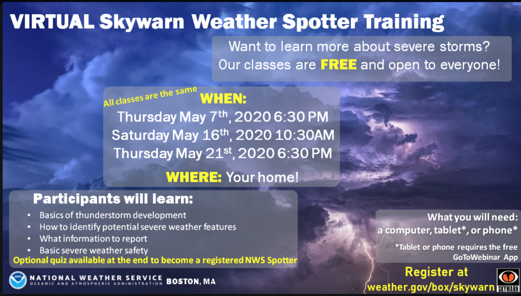
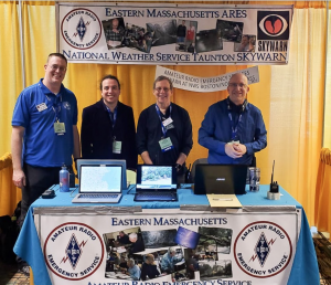
As we move forward in 2020, we will be continuing our commitment to SKYWARN training. Planning has started and sessions will be posted for 2020 SKYWARN Training starting in January. There will be a presence at the American Meteorological Society (AMS) 100th Anniversary Conference Weatherfest on Sunday January 12th from Noon-4 PM and planning is ongoing for this event. We know that we’ve continued to have a large influx of SKYWARN Spotters and Amateur Radio Operators after a full slate of SKYWARN Training classes. We will also look at ways spotters and Amateurs can become more active in supporting efforts to gather critical reports from other areas beyond where they are located and do so in a precise manner.
We will also continue to embrace new technologies while maintaining all the other technologies utilized to gather as much real-time and precise meteorological and damage report information as possible and this effort will be pushed more heavily as we get into 2020. We will attempt to look at expanding DMR usage and potentially look at DSTAR Amateur Radio as an additional means for reporting during severe weather and we are still looking at a new Amateur Radio technology called NBEMS, the Narrow Band Emergency Messaging System, as a potential means to gather weather spotter data digitally over Ham Radio. These are added capabilities that we will be looking at and will not replace the continued core technologies within VHF and UHF (2 Meters/440 MHz) SKYWARN Amateur Radio Repeaters and simplex capabilities, our usage of Echolink/IRLP Amateur Radio linked repeaters, Amateur Radio HF and 6 Meters capabilities as well as monitoring of weather stations ingested over APRS and into the Mesonet networks that have supported and helped with seeing what is happening on the ground.
We will also be looking at other ways to engage both Amateur Radio and non-Amateur Radio SKYWARN Spotters via other ways to get near real-time and historical spotter reports and near real-time video and pictures as well as historical video and pictures after a major severe weather event via a project the WX1BOX Amateur Radio team is working over the past year. Further details on this will be announced as the project progresses along with additional projects being worked over the past Spring as well. This will further enhance our abilities to gather situational awareness and disaster intelligence information in a short period of time
We continue to have our twitter feed setup and you can follow WX1BOX on Twitter by following our Amateur Radio Call-Sign, WX1BOX and have our WX1BOX Facebook page available as well. NWS Boston/Norton has also continued the use of their Twitter and Facebook feeds as well over the course of 2019. Spotters and Amateur Radio Operators can follow WX1BOX and ‘NWSBoston’ on Twitter and on Facebook can ‘like’ these pages. They are available via the following links:
WX1BOX Amateur Radio SKYWARN Facebook Page:
http://www.facebook.com/wx1box
NWS Boston/Norton Facebook Page:
https://www.facebook.com/NWSBoston/
WX1BOX Amateur Radio SKYWARN Twitter Feed:
http://twitter.com/wx1box
NWS Taunton Twitter feed:
https://twitter.com/NWSBoston
We, again, want to provide a tremendous THANK YOU to all of you that supported SKYWARN and the National Weather Service during 2019. We wish everyone once again, a Merry Christmas, Happy New Year, and Happy Holiday Season and hope people enjoy their time with family and friends during this joyous holiday season!
Respectfully Submitted,
Robert Macedo (KD1CY)
ARES SKYWARN Coordinator
Eastern Massachusetts ARES Section Emergency Coordinator
Home Phone #: (508) 994-1875 (After 6 PM)
Home/Data #: (508) 997-4503 (After 6 PM)
Work Phone #: 508-346-2929 (8 AM-5 PM)
Email Address: rmacedo@rcn.com
http://ares.ema.arrl.org
http://www.wx1box.org
Like us on Facebook – http://www.facebook.com/wx1box
 Rob Macedo, KD1CY, writes: