                         The KY1N Memorial List

   Scheduled Amateur Radio Volunteer Examinations - CT MA ME NH RI VT

                                 1/04/05

                            Jim, WW1Y, Editor

Date     Time   Contact                     Location           Phone

01/08/05 08:45  William J Needham, K1WN     Braintree       MA 781-843-4400

01/08/05 10:30  Larry Houbre, AA1FS         Dartmouth       MA 508-991-6055

01/08/05 09:00  Joanne Reid, N1LNE          Falmouth        MA 508-548-1121

01/08/05 12:00  Daniel Miller, K3UFG        Newington       CT 860-206-3379

01/09/05 12:00  Bob Quinn, WV1A             Gloucester      MA 978-283-4660

01/09/05 09:00  Richard Barton, N1NCZ       Milford         CT 203-877-5020

01/10/05 19:00  Mike Ardai, N1IST           Brookline       MA 781-321-7939

01/11/05 19:00  Lawrence Polowy, KU1L       Thomaston       CT 860-283-4089

01/12/05 19:30  Bruce Anderson, W1LUS       Chelmsford      MA 978-851-2886

01/13/05 19:00  Judy Nelson, KC1RI          Providence      RI 401-231-9156

01/13/05 19:00  Kevin Cellini, N1KGM        Trumbull        CT 203-268-5015

01/14/05 18:30  Ralph T Stetson III, KD1R   Burlington      VT 802-878-6454

01/15/05 09:00  Bill Wade, K1IJ             Marlborough     MA 617-699-3670

01/15/05 09:00  Bruce Howes, W1UJR          South Portland  ME 207-828-0248

01/17/05 19:00  Arthur Denault, KB1CNB      Fall River      MA 774-644-3469

01/18/05 19:00  Paul Lux, K1PL              Middletown      CT 860-635-1742

01/19/05 17:30  Donald R Smith, AE1Q        Augusta         ME 207-495-3891

01/19/05 19:30  Nick Altenbernd, KA1MQX     Cambridge       MA 617-253-3776

01/19/05 19:00  Robert E Moreland, KA1ZMF   Milford         CT 203-933-9587

01/20/05 19:30  Richard Cantin, AA1TI       Norwood         MA 508-339-1089

01/20/05 18:30  John Ruggiero, N2YHK        Worcester       MA 508-982-0617

01/25/05 12:00 +Neil Henden, AA1OA          Danvers         MA 978-777-1608

01/26/05 19:00 *Paul Upham, KD1YH           Shirley         MA 978-597-6535

01/28/05 18:00  David Cote, WA1DC           Holyoke         MA 413-592-4978

01/29/05 09:00  Thomas Jaworski, WA1MJE     Pittsfield      MA 413-528-9002

01/29/05 09:00  Bob Jones, WB1P             Slatersville    RI 401-333-4787

02/05/05 10:30  Larry Houbre, AA1FS         Dartmouth       MA 508-991-6055

02/05/05 09:00  Jack P Garforth, N1JK       Middletown      RI 401-683-2250

02/06/05 09:00  Richard Barton, N1NCZ       Milford         CT 203-877-5020

02/08/05 19:00  Lawrence Polowy, KU1L       Thomaston       CT 860-283-4089

02/09/05 19:30  Bruce Anderson, W1LUS       Chelmsford      MA 978-851-2886

02/10/05 19:00  Judy Nelson, KC1RI          Providence      RI 401-231-9156

02/10/05 19:00  Kevin Cellini, N1KGM        Trumbull        CT 203-268-5015

02/11/05 18:30  Ralph T Stetson III, KD1R   Burlington      VT 802-878-6454

02/12/05 08:45  William J Needham, K1WN     Braintree       MA 781-843-4400

02/12/05 09:00  Joanne Reid, N1LNE          Falmouth        MA 508-548-1121

02/12/05 12:00  Daniel Miller, K3UFG        Newington       CT 860-206-3379

02/13/05 12:00  Bob Quinn, WV1A             Gloucester      MA 978-283-4660

02/14/05 19:00  Mike Ardai, N1IST           Brookline       MA 781-321-7939

02/15/05 19:00  Paul Lux, K1PL              Middletown      CT 860-635-1742

02/16/05 19:30  Nick Altenbernd, KA1MQX     Cambridge       MA 617-253-3776

02/16/05 19:00  Robert E Moreland, KA1ZMF   Milford         CT 203-933-9587

02/17/05 19:30  Richard Cantin, AA1TI       Norwood         MA 508-339-1089

02/19/05 10:00  Bryce Rumery, K1GAX         Bath            ME 207-799-1116

02/19/05 09:00  Bill Wade, K1IJ             Marlborough     MA 617-699-3670

02/19/05 09:00  Tom Senerchia, KA1VAY       West Warwick    RI 401-822-2592

02/21/05 19:00  Arthur Denault, KB1CNB      Fall River      MA 774-644-3469

02/23/05 19:00 *Paul Upham, KD1YH           Shirley         MA 978-597-6535

02/25/05 18:00  David Cote, WA1DC           Holyoke         MA 413-592-4978

02/25/05 09:00  Mitch Stern, W1SJ           Milton          VT 802-879-6589

02/26/05 12:00 +Neil Henden, AA1OA          Danvers         MA 978-777-1608

02/26/05 09:00  Jim Heedles, WW1Y           Nashua          NH 603-672-4035

02/28/05 19:00  Walton G Congdon, W1ZPB     Northfield      MA 413-498-2729

03/05/05 10:30  Larry Houbre, AA1FS         Dartmouth       MA 508-991-6055

03/06/05 09:00  Richard Barton, N1NCZ       Milford         CT 203-877-5020

03/08/05 19:00  Lawrence Polowy, KU1L       Thomaston       CT 860-283-4089

03/09/05 19:30  Bruce Anderson, W1LUS       Chelmsford      MA 978-851-2886

03/10/05 19:00  Judy Nelson, KC1RI          Providence      RI 401-231-9156

03/10/05 19:00  Kevin Cellini, N1KGM        Trumbull        CT 203-268-5015

03/11/05 18:30  Ralph T Stetson III, KD1R   Burlington      VT 802-878-6454

03/12/05 08:45  William J Needham, K1WN     Braintree       MA 781-843-4400

03/12/05 09:00  Joanne Reid, N1LNE          Falmouth        MA 508-548-1121

03/12/05 12:00  Daniel Miller, K3UFG        Newington       CT 860-206-3379

03/13/05 12:00  Bob Quinn, WV1A             Gloucester      MA 978-283-4660

03/14/05 19:00  Mike Ardai, N1IST           Brookline       MA 781-321-7939

03/15/05 19:00  Paul Lux, K1PL              Middletown      CT 860-635-1742

03/16/05 17:30  Donald R Smith, AE1Q        Augusta         ME 207-495-3891

03/16/05 19:00  Robert E Moreland, KA1ZMF   Milford         CT 203-933-9587

03/17/05 19:30  Richard Cantin, AA1TI       Norwood         MA 508-339-1089

03/19/05 09:00  Don Tarbet, KD1XU           Bangor          ME 207-327-1453

03/19/05 09:00  Bill Wade, K1IJ             Marlborough     MA 617-699-3670

03/19/05 09:00  Bruce Howes, W1UJR          South Portland  ME 207-828-0248

03/21/05 19:00  Arthur Denault, KB1CNB      Fall River      MA 774-644-3469

03/23/05 19:30  Nick Altenbernd, KA1MQX     Cambridge       MA 617-253-3776

03/23/05 19:00 *Paul Upham, KD1YH           Shirley         MA 978-597-6535

03/25/05 18:00 *Mitch Stern, W1SJ           Essex Junction  VT 802-879-6589

03/25/05 18:00  David Cote, WA1DC           Holyoke         MA 413-592-4978

03/26/05 12:00 +Neil Henden, AA1OA          Danvers         MA 978-777-1608

03/26/05 12:30  Bryce Rumery, K1GAX         Lewiston        ME 207-799-1116

03/26/05 09:00  Bob Jones, WB1P             Slatersville    RI 401-333-4787

04/02/05 10:30  Larry Houbre, AA1FS         Dartmouth       MA 508-991-6055

04/02/05 09:00  Jack P Garforth, N1JK       Middletown      RI 401-683-2250

04/03/05 09:00  Richard Barton, N1NCZ       Milford         CT 203-877-5020

04/08/05 18:30  Ralph T Stetson III, KD1R   Burlington      VT 802-878-6454

04/09/05 08:45  William J Needham, K1WN     Braintree       MA 781-843-4400

04/09/05 09:00  Joanne Reid, N1LNE          Falmouth        MA 508-548-1121

04/09/05 12:00  Daniel Miller, K3UFG        Newington       CT 860-206-3379

04/09/05 10:10  Donald R Smith, AE1Q        Winslow         ME 207-495-3891

04/10/05 12:00  Bob Quinn, WV1A             Gloucester      MA 978-283-4660

04/11/05 19:00  Mike Ardai, N1IST           Brookline       MA 781-321-7939

04/12/05 19:00  Lawrence Polowy, KU1L       Thomaston       CT 860-283-4089

04/13/05 19:30  Bruce Anderson, W1LUS       Chelmsford      MA 978-851-2886

04/14/05 19:00  Judy Nelson, KC1RI          Providence      RI 401-231-9156

04/14/05 19:00  Kevin Cellini, N1KGM        Trumbull        CT 203-268-5015

04/16/05 09:00  Bill Wade, K1IJ             Marlborough     MA 617-699-3670

04/18/05 19:00  Arthur Denault, KB1CNB      Fall River      MA 774-644-3469

04/19/05 19:00  Paul Lux, K1PL              Middletown      CT 860-635-1742

04/20/05 19:30  Nick Altenbernd, KA1MQX     Cambridge       MA 617-253-3776

04/20/05 19:00  Robert E Moreland, KA1ZMF   Milford         CT 203-933-9587

04/21/05 19:30  Lou Harris, N1UEC           Norwood         MA 508-668-0858

04/21/05 18:30  John Ruggiero, N2YHK        Worcester       MA 508-982-0617

04/22/05 18:00  David Cote, WA1DC           Holyoke         MA 413-592-4978

04/23/05 10:00  Bryce Rumery, K1GAX         Bath            ME 207-799-1116

04/23/05 12:00 +Neil Henden, AA1OA          Danvers         MA 978-777-1608

04/23/05 09:00  Norm Smith, NY1B            Rockland        ME 207-354-6853

04/23/05 09:00  Tom Senerchia, KA1VAY       West Warwick    RI 401-822-2592

04/27/05 19:00 *Paul Upham, KD1YH           Shirley         MA 978-597-6535

05/01/05 09:00  Richard Barton, N1NCZ       Milford         CT 203-877-5020

05/07/05 10:30  Larry Houbre, AA1FS         Dartmouth       MA 508-991-6055

05/07/05 09:00  Bill Studley, AA1OC         Hopkinton       NH 603-424-2857

05/08/05 12:00  Bob Quinn, WV1A             Gloucester      MA 978-283-4660

05/09/05 19:00  Mike Ardai, N1IST           Brookline       MA 781-321-7939

05/11/05 19:30  Bruce Anderson, W1LUS       Chelmsford      MA 978-851-2886

05/12/05 19:00  Judy Nelson, KC1RI          Providence      RI 401-231-9156

05/13/05 18:30  Ralph T Stetson III, KD1R   Burlington      VT 802-878-6454

05/14/05 08:45  William J Needham, K1WN     Braintree       MA 781-843-4400

05/14/05 09:00  Joanne Reid, N1LNE          Falmouth        MA 508-548-1121

05/17/05 19:00  Paul Lux, K1PL              Middletown      CT 860-635-1742

05/18/05 17:30  Donald R Smith, AE1Q        Augusta         ME 207-495-3891

05/18/05 19:30  Nick Altenbernd, KA1MQX     Cambridge       MA 617-253-3776

05/19/05 19:30  Lou Harris, N1UEC           Norwood         MA 508-668-0858

05/21/05 09:00  Bill Wade, K1IJ             Marlborough     MA 617-699-3670

05/21/05 09:00  Bob Jones, WB1P             Slatersville    RI 401-333-4787

05/21/05 09:00  Bruce Howes, W1UJR          South Portland  ME 207-828-0248

05/25/05 19:00 *Paul Upham, KD1YH           Shirley         MA 978-597-6535

05/27/05 18:00  David Cote, WA1DC           Holyoke         MA 413-592-4978

06/04/05 09:00  Don Tarbet, KD1XU           Bangor          ME 207-327-1453

06/04/05 10:30  Larry Houbre, AA1FS         Dartmouth       MA 508-991-6055

06/08/05 19:30  Bruce Anderson, W1LUS       Chelmsford      MA 978-851-2886

06/09/05 19:00  Judy Nelson, KC1RI          Providence      RI 401-231-9156

06/10/05 18:30  Ralph T Stetson III, KD1R   Burlington      VT 802-878-6454

06/11/05 08:45  William J Needham, K1WN     Braintree       MA 781-843-4400

06/11/05 09:00  Joanne Reid, N1LNE          Falmouth        MA 508-548-1121

06/12/05 12:00  Bob Quinn, WV1A             Gloucester      MA 978-283-4660

06/13/05 19:00  Mike Ardai, N1IST           Brookline       MA 781-321-7939

06/16/05 19:30  Lou Harris, N1UEC           Norwood         MA 508-668-0858

06/18/05 10:00  Bryce Rumery, K1GAX         Bath            ME 207-799-1116

06/18/05 09:00  Bill Wade, K1IJ             Marlborough     MA 617-699-3670

06/18/05 09:00  Jim Heedles, WW1Y           Nashua          NH 603-672-4035

06/21/05 19:00  Paul Lux, K1PL              Middletown      CT 860-635-1742

06/22/05 19:30  Nick Altenbernd, KA1MQX     Cambridge       MA 617-253-3776

06/22/05 19:00 *Paul Upham, KD1YH           Shirley         MA 978-597-6535

06/24/05 18:00  David Cote, WA1DC           Holyoke         MA 413-592-4978

06/25/05 12:00 +Neil Henden, AA1OA          Danvers         MA 978-777-1608
                                 NOTES:

                      * = PREREGISTRATION MANDATORY

                   +  = PLEASE CALL TO GAURANTEE SEATING

                        T = Technician Exams only

                           Times are Local Time

    Please check with the contact person as some dates are tentative!

              For the latest examination information, check

                  http://www.ky1n.net/ky1n.html.

            If attending a session please remember to bring:

   1) One photo ID, or two non-photo ID's (one with address)

   2) Original FCC-issued license plus a photocopy (if already licensed)

   3) Original plus photocopies of all CSCE's you are claiming

   4) The 2005 test session fee of $14.00

                 All VE Teams are invited to contribute.

 For additions/corrections contact Jim Heedles, WW1Y, 603-672-4035,

                     via email at ky1n@ky1n.net

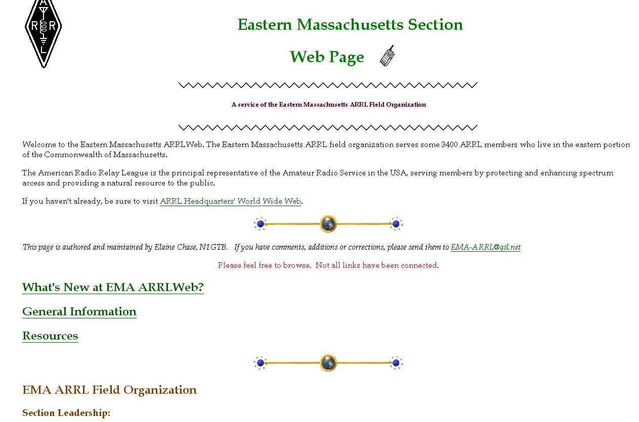 Shown here is a snapshot of the old Eastern MA ARRL web site circa December, 1998. At the time, our site was hosted by QSL.NET. The site consisted of static HTML pages. Elaine Chase, N1GTB served for many years as the site’s webmaster.
  The Monday January 24, 2005 NEDXCC meeting has been CANCELLED.
 The December, 2004 EMA traffic net and Public Service Honor Roll totals have been posted to
  SEC Rob Macedo, KD1CY writes:
 Openings are still available for persons with disabilities who wish to attend the Courage Center Handiham Radio Camp in Malibu, California, February 27 through March 6, 2005.
  VOICE OVER IP and EchoLINK – Linking HAMs everywhere!
 JC Cunningham, W1AI writes:
 The NorthEast TCP Association is hosting a special meeting on Jan 22, 2004 at 10 a.m. on the premises of Russet Communications at 360 Merrimack Street in Lawrence.
 The Framingham Amateur Radio Association announces its annual License in a Weekend Class for entry-level Technician class March 11-13, 2005 at the Danforth Museum in downtown Framingham.
  An unusual interference problem plaguing the Minuteman Repeater Association’s 146.61 repeater in Marlborough since the spring of 2004 has been solved, according to MMRA’s DeMattia, K1IW.
 The library at the Southeastern MA ARA is about to get a whole lot more interesting, thanks to the efforts of Bob “Whitey” Doherty, K1VV. Doherty is donating a set of DVDs with ham-related materials to the club’s library for use by its members. Doherty has personally produced and created many of the titles himself.
 Bob DeMattia, K1IW writes:
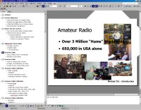 Tim Smith, N1TI writes: