New Domain Name for ARES EMa ARRL Site

I’m pleased to report that the League’s internet service provider, Interbridge.net, has agreed to assign a distinct subdomain name for the EMa ARRL ARES web site. Beginning today, this site can be accessed via the address,

http://ares.ema.arrl.org

In addition, the old address,

http://ema.arrl.org/ares

will continue to be supported.

Why did we implement this change? Because it more accurately describes the site from a hierarchical perspective.

73,

Phil Temples, K9HI

ARRL Section Manager,
Eastern Massachusetts Section
and “web host”

“IRLP Comes to the New Bedford Area”

SEMARA logoSoutheastern Mass. ARA club member Larry Lygren, W1DBX has installed a simplex mode IRLP node at his home in New Bedford. Larry’s system is comprised of a Yaesu FT-2600M 2-meter transceiver running 60 watts into a Diamond X500NA antenna. The computer is a donation from the Saint Joseph / Saint Theresa School of New Bedford. It is an “open” system for all hams to use.

IRLP is a world-wide system that allows one to talk to fellow hams around the world. For example, you can actually talk to a mobile station in New Zealand using your handheld! Another feature is the use of reflectors that allow several nodes to be tied together. This permits several nodes to talk to each other over the same link. Ham in several states could engage in a multi-way QSO with hams in Japan and Germany – a worldwide roundtable.

The system uses the Linux operating system because of its superb networking characteristics and robust fail-safe design. This new system has proven itself and IRLP has expanded from a cross-Canada system to a worldwide system.

First time users of IRLP should download and read the “IRLP Introduction” and “IRLP FAQ” pages at http://www.irlp.net. A full list of all nodes on the system is also available on the site.

—Thanks, SEMARA Zero Beat

SEC Announcement – Mobilization Not Needed

****** EMa ARES MOBILIZATION NOT NEEDED *****

Hello to all….

With the exception of some high winds remaining for Cape and Islands and SE coastal areas, the storm has passed out to sea and NWS has allowed all Winter Storm Warnings to expire. There are some pockets of power outages, but utility crews report that they are confident service will be restored shortly. There appears to be little damage to the communications infrastructure.

Thank you all for taking the time to prepare yourselves for a possible need, and monitoring the situation during your family celebrations.

Happy New Year!

s/Michael P. Neilsen
Michael P. Neilsen, W1MPN
Section Emergency Coordinator
Eastern Massachusetts Section
Pager: 1-800-759-8888 PIN 1155084
Admin: w1mpn (symbol for at) arrl.net
978-562-5662 Primary/Voice Mail
978-389-0558 FAX/ EFax Voice Mail

SEC UPDATE – Possible Moblization

****** NOTIFICATION OF POSSIBLE EMa ARES MOBILIZATION ******
***** MAJOR WINTER STORM TO IMPACT AREA *****
**** PLEASE CONTINUE YOUR PREPARATORY EFFORTS *****

Good Morning to all and Merry Christmas to you and your families…

I am requesting that you consider yourselves on 24 hour standby for possible activation, and that you continue your preparation efforts at a somewhat higher intensity at this time. I will update again by 1800 local time. ARES folks in the areas mentioned in the areas of the high wind watch should be particularly watchful of the situation. Please refer to my earlier message (1754 12/24/02) for a discussion on some preparatory elements. I have also attached a text formatted copy of the frequency list, in response to requests from some of you last night.

National Weather is maintaining Winter Storm Warning for most of our area for a major winter storm. Additionally, a high wind advisory has now been issued confirming concerns last night for very strong winds commencing later today, and lasting through tonight and part of tomorrow. Additionally “blizzard like” conditions may exist meaning visibilities will be substantially reduced due to blowing and drifting snow, making driving very hazardous. Please note, however, that an official Blizzard Warning has NOT been issued. Other stringent criteria must be met first before NWS would issue one.

Several net controls have checked in, but more are needed. Please indicate your availability, especially if you have just returned from your travels/visits and are only becoming aware of the need now.

Enjoy the rest of your day! More later. Please watch for Rob’s weather/SKYWARN messages in the interim.

s/Michael P. Neilsen
Michael P. Neilsen, W1MPN
Section Emergency Coordinator
Eastern Massachusetts Section
Pager: 1-800-759-8888 PIN 1155084
Admin: w1mpn (symbol for at) arrl.net
978-562-5662 Primary/Voice Mail
978-389-0558 FAX/ EFax Voice Mail

===== NWS Messages Follow ==========

WWUS71 KBOX 251033
NPWBOX

URGENT – WEATHER MESSAGE
NATIONAL WEATHER SERVICE TAUNTON MA
459 AM EST WED DEC 25 2002

MAZ007-015-016-019-022>024-251559-
BARNSTABLE MA-DUKES MA-EASTERN ESSEX MA-EASTERN NORFOLK MA-
EASTERN PLYMOUTH MA-NANTUCKET MA-SUFFOLK MA-
459 AM EST WED DEC 25 2002

…HIGH WIND WATCH FOR TONIGHT…

NORTHEAST WINDS OF 30 TO 40 MPH MAY REACH 50 TO 60 MPH AT TIMES IN
GUSTS OVER COASTAL SECTIONS OF EASTERN MASSACHUSETTS. THE STRONG
WINDS WILL START AROUND 5 PM AND WILL LIKELY CONTINUE UNTIL AFTER
MIDNIGHT.

THE FORECAST WATCH AREA INCLUDES THE ENTIRE EAST COAST OF
MASSACHUSETTS SOUTH OF THE MERRIMACK RIVER…TO CAPE ANN…TO
BOSTON…TO PLYMOUTH SOUTH ACROSS CAPE COD TO MARTHAS VINEYARD AND
NANTUCKET.

IF THESE HIGH WINDS MATERIALIZE…AND IF HEAVY SNOW IS FALLING AT
THE SAME TIME…THEN IT WOULD RESULT IN NEAR BLIZZARD CONDITIONS.
TRAVEL IS NOT RECOMMENDED DURING BLIZZARD CONDITIONS.

A HIGH WIND WATCH MEANS THAT THE POTENTIAL EXISTS FOR STRONG DAMAGING
WINDS TO DEVELOP IN THE MENTIONED AREAS. THESE STRONG WINDS CAN CAUSE
TREES AND POWER LINES TO FALL AS WELL AS CAUSING PROPERTY DAMAGE. IF
A HIGH WIND WARNING IS ISSUED…STAY INSIDE…AND AWAY FROM WINDOWS.

STAY TUNED TO NOAA WEATHER RADIO OR YOUR FAVORITE MEDIA SOURCE FOR
LATER STATEMENTS OR POSSIBLE UPGRADES. YOU CAN ALSO VISIT THE WEB
AT WEATHER.GOV.

$$
DMH/GAF

WWUS41 KBOX 251124
WSWBOX

URGENT – WINTER WEATHER MESSAGE
NATIONAL WEATHER SERVICE TAUNTON MA
622 AM EST WED DEC 25 2002

CTZ002>004-MAZ002>018-NHZ011-012-RIZ001>004-251651-
CHESHIRE NH-EASTERN ESSEX MA-EASTERN FRANKLIN MA-EASTERN HAMPDEN MA-
EASTERN HAMPSHIRE MA-EASTERN KENT RI-EASTERN NORFOLK MA-HARTFORD CT-
HILLSBOROUGH NH-NORTHERN BRISTOL MA-NORTHERN WORCESTER MA-
NORTHWEST PROVIDENCE RI-SOUTHEAST MIDDLESEX MA-
SOUTHEAST PROVIDENCE RI-SOUTHERN WORCESTER MA-SUFFOLK MA-TOLLAND CT-
WESTERN ESSEX MA-WESTERN FRANKLIN MA-WESTERN HAMPDEN MA-
WESTERN HAMPSHIRE MA-WESTERN KENT RI-WESTERN MIDDLESEX MA-
WESTERN NORFOLK MA-WESTERN PLYMOUTH MA-WINDHAM CT-
622 AM EST WED DEC 25 2002

…WINTER STORM WARNING REMAINS IN EFFECT THROUGH TONIGHT FOR MUCH
OF SOUTHERN NEW ENGLAND…

A MAJOR WINTER STORM IS EXPECTED TO DUMP 15 TO 20 INCHES OF SNOW
ACROSS NORTHWEST MASSACHUSETTS AND SOUTHWEST NEW HAMPSHIRE. 12 TO
18 INCHES ARE FORECAST FOR NORTHEAST MASSACHUSETTS. GENERALLY 10
TO 15 INCHES ARE FORECAST FROM HARTFORD COUNTY CONNECTICUT
NORTHEASTWARD THROUGH SOUTHERN WORCESTER COUNTY AND NORTHWEST RHODE
ISLAND TO JUST OUTSIDE THE CITY OF BOSTON. IN BOSTON…WHERE RAIN
OR SLEET MAY MIX IN FOR A TIME…8 TO 14 INCHES ARE PREDICTED.
LESSER AMOUNTS…FROM 5 TO 10 INCHES ARE FORECAST FROM PROVIDENCE
RHODE ISLAND TO BROCKTON MASSACHUSETTS.

THE SNOW WILL BE HEAVIEST FROM MID AFTERNOON THROUGH ABOUT
MIDNIGHT. WINDS ARE EXPECTED TO INCREASE TO 20 TO 30 MPH WITH GUSTS
TO 4O TO 45 MPH POSSIBLE ACROSS THE REGION LATE THIS AFTERNOON.
THIS WILL CAUSE BLOWING AND DRIFTING OF THE SNOW…ESPECIALLY IN
NORTHWESTERN AREAS WHERE THE SNOW WILL BE FLUFFIER. FARTHER TO THE
SOUTHEAST…FROM NORTHEAST CONNECTICUT TO THE BOSTON AREA…A HEAVY
WET SNOW IS ANTICIPATED…WITH TEMPERATURES NEAR OR POSSIBLY EVEN A
DEGREE OR TWO ABOVE FREEZING THIS AFTERNOON.

A HIGH WIND WATCH HAS BEEN ISSUED FOR EAST COASTAL MASSACHUSETTS FOR
TONIGHT. THE POTENTIAL EXISTS FOR NORTHEAST TO NORTH WINDS OF 30 TO
40 MPH WITH GUSTS TO 50 TO 60 MPH THERE. IF THESE HIGH WINDS
MATERIALIZE AND HEAVY SNOW FALLS IN CONJUNCTION WITH THEM…NEAR
BLIZZARD CONDITIONS COULD RESULT.

TRAVEL IS NOT ADVISED. IN FACT…BY TONIGHT…SOME SECONDARY ROADS
COULD BECOME IMPASSABLE.

STAY TUNED TO NOAA WEATHER RADIO OR YOUR FAVORITE LOCAL MEDIA OUTLET
FOR THE LATEST INFORMATION ON THIS STORM AND FOR THE POTENTIAL
BLIZZARD THREAT FOR TONIGHT. YOU CAN ALSO VISIT THE WEB AT
WWW.WEATHER.GOV.

==== End NWS Messages ========
1

SEC Annoucement

****** NOTIFICATION OF POSSIBLE EMa ARES MOBILIZATION ******
***** MAJOR WINTER STORM TO IMPACT AREA *****
**** PLEASE COMMENCE PREPARATORY EFFORTS ONLY *****

Hello to all and Merry Christmas to you and your families…

IMPORTANT: I am requesting that ARES team leaders (including new teams from
the 11/9 exercise), and NCS skilled members contact me ASAP as to your
availability and probable location (i.e. you may be away from home with
family/friends). Please respond by direct email, or call at numbers noted
below in my signature.

A major winter storm is predicted to hit the EMa Section area with possibly
significant impact on travel and our community. Of particular concern, are
high winds forecast to develop during and after the snow event, which could
in turn damage the electrical distribution, telephone, and cable
distribution systems. There is some additional risk to the “cellular” tower
infrastructure in our section as well, further degrading the communications
infrastructure. Moreover, if towers and similar structures can be impacted,
so can public safety and EMA communications.

In view of us all commencing a major holiday celebration, and the
seriousness of the threat, I must ask all of you to consider yourselves on
36 hour standby for mobilization. Before I discuss the likely scenario to
trigger a mobilization, I would like to cover the activities you should
undertake now in order to be ready, IF we will be needed.

1. Secure your homes and family, and review your personal needs for a
mobilization. As you know from your ECC class and our Workshop, be sure you
have medicines, clothing, water, and other food and personal supplies. Much
like the oxygen mask from overhead in the plane, you can only help others
after you have helped yourself.

2. Charge batteries, test equipment, review your go-kits and program your
radios if necessary. We will be using familiar repeater frequencies. More
below.

3. I will update you all again tomorrow morning. If there is no message
because of technical difficulties, consider yourselves on 24 hour standby.
If the situation allows a stand down, I will notify you right away.

4. Keep “plugged-in” by email, especially to Rob’s KD1CY weather alert
messages. Monitor the wx radio frequencies and the broadcast media. Watch
for possible hype and mania with the latter, however. Most importantly,
ENJOY YOUR HOLIDAY! This message is only to encourage you to think a little
about getting ready while you have your holiday celebrations with friends
and family.

The factor we are watching the closest is the high wind scenario during
which the snow that falls is wet. In high winds, it will be like blowing
wet plaster around. It is believed the vulnerabilities mentioned above will
be realized. You can watch for these factors to help you gauge how close we
will be getting to experiencing problems.

I have attached a frequency schedule of SKYWARN and RACES/ARES frequencies.
Please plan on using the RACES/ARES frequencies for ARES operations, as the
SKYWARN frequencies will be fully utilized. Please note the following
important exception: ARES will use the MMRA network in order to free up the
Waltham and PART repeaters for SKYWARN. Please visit www.mmra.org to get
frequencies, PL’s, and locations of repeaters in their network. We will
also use the Paxton repeater for coordination with Western Mass ARES as
needed on a shared basis with SKYWARN.

HF support is also requested during any mobilization. Please coordinate
with W3EVE, WQ1O, and N1CPE, with copy to W1MPN your capabilities and sked.

Let me say again, this is only a notification at this time. Please…enjoy
your celebration and the “White Christmas”. My best to you and your
families.

s/ Michael P. Neilsen
Michael P. Neilsen, W1MPN
Section Emergency Coordinator
Eastern Massachusetts Section
Pager: 1-800-759-8888 PIN 1155084
Admin: w1mpn (symbol for at) arrl.net
978-562-5662 Primary/Voice Mail
978-389-0558 FAX/ EFax Voice Mail

SKYWARN – Statement from NWS Taunton

Bulletin from the KA1JJM Emwin Feed:
WWUS41 KBOX 242018
WSWBOX

URGENT – WINTER WEATHER MESSAGE
NATIONAL WEATHER SERVICE TAUNTON MA
310 PM EST TUE DEC 24 2002

A MAJOR WINTER STORM IS EXPECTED TO IMPACT SOUTHERN NEW ENGLAND DURING CHRISTMAS DAY AND NIGHT. THE STORM IS EXPECTED TO MOVE FROM THE SOUTHEAST U.S. TO THE VIRGINIA COAST BY DAYBREAK WEDNESDAY… THEN TRACK NEAR THE SOUTHERN NEW ENGLAND COASTAL WATERS WEDNESDAY EVENING.

A SLIGHT CHANGE IN THE STORM TRACK COULD SHIFT THE SNOWFALL TOTALS.

TO AVOID TRAVEL DURING THIS WINTER STORM AS IT IMPACTS SOUTHERN NEW ENGLAND…THE BEST TIME TO COMPLETE TRAVEL WOULD BE CHRISTMAS EVE OR EARLY MORNING CHRISTMAS DAY.

MAZ002>005-008-009-NHZ011-012-250046-
CHESHIRE NH-EASTERN FRANKLIN MA-HILLSBOROUGH NH-
NORTHERN WORCESTER MA-WESTERN FRANKLIN MA-WESTERN HAMPDEN MA-
WESTERN HAMPSHIRE MA-WESTERN MIDDLESEX MA-
310 PM EST TUE DEC 24 2002

…WINTER STORM WARNING FOR WEDNESDAY THROUGH WEDNESDAY NIGHT…

THIS WARNING INCLUDES SOUTHWEST NEW HAMPSHIRE…NORTH CENTRAL MASSACHUSETTS AND THE EAST SLOPES OF THE BERKSHIRES IN MASSACHUSETTS. SNOW IS EXPECTED TO SPREAD INTO THIS AREA BY MID MORNING. SNOW WILL BE HEAVY AT TIMES…ESPECIALLY WEDNESDAY AFTERNOON. THE SNOW IS EXPECTED TO END LATER WEDNESDAY NIGHT.

STORM TOTAL ACCUMULATIONS OF 10 TO 20 INCHES ARE FORECAST.

IN ADDITION NORTHEAST WINDS WILL INCREASE TO 15 TO 25 MPH WITH GUSTS TO 35 MPH ACROSS THE HIGHER ELEVATIONS BY WEDNESDAY EVENING. THIS WILL FREQUENTLY CREATE VISIBILITY RESTRICTIONS LESS THAN ONE HALF
MILE…ALONG WITH SOME BLOWING AND DRIFTING SNOW.

HEAVY SNOW WILL ACCUMULATE ON ROADWAYS AND SIGNIFICANTLY HAMPER TRAVEL. SOME SECONDARY ROADS MAY BE IMPASSABLE. THOSE THAT HAVE TO BE OUT ON THE ROADS WILL NEED TO USE EXTREME CAUTION AND ALLOW PLENTY OF
EXTRA TIME.
$$

MAZ006-007-014>016-250047-
EASTERN ESSEX MA-EASTERN NORFOLK MA-SOUTHEAST MIDDLESEX MA-
SUFFOLK MA-WESTERN ESSEX MA-
310 PM EST TUE DEC 24 2002

…WINTER STORM WARNING FOR WEDNESDAY THROUGH WEDNESDAY NIGHT…

THIS WARNING INCLUDES NORTHEAST COASTAL MASSACHUSETTS INCLUDING THE IMMEDIATE BOSTON AREA. SNOW…POSSIBLY MIXING WITH SLEET OR RAIN AT TIMES…WILL MOVE INTO THE AREA AROUND MID MORNING WEDNESDAY. THE
PRECIPITATION IS EXPECTED TO BE HEAVY AT TIMES…ESPECIALLY DURING WEDNESDAY AFTERNOON AND EARLY EVENING. THE PRECIPITATION IS FORECAST
TO END AS SNOW LATE WEDNESDAY NIGHT.

STORM TOTAL ACCUMULATIONS OF 5 TO 10 INCHES ARE FORECAST.

IN ADDITION NORTHEAST WINDS WILL INCREASE TO 20 TO 30 MPH BY WEDNESDAY EVENING. THIS WILL FREQUENTLY CREATE VISIBILITY RESTRICTIONS LESS THAN ONE HALF MILE.

HEAVY SNOW WILL ACCUMULATE ON ROADWAYS AND SIGNIFICANTLY HAMPER TRAVEL. THOSE THAT HAVE TO BE OUT ON THE ROADS WILL NEED TO USE EXTREME CAUTION AND ALLOW PLENTY OF EXTRA TIME.
$$

CTZ004-MAZ013-RIZ001-250047-
NORTHWEST PROVIDENCE RI-WESTERN NORFOLK MA-WINDHAM CT-
310 PM EST TUE DEC 24 2002

…WINTER STORM WARNING FOR WEDNESDAY THROUGH WEDNESDAY NIGHT…

THIS WARNING INCLUDES NORTHWEST RHODE ISLAND…FAR NORTHEAST CONNECTICUT…AND SUBURBS SOUTH OF BOSTON. SNOW…MIXED WITH SLEET OR RAIN AT TIMES…WILL MOVE INTO THE AREA BY MID MORNING WEDNESDAY.
THE PRECIPITATION IS EXPECTED TO BE HEAVY AT TIMES…ESPECIALLY DURING WEDNESDAY AFTERNOON AND EARLY EVENING. THE PRECIPITATION IS FORECAST TO END AS SNOW LATE WEDNESDAY NIGHT.

STORM TOTAL ACCUMULATIONS OF 5 TO 10 INCHES ARE FORECAST.

IN ADDITION NORTHEAST WINDS WILL INCREASE TO 20 TO 30 MPH BY WEDNESDAY EVENING. THIS WILL FREQUENTLY CREATE VISIBILITY RESTRICTIONS LESS THAN ONE HALF MILE.

HEAVY SNOW WILL ACCUMULATE ON ROADWAYS AND SIGNIFICANTLY HAMPER TRAVEL. THOSE THAT HAVE TO BE OUT ON THE ROADS WILL NEED TO USE EXTREME CAUTION AND ALLOW PLENTY OF EXTRA TIME.
$$

MAZ017-018-RIZ002>004-250047-
EASTERN KENT RI-NORTHERN BRISTOL MA-SOUTHEAST PROVIDENCE RI-
WESTERN KENT RI-WESTERN PLYMOUTH MA-
310 PM EST TUE DEC 24 2002

…WINTER STORM WARNING FOR WEDNESDAY THROUGH WEDNESDAY NIGHT…

THIS WARNING INCLUDES NORTHEAST AND CENTRAL RHODE ISLAND…AND NORTHERN BRISTOL AND WESTERN PLYMOUTH COUNTIES IN MASSACHUSETTS. SNOW…MIXED WITH SLEET AND RAIN AT TIMES…IS FORECAST TO SPREAD INTO THE AREA AROUND MID MORNING WEDNESDAY. THE PRECIPITATION IS EXPECTED TO BE HEAVY AT TIMES…ESPECIALLY WEDNESDAY AFTERNOON AND EARLY EVENING. THE PRECIPITATION IS FORECAST TO END AS SNOW LATE
WEDNESDAY NIGHT.

STORM TOTAL ACCUMULATIONS OF 4 TO 8 INCHES ARE FORECAST.

IN ADDITION NORTHEAST WINDS WILL INCREASE TO 20 TO 30 MPH BY WEDNESDAY EVENING. THIS WILL FREQUENTLY CREATE VISIBILITY RESTRICTIONS LESS THAN ONE HALF MILE.

CONDITIONS CAN DETERIORATE RAPIDLY IN WINTER WEATHER SITUATIONS. SLOW DOWN AND ALLOW EXTRA TIME WHEN TRAVELING. IF YOU MUST TRAVEL BE SURE TO ALLOW PLENTY OF EXTRA TIME.
$$

MAZ019-250048-
EASTERN PLYMOUTH MA-
310 PM EST TUE DEC 24 2002

…WINTER WEATHER ADVISORY FOR MIDDAY WEDNESDAY THROUGH WEDNESDAY
NIGHT…

THIS ADVISORY INCLUDES EASTERN PLYMOUTH COUNTY. A MIXTURE OF SNOW…SLEET…AND RAIN IS FORECAST TO MOVE INTO THE ADVISORY AREA AROUND MID MORNING WEDNESDAY. THE PRECIPITATION MAY BE HEAVY AT TIMES WEDNESDAY AFTERNOON AND EVENING. THE MIXED PRECIPITATION IS
EXPECTED TO END LATE WEDNESDAY NIGHT.

A 3 TO 6 INCH SNOW AND SLEET ACCUMULATION IS FORECAST.

IN ADDITION NORTHEAST WINDS WILL INCREASE TO 20 TO 30 MPH WITH GUSTS TO 40 MPH BY WEDNESDAY EVENING. THIS WILL FREQUENTLY CREATE VISIBILITY RESTRICTIONS LESS THAN ONE HALF MILE.

STAY TUNED TO NOAA WEATHER RADIO…OR YOUR FAVORITE MEDIA OUTLET…
FOR THE LATEST INFORMATION ON THIS DEVELOPING WEATHER SITUATION.

$$

NBELK/STRAUSS

WWWW
1
VRC Field Organization Recommendations

ARRL FlagHello Section Managers,

The ARRL Volunteer Resources Committee asked me to forward the following message. Best wishes to you for this Holiday Season.

Steve, WV1X

[more] To: ARRL Section Managers
From: VRC

During the past 12 months, the Volunteer Resources Committee has held many discussions about emergency communications and traffic handling. These discussions included the review of excellent responses to questionnaires, forwarded by Steve Ewald, from Section Managers, their Field appointees and from NTS officials. At a VRC meeting in early November the committee’s discussion continually returned to the following: professionalism, reliability, discipline, skills, training. The VRC concluded with the following recommendations:

* SMs develop in their Field volunteers at all levels increased professionalism so as to meet more effectively the needs of served agencies

* SECs and STMs, earn Level 1, 2, and 3 certification as soon as possible

* DECs and NMs earn at least Level 1 and 2 certification as soon as possible

* ECs and OES appointees earn at least Level l certification as soon as possible

* SECs, and STMs strongly encourage all ARES and NTS members to earn Level l certification in order to prepare them for possible future disasters and in order to prepare them to become future leadership officials.

* SECs make effective use of OES appointees — the guidelines for this Field appointment are left somewhat open to allow the SEC flexibility in order to meet the needs of the particular Section

* SMs, in collaboration with their SECs and STMs, should be encouraged to study, on a continuing basis, the training needs of their Sections and the effectiveness of training programs in place, in order to heighten the state of readiness of Amateur communicators within their Sections.

73 and best Season’s Greetings
From the VRC

Algonquin ARC Flea Market Saturday, February 15, 2003!

Mark your calendars for the Marlborough, MA flea market on Saturday, Feb. 15, 2003 at the Marlborough Middle/Intermediate Elementary School, Thresher Drive (off Union Street) or off Bolton Street (Rt. 85).

New Hours: 9:00 a.m. to 1:00 p.m.

Exam session will be held from 9:00 a.m. to 11:00 a.m. Walk-ins for all Amateur Radio exams will be welcomed

5 1/2 ft. Round Tables or 10 ft. spaces
$12.00 before February 7, 2003
$15.00 February 7, 2003 or later
Tables and spaces include One Admission
Spaces provide own chairs, tables

Setup Time: 7:00 a.m.
Information: Ann Weldon, KA1PON
508-481-4988 (before 8 p.m.)

Talk-in: 146.61, 233.94, 449.925 (pl 103.5)

Grand door prize $200.00 awarded at 11:30 a.m.
Must be present to WIN
Other door prizes to be awarded during the flea market

See http://www.qsl.net/n1em/FleaMarketFlyer2-2003.htm

Best Wishes for the Holidays and Happy New Year!

On behalf of Phil Temples, K9HI, and the EMa and ARES staffs, I would like to wish all of you and your families the best for the holidays, and a happy and prosperous New Year. Please drive safely wherever your travels take you.

I look forward to working with you in the year ahead.

Michael P. Neilsen, W1MPN
Section Emergency Coordinator
Eastern Massachusetts Section

Winter Communications Exercise

The EMa Section ARES will be conducting another in a series of communications exercises on Saturday February 8, 2003, based on the format used in the November 9th SET. All ARES members are invited to participate, and a speical invitation is extended to clubs with emergency communication teams. Please check the “Exercises” area under the “Departments” button to the left. W1MPN

Request For Comments: ARES and NTS Cooperation

I wanted to share this Request For Information from the ARRL Volunteer Resources Committee, via Steve Ewald at ARRL Hq. VRC feels that more cooperation is needed between ARES and NTS programs. They are looking for input from Section Managers, Section Traffic Managers and Section Emergency Coordinators as to how this might occur.

Additionally, I invite comments from any ARES or NTS participants.

73,

Phil Temples, K9HI

ARRL Section Manager,
Eastern Massachusetts Section
k9hi@arrl.orgARRL Section Managers,

The ARRL Volunteer Resources Committee has asked me to forward this letter to you.
Thank you very much for your help.

73,

Steve, WV1X
sewald@arrl.org
_______________

Dear Section Managers,

It has never been more important for the volunteers in ARRL’s
emergency communications programs to serve with professionalism and
excellence. During the past year, the Volunteer Resources Committee
has been studying the ARRL’s programs related to emergency
communications (see Minute 35, Board of Directors meeting, January
2002, March QST, page 64). This review was undertaken not only because
of the growing concern for homeland security following September 11,
2001, but also because of the ongoing need to ensure that Amateur
Radio responds effectively to disasters unrelated to terrorism —
floods, hurricanes, forest fires, earthquakes, hazardous materials
incidents, etc.

Several inter-related themes have emerged during the study. One is
that Amateur Radio must earn and maintain increased credibility with
served agencies, both nationally and at the local level. Another is
that Amateur Radio emergency communications volunteers must be more
actively involved in a variety of training experiences throughout the
year. Finally, although ARES and NTS are (and will continue to be)
structurally separate in your Section Field Organizations, these two
volunteer programs need to work more cooperatively, functioning as
part of one coherent emergency communications program at the Section
level.

The VRC believes that both ARES and NTS are valuable programs, and so
we will propose no structural change at the Section Level. We are
convinced that more cooperation is needed, however.

Some Sections have achieved a high degree of functional integration
and cooperation between ARES and NTS. In other Sections, each may
operate as though the other did not exist. The VRC believes that close
cooperation between ARES and NTS, with mutual respect and pooling of
expertise, is the best way to serve agencies effectively and to earn
credibility as fully-skilled emergency communicators.

The VRC will recommend that leadership officials in both ARES and NTS
be strongly encouraged to achieve certification in the ARRL’s
Emergency Communications certification program. We will also recommend
that grass-roots volunteers be encouraged to pass at least the Level 1
certification. Along with the many other benefits of certification,
ARES and NTS operators will gain better understanding of and
appreciation for the value of both programs.

The VRC requests all Section Managers (in consultation with your SEC’s
and STM’s) and the three NTS Area Staff Chairmen to develop a vision
of how a closer working relationship can be effected between ARES and
NTS.

Input from all Section Managers is needed, because Sections are very
different from one another.

1. If your Section has already brought ARES and NTS together quite
well, please describe how it is done, what problems may have arisen,
and how the problems were resolved. Your success stories will provide
ideas to other Section Managers.

2. If your Section’s ARES and NTS are functionally separate now,
you are asked to work with your SEC and STM to develop a plan for
bringing them into closer cooperation. Please describe your thought
process: what do you see as the major issues to be considered, the
important problems to be solved, and the major goals to be achieved?

Please post comments as soon as possible on the SM reflector. ARRL HQ
Staff will see that your input is relayed to the VRC, so it can be
considered as we prepare our report to the Board.

Thank you for working with us toward the goal of serving our
communities and our country to the best of Amateur Radio’s capability.

73,
The VRC

Whitman ARC Plimoth Plantation Special Events Op a Huge Success!

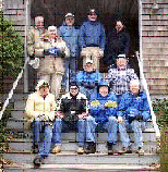
Whitman ARA gangThe Whitman Amateur Radio Club conducted a two-day special event from the Plimoth Plantation over the weekend following Thanksgiving.

Bruce Hayden, President of the Whitman Club reports that 16 area amateur radio operators “hams” set up five base stations and portable antennas at the re-creation of the 17th century Pilgrim settlement and Indian homesite. They exchanged contacts with just over 170 other amateur radio operators in 32 States, 8 foreign countries and 4 Canadian Provinces…The ham operators spread the word of Plimoth Plantation over the airways. They explained about the living museum and how they found the visitors, especially the children, amazed by the actors, dressed as Pilgrims and trained to speak in the language of the time. The ‘settlers’, to stay ‘in part’ would not acknowledge the existence of any of our modern technical wonders as they explained about the harsh reality of early Pilgrim life.

In preparation of the event, notice of the program was published in QST. The crew found amateur radio operators from all over the world waiting to make contact with Plimoth Plantation.

Each amateur who contacted the club station WA1NPO, was entitled to receive a certificate suitable for framing which includes a picture of the Mayflower II and confirms the date and time of the contact.

Along with listening to one of the conventional voice stations, Walter Dolson K1BZD of Whitman set up a message center and 36 visitors took advantage of the opportunity to send messages to friends or relatives. Walter was able to explain to the visitors to the plantation how we practice sending routine messages, via radio to amateur radio operators in the local neighborhood who pick up the phone and deliver the message free of charge. Walter also explained how these routine messages could quickly change to priority or emergency messages in times of National emergencies.

The Licensed operators who were able to participate in this special event were Jeff Tracey N1SOM and Mike Marinucci N1FRV of Abington, Roy Logan KB1CYV of Bridgewater, Ed Meehan N1NTZ of Brockton, Bill McInerney N1KBV of Buzzards Bay, Chris Tilden N1WWI and George Pedro KE1KR of E. Bridgewater, George Davis KC1FZ of Hingham, John Coombs WQ1L and Jim Gilbert W5IRW of Marshfield, Jim Halpin KB1ETW, Jim O’Rourke WG1L and Don Keene KA1PJX of No. Weymouth, Bruce Hayden NI1X of Raynham and Bill Hayden N1FRE and Walter Dolson K1BZD of Whitman. —Thanks, MARANews

MARCONI WIRELESS CENTENNIAL – January 11-19, 2003

K1VV writes:

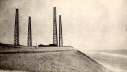
Marconi towers Celebrating The 100th Anniversary of Guglielmo Marconi’s First Wireless transmission between the United States and Europe on January 11 – 19, 2003.

From atop high, sandy cliffs overlooking the Atlantic, Marconi transmitted a simple, 54-word greeting from President Theodore Roosevelt to Great Britain’s King Edward VII. Within hours, the King acknowledged receiving the message, and the spark of global communications was lit.
The Marconi Radio Club, W1AA, and the Marconi Cape Cod Memorial Radio Club, KM1CC, working in partnership with the National Park Service at Cape Cod National Seashore, will operate a Special Event station from January 11-19 at the former Coast Guard station at Coast Guard Beach in Eastham, Massachusetts, from near the site of the original Marconi 1903 Station. From 9:00 a.m. to 5:00 p.m. each day, the public will be able to tour the station, listen to voice and Morse Code discussions with other radio operators around the world, and learn about wireless technology and the significance of Marconi’s achievement. For Details See: http://personal.tmlp.com/k1vv/w1aa

January 18, 2003 will mark the centennial of Marconi’s groundbreaking transatlantic wireless transmission with a reenactment of this historic scientific achievement, rivaling the Wright Brother first flight at Kitty Hawk.

Marconi’s daughter Princess Elettra Marconi is scheduled to attend the event.

A PRESIDENTIAL Commemorative message is anticipated from President George W. Bush.

NASA International Space Station Link – Selected Students from three Cape Cod High Schools (Cape Cod Vocational Technical High School-Harwich, Provincetown High School- Nauset Regional High School) will communicate with astronauts aboard the orbiting International Space Station.

For a complete events calendar, go to www.nps.gov/caco and click on “In Depth,” then “News.”

Bob Doherty K1VV
Pres. Marconi Radio Club W1AA
http://personal.tmlp.com/k1vv/w1aa
k1vv@tmlp.com

Another CEMARC Youth Net Milestone

CEMARCN1DHW writes:

This week’s CEMARC Youth Net reached its second milestone.

Young Kelsey McGovern, using her father John’s call, W1JMC, acted as Net Control for the net entirely on her own this week. She performed her net control duties perfectly by maintaining control, generating a platform for participant discussion, and overall, sounded like a professional NC with years of experience.

“Kelsey, congratulations on your performance.”

For those of you who haven’t taken the time to encourage young hams, or future hams that you are aware of, whether are your own, a relative’s, a neighbor’s or a friend’s, to join this wonderful group of young adults in their ham radio experience on the air, shame on you.

If we don’t encourage these young adults now, then we are doing them, and ourselves a disservice. Take a minute, think of who might enjoy getting on the air with them. Call their parents. Offer them your assistance in getting on the air. Review your club rosters for family memberships, and contact that member and remind them of the net. If you’re connected to a Scout group, arrange to have them over your shack on Sunday. Thanks to the MMRA linked system, it’s possible for almost any youngster to join in.

It’s up to all of us now to help build this fine group. Keep them active and help the net grow. Give our youth a minute of your time, make a call.

Note: Ann Weldon, KA1PON, was presented a well deserved Certificate at the CEMARC meeting Saturday for her outstanding, and continuing contributions to the children of the ham community.” Congratulations and thank you, Ann”. Additionally, Kevin, K1KWP, and the MMRA Control Operaters were also recognized for their contributions in helping to make the Youth Net possible.

Remember, this net is for children ONLY.

Weekly Schedule – Sunday 7:00pm MMRA Repeaters