
(Hurricane Isabel Coordination Message #8)
Hello to all…
….Hurricane Isabel Expected to Make Landfall in North Carolina around
Midday Today and is Pounding a Large Portion of the Mid-Atlantic Coast with
Tropical Storm and Hurricane force conditions….
….Large Eye of Isabel seen on Morehead City, North Carolina Radar….
….Hurricane Isabel’s expected track remains through Central Pennsylvania
into Western New York after landfall. Track must be watched for any eastward
deviation….
….Tropical Storm Warnings Have Been Expanded to cover all of New Jersey,
the New York City area into Long Island, New York. A shift in track of 150
miles could bring Tropical Storm Warnings to part of the Southern New
England Coastline and needs to be monitored….
….Wind Advisory May Be Required for Much of Southern New England late
tonight and Friday….
….Hazardous Weather Outlook Cites Potential for SKYWARN Activation
beginning possibly early Friday Morning….
….SKYWARN Coordinators and Spotters Should Prepare for some form of
SKYWARN Activation Beginning Friday Morning. ARES/RACES Groups Should
Monitor in case Tropical Storm Conditions Affect Portions of the Area….Hurricane Isabel is pounding the North Carolina-Virginia and Mid-Atlantic
Coastline with hurricane force and tropical storm force conditions. The
large eye of Isabel can be seen on Morehead City, North Carolina making slow
progress Northwest to North-Northwest. Inital motion at this time is at
325-330 degrees. There has been only a slight bend more westerly so far. If
a further bend west does not occur and a northward turn were to start
earlier than expected, tropical storm force conditions could affect some
parts of the Southern New England Coastline and should continue to be
monitored.
At this time, Southern New England is expected to see conditions just short
of Tropical Storm force conditions. Winds will be sustained at 20-30 MPH
with wind gusts to “Tropical Storm” or Gale force of around 45 to perhaps 50
MPH. A Wind Advisory is expected to be posted for portions of Southern New
England later today as the evolution of Isabel unfolds and the track of her
feeder bands and strongest winds are understood. These winds could cause
sporadic pockets of wind damage across the region. Tropical Heavy Downpours
are also expected across portions of Southern New England with 1-2″ of rain
possible. Localized areas of 3″ of rain or more may occur in parts of
Southern New England. This amount of rain would be enough to cause flooding
of urban and poor drainage area. It would take 4″ of rain in less than a 6
hour period to cause small river and stream flooding. Larger stem river
flooding is not expected at this time. There is also a small chance of
strong thunderstorms. Any strong thunderstorms that manage to develop would
have the ability to rotate and bring stronger winds down to the surface and
could cause isolated wind damage. It is noted that the Storm Prediction
Center has placed Eastern Pennsylvania, New York City, New Jersey and
Delaware in a slight risk for Severe Weather and has placed Southern New
England in a general risk for thunderstorms with a 5% probability of
isolated severe weather.
Once again, a track deviation of 150 Miles further east could bring stronger
conditions to the region. Therefore, all SKYWARN Spotters and Coordinators
should monitor the situation and activation is possible as early as early
Friday Morning. ARES/RACES Groups should monitor in case tropical storm
force conditions affect parts of the area or localized greater impact
occurs.
The Hurricane Watch Net has reactivated on 14.325 MHz along with National
Hurricane Center Operations for traffic into and out of the affected area.
The latest Hurricane Watch Net Activation Plan is listed at the link below:
http://www.hwn.org/activationplans.shtml
Information on SATERN assistance for the affected area can be found at the
following link per the Hurricane Watch Net Web Site:
http://www.satern.org/
Echolink and IRLP are being utilized by the National Hurricane Center and
ARES and SKYWARN Operators in the affected area. You can click on the
following link to listen to it from the IRLP side or listen on reflector
9210 (Please do NOT transmit or interrupt stations in the affected area):
http://www.irlp.net/
If you have Echolink or an Echolink node in your area, the “WX-Talk” node is
being utilized for communications into and out of the affected area. Once
again, do NOT tramsit or interrupt stations in the affected area.
The next coordination message should be posted no later than 11:30 PM. The
last coordination message may this mesage, tonight or tomorrow morning
depending on how extensive an Activation of SKYWARN occurs and if Ops are
required at NWS Taunton. Below is the NWS Taunton Hazardous Weather Outlook,
Special Weather Statement and Area Forecast Discsussion, along with the
latest 8 AM National Hurricane Center Advisory:
FLUS41 KBOX 181055
HWOBOX
CTZ002>004-MAZ002>024-026-NHZ011-012-015-RIZ001>008-191100-
HAZARDOUS WEATHER OUTLOOK
NATIONAL WEATHER SERVICE TAUNTON MA
655 AM EDT THU SEP 18 2003
THIS HAZARDOUS WEATHER OUTLOOK IS FOR SOUTHWEST NEW HAMPSHIRE…
MASSACHUSETTS EAST OF BERKSHIRE COUNTY…NORTHEAST CONNECTICUT AND
RHODE ISLAND.
.DAY ONE…TODAY
A HIGH SURF ADVISORY (INCLUDING RIP TIDE POTENTIAL) IS POSTED FOR
VULNERABLE PORTIONS OF THE SOUTH COASTS OF MASSACHUSETTS AND RHODE
ISLAND INCLUDING THE CAPE AND ISLANDS. INCREASING WINDS AND
POTENTIALLY DANGEROUS SEAS WILL OCCUR TONIGHT OVER THE COASTAL
WATERS SOUTH OF NEW ENGLAND. HURRICANE ISABEL WILL MAKE LANDFALL
AROUND MIDDAY TODAY NEAR THE OUTER BANKS OF NORTH CAROLINA AND MOVE
TO NEAR OR JUST WEST OF WASHINGTON TONIGHT.
.DAYS TWO THROUGH SEVEN…
CONSULT THE LATEST GUIDANCE AND INFORMATION FROM THE TROPICAL
PREDICTION CENTER REGARDING HURRICANE ISABEL. HURRICANE ISABEL WILL
GRADUALLY WEAKEN AND BECOME EXTRATROPICAL FRIDAY…AS IT HEADS
NORTH THROUGH CENTRAL PENNSYLVANIA AND WESTERN NEW YORK. SEVERAL
POTENTIAL HAZARDS EXIST FOR SOUTHERN NEW ENGLAND.
SEAS/SURF…
WINDS MAY INCREASE TO NEAR GALE FORCE…AND POTENTIALLY DANGEROUS
SEAS WILL OCCUR LATE TONIGHT INTO FRIDAY. SEAS WILL BUILD TO BETWEEN
15 AND 20 FEET OVER THE SOUTH COASTAL WATERS BY EARLY FRIDAY
MORNING…AND TO AROUND 10 FEET EAST OF CAPE ANN DURING FRIDAY. HIGH
SURF MAY CAUSE MINOR SPLASHOVER ON THE MOST VULNERABLE OF SHORELINES
AT THE TIMES OF HIGH TIDE ON FRIDAY…AND WILL CONTINUE TO CAUSE
DANGEROUS RIP TIDES THROUGH FRIDAY. THE HIGH SURF ADVISORY MAY
HAVE TO BE EXTENDED LATE TONIGHT OR FRIDAY TO THAT PORTION OF
BOSTONS SOUTH SHORE FROM HULL TO DUXBURY…AS WELL AS THE CAPE ANN
AREA. THE ROUGH SEAS MAY STRESS ANY WEAK MOORINGS. BEACH EROSION IS
LIKELY LATE TONIGHT INTO FRIDAY ALONG SUSCEPTIBLE SOUTH AND SOUTHEAST
FACING SHORELINES ON MARTHAS VINEYARD…NANTUCKET AND THE SOUTH COAST
OF RHODE ISLAND AND MASSACHUSETTS.
WIND OVER LAND…
FOR THE LAND AREA…GALE FORCE (TROPICAL STORM FORCE) WIND GUSTS ARE
LIKELY…ESPECIALLY ACROSS HIGH TERRAIN AND EXPOSED SOUTH COAST
LOCATIONS VERY LATE TONIGHT AND FRIDAY. THIS MAY REQUIRE A WIND
ADVISORY TO BE ISSUED LATER. SUSTAINED WINDS NEAR 30 MPH AND GUSTS
TO AROUND 45 MPH MAY AFFECT SOUTH COASTAL AREAS LATE TONIGHT AND
SPREAD ACROSS OTHER LOCATIONS IN SOUTHERN NEW ENGLAND DURING
FRIDAY MORNING. THESE WINDS COULD PRODUCE POCKETS OF BROKEN TREE
LIMBS.
THERE IS A SMALL CHANCE OF ISOLATED STRONG THUNDERSTORMS
ON FRIDAY MORNING.
RAINFALL…
RAINFALL OF 1 TO 1.5 INCHES IS EXPECTED OVER MUCH OF SOUTHERN NEW
ENGLAND…WITH POCKETS OF 2 TO 3 INCHES POSSIBLE…ESPECIALLY
OVER THE EAST SLOPES OF THE BERKSHIRES…THE WORCESTER HILLS…AND
NORTHWEST RHODE ISLAND. LOCAL POOR DRAINAGE FLOODING IS POSSIBLE
LATE TONIGHT AND FRIDAY. SMALL STREAM FLOODING IS NOT EXPECTED…
UNLESS MORE THAN 4 INCHES FALLS IN LESS THAN A SIX HOUR PERIOD.
MAIN STEM RIVER FLOODING IS UNLIKELY IN SOUTHERN NEW ENGLAND.
DRY WEATHER AND SLOWLY SUBSIDING SEAS WILL FOLLOW THIS WEEKEND.
.SPOTTER CALL TO ACTION STATEMENT…
SPOTTER ACTIVATION IS NOT ANTICIPATED TODAY…BUT MAY BE NECESSARY
AS SOON AS EARLY FRIDAY MORNING.
$$
THOMPSON
WWUS81 KBOX 180927
SPSBOX
CTZ002>004-MAZ002>024-026-NHZ011-012-015-RIZ001>008-181630-
SPECIAL WEATHER STATEMENT
NATIONAL WEATHER SERVICE TAUNTON MA
525 AM EDT THU SEP 18 2003
…GUSTY WINDS AND HEAVY RAIN ARE EXPECTED LATE TONIGHT AND FRIDAY
IN ADDITION TO CONTINUED HIGH SURF ALONG THE SOUTH COAST…
HURRICANE ISABEL IS FORECAST TO MOVE ONSHORE IN NORTH CAROLINA
AROUND MIDDAY TODAY…THEN WEAKEN AS IT HEADS ACROSS CENTRAL
PENNSYLVANIA AND WESTERN NEW YORK ON FRIDAY. ALTHOUGH SOUTHERN NEW
ENGLAND WILL BE ON THE EASTERN FRINGES OF THE STORM…ISABEL OR ITS
REMNANTS WILL STILL BRING STRONG WINDS…HEAVY RAIN AND HIGH SURF TO
OUR REGION LATE TONIGHT AND FRIDAY.
…HIGH SURF…
A HIGH SURF ADVISORY CONTINUES THROUGH FRIDAY FOR SOUTH COASTAL
RHODE ISLAND AND MASSACHUSETTS…INCLUDING CAPE COD AND THE
ISLANDS. IT MAY BE EXPANDED TO ALSO INCLUDE VULNERABLE BEACHES ALONG
THE EASTERN MASSACHUSETTS COAST TONIGHT OR FRIDAY. INCREASING WINDS
LATE TONIGHT INTO FRIDAY MAY BRING SEAS AS HIGH AS 15 TO 20 FEET ON
THE SOUTH COASTAL WATERS…AND AS HIGH AS 7 TO 10 FEET OFF THE EAST
COAST OF MASSACHUSETTS.
THE HIGH SEAS WILL PRODUCE 5 TO 10 FOOT BREAKERS AND DANGEROUS RIP
TIDES ON THE MORE SUSCEPTIBLE BEACHES ON THE SOUTHERN NEW ENGLAND
COAST THROUGH FRIDAY…CREATING A VERY TREACHEROUS SITUATION FOR ANY
OCEAN SWIMMERS. THE ASTRONOMICAL TIDES ARE NOT PARTICULARLY HIGH
NOR IS A STORM SURGE OF MORE THAN 1 OR 2 FEET LIKELY. EVEN SO…
A CONTINUING ONSLAUGHT OF LARGE BREAKERS MAY CAUSE MINOR SPLASHOVER
IN THE MOST VULNERABLE PORTIONS OF THE SOUTH COAST DURING THE TIMES
OF HIGH TIDE ON FRIDAY. BEACH EROSION WILL LIKELY OCCUR AS WELL
ALONG SOME SOUTH AND SOUTHEAST FACING SHORES…ESPECIALLY ON MARTHAS
VINEYARD AND NANTUCKET.
…WIND…
THE STRONGEST WINDS ARE EXPECTED LATE TONIGHT INTO FRIDAY…AS
EAST WINDS SHIFT TO THE SOUTH. SUSTAINED WINDS SHOULD PEAK BETWEEN
20 AND 30 MPH…WITH THE POSSIBILITY OF GUSTS AS HIGH AS 45 OR
EVEN 50 MPH. THE WINDS SHOULD BE HIGHEST IN SOUTHEAST NEW ENGLAND…
AND IN THE EXPOSED HIGHER TERRAIN ACROSS THE INTERIOR. WINDS WILL
GRADUALLY DIMINISH FRIDAY NIGHT.
…RAINFALL…
THE HEAVIEST RAIN IS LIKELY TO FALL ACROSS THE EAST SLOPES OF THE
BERKSHIRES…THE HILLS OF WORCESTER COUNTY AND NORTHWEST RHODE
ISLAND…AND PORTIONS OF THE MERRIMACK VALLEY. RAINFALL TOTALS OF
1 TO 2 INCHES ARE EXPECTED IN THESE AREAS WITH LOCALLY AS MUCH AS
3 INCHES BY FRIDAY NIGHT. LESSER AMOUNTS ARE EXPECTED ELSEWHERE.
WHILE FLOODING OF RIVERS AND STREAMS IS NOT FORECAST AT THIS TIME…
HEAVY RAIN MAY LEAD TO MINOR FLOODING OF LOW LYING AND POOR
DRAINAGE AREAS.
STAY TUNED TO NOAA WEATHER RADIO…OR YOUR LOCAL MEDIA FOR UPDATED
INFORMATION ON THIS WEATHER SITUATION.
$$
THOMPSON
FXUS61 KBOX 180726
AFDBOX
AREA FORECAST DISCUSSION
NATIONAL WEATHER SERVICE TAUNTON MA
300 AM EDT THU SEP 18 2003
.SHORT TERM…
TODAY AND TONIGHT
LITTLE CHANGE TO THE FORECAST. CHANGES HAVE BEEN MORE REFINEMENT
BASED ON CURRENT CONDITIONS A LITTLE COOLER THAN PREVIOUS FORECAST.
ALSO LOWERED THE POPS A LITTLE TODAY…BUT HAVE CHC TO LIKELY IN
TNT. PATCHY FOG EARLY THIS MORNING…THEN COASTAL FOG AGAIN TNT.
MARINE…MARINE SMALL CRAFT ADVISORIES FOR SEAS ON THE OPEN
WATERS AS WELL AS THE SOUNDS SOUTH OF NEW ENGLAND. WINDS
INCREASING TONIGHT WILL RESULT IN THE POSSIBILITY OF SMALL CRAFT
ADVISORIES FOR WINDS MOST WATERS STARTING TONIGHT.
AVIATION…GENERALLY VFR CONDITIONS THROUGH TODAY…PATCHY GROUND
FOG MAY RESTRICT CONDITIONS TO IFR IN A FEW LOCALITIES THIS EARLY
MORNING. HOWEVER CONDITIONS WILL LIKELY IMPROVE RAPIDLY AFTER
SUNRISE. IFR CONDITIONS REDEVELOP OVERNIGHT TONIGHT IN RAIN AND
FOG WITH GUSTY WINDS SURFACE AND ALOFT.
&&
.LONG TERM…
FRIDAY THROUGH WEDNESDAY
MAIN FOCUS THIS SHIFT IS ON IMPACT FROM ISABEL PASSING TO OUR W.
MODELS CONTINUE TO SHOW CLOSE CONVERGENCE AND GREAT
CONSISTENCY FROM RUN TO RUN ON TRACK OF ISABEL…NOT TYPICALLY
SEEN WITH TROPICAL CYCLONES. CONTINUE TO HAVE RELATIVELY HIGH
CONFIDENCE IN SYNOPTIC PATTERN IN ASSOCIATION WITH ISABEL. MAIN
UNCERTAINTIES CONTAINED IN DETAILS…ESPECIALLY WITH REGARD TO
TIMING OF RAIN AND QPF. BELIEVE PRIOR FORECAST HAS GOOD HANDLE IN
MOST RESPECTS AND DO NOT PLAN ON ANY MAJOR REVISIONS. AGREE WITH
PRIOR THINKING OF 1 TO 2 INCHES OVER LARGE PART OF FORECAST AREA…
WITH LOCALLY UP TO 3 INCHES POSSIBLE IN FAVORABLE UPSLOPE AREAS…
ESPECIALLY E SLOPES OF BERKSHIRES. WILL CONTINUE MENTION OF WIND
GUSTS AROUND 45 MPH FOR LATE TONIGHT AND FRI…ESPECIALLY S COAST
AND HIGHER/EXPOSED TERRAIN IN CENTRAL AND WESTERN SECTIONS.
ANTICIPATE THAT WIND ADVISORY WILL LIKELY NEED TO BE ISSUED
SOMETIME DURING THE NEXT SHIFT.
SAT LOOKS TO BE DRY WITH AID OF DOWNSLOPING FLOW…AND SURFACE HIGH
OVER REGION GIVES HIGH CONFIDENCE FOR DRY WEATHER SUN AND MON.
RATHER SIGNIFICANT MERIDIONAL EXTENT TO SHORT WAVE TROF TUE/TUE NIGHT
WITH POTENTIAL SURFACE WAVE ON FRONT. UPPER TROF LOOKS NEUTRAL
WITH HINT OF NEGATIVE TILT POTENTIAL ON BOTH GFS AND GEM. WILL
CONTINUE CHANCE FOR SHOWERS IN THAT TIME FRAME.
MARINE…ANTICIPATE HIGH SURF/RIP TIDE ADVISORY WILL NEED TO BE
CONSIDERED FOR VULNERABLE LOCATIONS ON S SHORE FROM HULL TO DUXBURY
AND NORTH SHORE BY LATE TONIGHT OR EARLY FRI. WINDS AND SEAS FROM
PREVIOUS FORECAST LOOKS REASONABLE AND AGAIN NO MAJOR CHANGES
EXPECTED. TIDE MAY RUN 1 TO 2 FT ABOVE NORMAL ALONG S
COAST…BUT IN A NEAP TIDE PERIOD WITH THE FRI MORNING HIGH TIDE
PARTICULARLY LOW. EVEN SO…MIGHT SEE SOME SPLASHOVER AT TIME OF
FRI HIGH TIDES ALONG VERY EXPOSED AND VULNERABLE S/SE FACING
SHORELINES ALONG S COAST AND ISLANDS. MAIN ISSUE SHOULD BE ROUGH
SEAS…VERY LARGE BREAKERS… AND MAJOR RIP TIDES. WILL ALSO NOTE IN
HWO POTENTIAL FOR BEACH EROSION ALONG SOME S/SE FACING SHORE LINES
ALONG S COAST AND ISLANDS.
HYDRO…LOCAL FLOODING OF POOR DRAINAGE AREAS DUE TO TROPICAL
DOWNPOURS POSSIBLE. ALTHOUGH MAY SEE SLUG OF 1 TO 2 INCH
RAINFALL WITH LOCALLY UP TO AROUND 3 INCHES…MORE EXTENSIVE SMALL
STREAM OR MAIN STEM FLOODING APPEARS UNLIKELY AT THIS TIME. FLASH
FLOOD GUIDANCE INDICATES 4.0-4.5 INCHES NEEDED IN 6 HOURS AS
THRESHOLD FOR HIGHER TERRAIN AREAS IN CENTRAL AND WESTERN ZONES. IF
ANY PORTION OF OUR FORECAST AREA MAY BE A TAD MORE VULNERABLE THAN
OTHERS…PROBABLY WOULD BE WESTERN HARTFORD COUNTY.
&&
.BOX WATCHES/WARNINGS/ADVISORIES…
CT…NONE.
MA…HIGH SURF ADVISORY ALONG SOUTHERN COAST TO CAPE COD.
NH…NONE.
RI…HIGH SURF ADVISORY ALONG COAST.
MARINE…GALES MAY BE REQUIRED FRI MONTAUK POINT TO NANTUCKET AS WELL
AS BLOCK ISLAND AND RHODE ISLAND SOUNDS
SCA FOR SEAS ALL WATERS EXCEPT CAPE COD BAY-NARRAGANSETT
BAY-BOS HARBOR
SCA MAY BE REQUIRED THU NARRAGANSETT BAY
SCA MAY BE REQUIRED THU NIGHT CAPE COD BAY AND BOS HARBOR
$$
LONG TERM…THOMPSON
WTNT33 KNHC 181144
TCPAT3
BULLETIN
HURRICANE ISABEL INTERMEDIATE ADVISORY NUMBER 49A
NWS TPC/NATIONAL HURRICANE CENTER MIAMI FL
8 AM EDT THU SEP 18 2003
…ISABEL CONTINUES TOWARD THE OUTER BANKS…WINDS DECREASE
SLIGHTLY…
A HURRICANE WARNING REMAINS IN EFFECT FROM CAPE FEAR NORTH CAROLINA
TO CHINCOTEAGUE VIRGINIA…INCLUDING PAMLICO AND ALBEMARLE
SOUNDS…AND THE CHESAPEAKE BAY SOUTH OF SMITH POINT. A HURRICANE
WARNING MEANS THAT HURRICANE CONDITIONS ARE EXPECTED WITHIN THE
WARNING AREA…GENERALLY WITHIN 24 HOURS.
ALL PREPARATIONS TO PROTECT LIFE AND PROPERTY SHOULD BE RUSHED TO
COMPLETION IN THE HURRICANE WARNING AREA.
A TROPICAL STORM WARNING REMAINS IN EFFECT NORTH OF CHINCOTEAGUE TO
MORICHES INLET NEW YORK…INCLUDING DELAWARE BAY. A TROPICAL STORM
WARNING REMAINS IN EFFECT SOUTH OF CAPE FEAR TO SOUTH SANTEE RIVER
SOUTH CAROLINA…FOR THE CHESAPEAKE BAY FROM SMITH POINT
NORTHWARD…AND FOR THE TIDAL POTOMAC.
AT 8 AM EDT…1200Z…THE CENTER OF HURRICANE ISABEL WAS LOCATED
NEAR LATITUDE 33.7 NORTH…LONGITUDE 75.2 WEST OR ABOUT 110 MILES
SOUTH-SOUTHEAST OF CAPE HATTERAS NORTH CAROLINA. THIS IS ALSO
ABOUT 95 MILES SOUTHEAST OF CAPE LOOKOUT NORTH CAROLINA.
ISABEL IS MOVING TOWARD THE NORTHWEST NEAR 15 MPH…AND THIS GENERAL
MOTION IS EXPECTED TO CONTINUE FOR THE NEXT 24 HOURS. ON THE
FORECAST TRACK…THE CENTER OF ISABEL IS EXPECTED TO MAKE LANDFALL
IN EASTERN NORTH CAROLINA EARLY THIS AFTERNOON. HOWEVER…
CONDITIONS ARE DETERIORATING OVER A LARGE AREA WELL BEFORE THE
CENTER REACHES THE COAST. HURRICANE CONDITIONS ARE BEGINING TO
SPREAD ONTO THE COAST IN THE HURRICANE WARNING AREA. WIND GUSTS TO
HURRICANE-FORCE COULD ALSO EXTEND INLAND UP TO 150 MILES ALONG THE
PATH OF ISABEL.
MAXIMUM SUSTAINED WINDS ARE NEAR 100 MPH…WITH HIGHER GUSTS. THIS
IS JUST ABOVE THE CATEGORY TWO WIND SPEED THRESHOLD OF THE
SAFFIR-SIMPSON HURRICANE SCALE. ONLY SMALL CHANGES IN STRENGTH ARE
LIKELY PRIOR TO LANDFALL…AND WEAKENING IS EXPECTED AFTER
LANDFALL.
HURRICANE FORCE WINDS EXTEND OUTWARD UP TO 115 MILES FROM THE
CENTER…AND TROPICAL STORM FORCE WINDS EXTEND OUTWARD UP TO 345
MILES.
A GUST OF 63 MPH WAS RECENTLY OBSERVED AT ATLANTIC BEACH NORTH
CAROLINA. A GUST OF 60 MPH WAS OBSERVED AT ELIZABETH CITY NORTH
CAROLINA.
THE MOST RECENT MINIMUM CENTRAL PRESSURE MEASURED BY A HURRICANE
HUNTER AIRCRAFT WAS 957 MB…28.26 INCHES.
STORM SURGE FLOODING OF 5 TO 8 FEET ABOVE NORMAL TIDE LEVELS…
ALONG WITH EXTREMELY LARGE AND DANGEROUS BATTERING WAVES…IS
EXPECTED NEAR AND TO THE NORTH OF WHERE THE CENTER CROSSES THE
COAST. STORM SURGE FLOODING OF 4 TO 8 FT ABOVE NORMAL TIDE LEVELS
IS EXPECTED IN CHESAPEAKE BAY AND THE TIDAL PORTIONS OF ADJACENT
RIVERS.
STORM TOTAL RAINFALLS OF 6 TO 10 INCHES…WITH LOCALLY HIGHER
AMOUNTS…ARE LIKELY IN ASSOCIATION WITH ISABEL.
THERE IS A THREAT OF ISOLATED TORNADOES OVER EASTERN NORTH
CAROLINA AND SOUTHEASTERN VIRGINIA TODAY
REPEATING THE 8 AM EDT POSITION…33.7 N… 75.2 W. MOVEMENT
TOWARD…NORTHWEST NEAR 15 MPH. MAXIMUM SUSTAINED
WINDS…100 MPH. MINIMUM CENTRAL PRESSURE… 957 MB.
FOR STORM INFORMATION SPECIFIC TO YOUR AREA…PLEASE MONITOR
PRODUCTS ISSUED BY YOUR LOCAL WEATHER OFFICE AND STATEMENTS FROM
LOCAL EMERGENCY MANAGEMENT OFFICIALS.
THE NEXT ADVISORY WILL BE ISSUED BY THE NATIONAL
HURRICANE CENTER AT 11 AM EDT.
FORECASTER FRANKLIN
Respectfully Submitted,
Robert Macedo (KD1CY)
ARES SKYWARN Coordinator
Southeast Massachusetts ARES District Emergency Coordinator
SEMARA ARES Emergency Coordinator
Pager #: (508) 354-3142
Home Phone #: (508) 994-1875 (After 6 PM)
Home/Data #: (508) 997-4503 (After 6 PM)
Work Phone #: 1-800-445-2588 Ext.: 72929 (8 AM-5 PM)
Email Address: rmacedo@rcn.com
http://users.rcn.com/rmacedo
 Bob Mims, WA1OEZ writes:

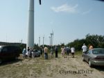 Six members of the Nashoba Valley ARC traveled to the Green Mountain Power’s Searsburg VT, Wind Power Facility recently. Their “tour guide” was a retired science teacher, W1ZPB.
 The Falmouth Amateur Radio Association will conduct its highly touted “License in a Weekend” Technician class Friday, November 7 through Sunday, November 9 at the Barnstable County Fairgrounds Classroom on Route 151. [
 The
The  The Billerica Amateur Radio Society is sponsoring a one day ham radio class on November 15, 2003 to help you get your Technician class amateur radio license. Knowledge of the Morse code is NOT required for this class license. The class will cover all of the topics you need to know to pass the exam.
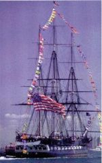 Amateur radio operations are planned as part of the bi-annual “Turnaround Cruise” October 11. The event will see two famous ships–the USS Constitution and the USS Cassin Young–traversing Boston Harbor exchanging cannon salutes with the fort on Castle Island. From there, the ships will meet up with the guided missile destroyer USS Chaffee, and then head back to the Old Boston Navy Yard Pier.
  Mike Neilsen, W1MPN writes:
 The bi-annual Hosstraders Hamfest happens October 3-4, 2003 at the Hopkinton State Fairgrounds, off I-89, Exit 7, in Hopkinton NH.
 Mike Neilsen, W1MPN writes:
 From K5MP:
 The present forecast is a nominal solution, even though the present consolidated prediction has the storm hitting land in the Carolinas and moving well inland away from us. Still, a run straight at us has not been ruled out as of yet, and a strike east of NYC (which is not a big change of direction from where it is now), could bring very undesirable effects into our area. Please don’t let down from your vigilance or preparations for this storm until Rob or I give an all clear.
 Tim Smith, N1TI writes:
 In view of the possibility that the U.S. East Coast could be impacted by Hurricane Isabel sometime this week, please indicate your availability to help with your DEC, and/or SKYWARN coordinator, KD1CY as soon as possible. Please be sure to update those officials with your phone and email changes since the last time you spoke.
  Bob Salow, WA1IDA writes:
 Ed Weiss, W1NXC received the prestigious Herb S. Brier Instructor of the Year Award this past Thursday night at the Framingham ARA’s “Night Out” Dinner at the Pacific Buffet in Framingham. Presenting the award and gift certificate were ARRL New England Division Director Tom Frenaye, K1KI and Eastern Massachusetts Section Manager Phil Temples, K9HI. Many of the club members in attendance stood up and gave testimony to Ed’s ceaseless and unwavering commitment to volunteer teaching of Amateur Radio material spanning many years.
 Ken, WO1N writes: