Hello to all….
….Eastern Massachusetts ARES Assistance Requested by the Massachusetts Bay Red Cross for the Operation Atlas Boston Logan Airport Drill….
….Drill Rescheduled for Saturday June 4th, 2005 with the same timeline to be utilized. A backup date of Sunday June 5th, 2005 has already been defined as well….
The Operation Atlas, Boston Logan Airport Drill, has been rescheduled for Saturday June 4th with the same timeline to be utilized by Massachusets By Red Cross. A backup date of Sunday June 5th has also been designed in case of weather issues on Saturday June 4th. The Red Cross has defined their timeline and we had 10-20 Amateurs assigned for this exercise for the orignial date, however, given the new rescheduled date of June 4th, we may need different Amateurs to step forward in case the ones previously assigned cannot make the new data. In particular, we are looking for Hams in the Metro Boston area to provide additional support for the drill.
The Massachusetts Bay Red Cross Chapter has requested Eastern Massachusetts ARES to assist in the Operation Atlas-Boston Logan Airport Drill. This drill is being conducted by the Department of Homeland Security and the Red Cross has a role in the drill to provide a Disaster Mental Health Services Team, Mass. Care Team, and will have their Boston and Waltham offices active for this exercise. The Red Cross has requested communications assistance from Eastern Massachusetts ARES for this drill.
Currently, we are anticipating a need for approximately 15-20 Amateurs. The town of Bridgewater EOC will be setup as a Net Control center similar to what was done for the Democratic National Convention. Amateurs will be needed at the Waltham and Boston Red Cross chapters and several Amateurs will be needed on “Go” teams that will be going into the city or to the airport itself. Home stations will also be needed for this exercise.
This is the first major drill that we have participated in with Red Cross since the Democratic National Convention. While not as large as the TOPOFF exercise just completed in Connecticut, the Department of Homeland Security is running the Operation Atlas-Logan Airport Drill and all eyes will be on the performance of Amateur Radio during this drill. It is widely known through several federal government agencies of the tremendous effort that the ARES/RACES/SKYWARN and MARS operators played during the Democratic National Convention and this is an opportunity to prove that the high level of organization that existed last year has been sustained since the DNC by a strong performance in this exercise.
Please contact your DEC or myself if you’re interested in participating in this exercise. Please note that deployments to the Red Cross and as go teams for the Red Cross will have requirements set forth by our ARES staff. For Net Control duties in Bridgewater, please contact Carl Aveni-N1FY at caave@peoplepc.com or myself.
This is a worthwhile event to practice deployment skills not utilized since the Democratic National Convention. Also, remember that in this drill, much like a real emergency communications situation, unexpected things may happen so remember one of the most important aspects to supporting a drill or real emergency communications situation, Blessed are the flexible for they will not get bent out of shape.
This announcement will be updated again as further information becomes available.
Respectfully Submitted,
Robert Macedo (KD1CY)
ARES SKYWARN Coordinator
Eastern Massachusetts ARES Section Emergency Coordinator
Pager #: (508) 354-3142
Home Phone #: (508) 994-1875 (After 6 PM)
Home/Data #: (508) 997-4503 (After 6 PM)
Work Phone #: 1-800-445-2588 Ext.: 72929 (8 AM-5 PM)
Email Address: rmacedo@rcn.com
http://users.rcn.com/rmacedo
1

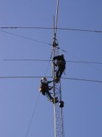 New England DX Century Club members W1ZT, W1FJ, W1CWU and W1CPR lent a “helping hand” to Ray, KM1D, in the removal of his tower in North Andover recently. The dynamic duo of W1ZT and W1FJ climbed the 70-foot tower and “made this very scary job look easy” according to those present. [Additional photos]
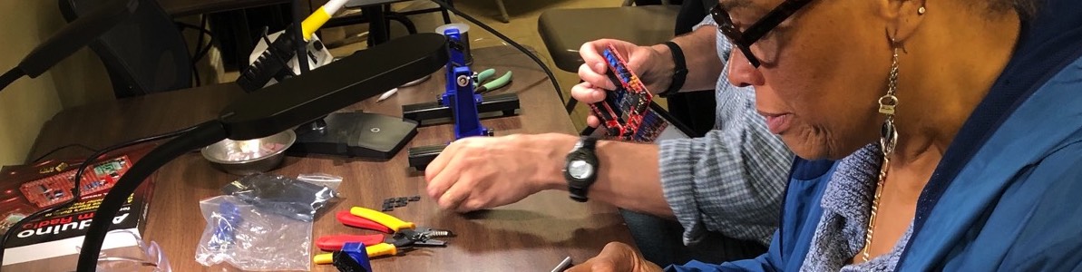
 Members of the Nashoba Valley Amateur Radio Club participated in their first highway cleanup of 2005 on April 10th. The group collected a total of 21 bags of trash.
 Bill O’Hara, N1EY, writes:
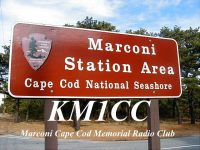 The Marconi Cape Cod Memorial Radio Club,
 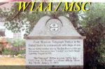 The Marconi Radio Club will operate W1AA/MSC, representing the 1901 Marconi Nantucket ship-to-shore station for International Marconi Day, April 23, 2005.
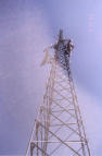 “After much debate and the two closest votes of this year’s Town [of Acton] Meeting, residents chose to adopt the more stringent of two zoning bylaw amendments governing amateur radio towers,” states an article in the April 7, 2005 issue of The Beacon in TownOnline.com. [
 The Framingham Amateur Radio Association is now accepting nominations for the FARA Scholarship.
  The March, 2005 EMA traffic net and Public Service Honor Roll totals have been posted to
 The Massachusetts Bay Chapter of the American Red Cross has requested Eastern MA ARES to assist in the Operation Atlas-Boston Logan Airport Drill on May 7, 2005. The drill is being conducted by the Department of Homeland Security.
 The fourth New England QSO Party will be held on May 7-8, 2005. It’s a great operating event and it is easy to participate in. The object is to contact as many New England stations in as many New England counties as possible on 80, 40, 20, 15, and 10 meters.
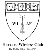 Two local college radio clubs–the MIT Radio Society and the Harvard Wireless Club–received mention in
 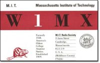 They carried links to the two clubs’ respective historical archives.
 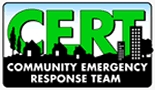 The Walpole Emergency Management Agency is offering a CERT training course April 19-21, 2005.