Hello everyone:
There are some comments in Gil’s letter below that I find very disturbing.
In particular, the comment about “handing the whole show to ARES.” Having
served as an EC, NM, STM, and SEC, as well as having dealt with ARES and
RACES organizations from the other side of the fence (as a Professional
Emergency Manager), I feel I have a fairly unique perspective.
On one hand, I agree that there is no harm integrating the Internet and
automated digital protocols into ARES and NTS. This is simply evolution and
progress. It needs to be done. However, it should be noted that these are
simply additional communications tools, whereas NTS is a methodology.
Please bear with me while I illustrate with an example:
During a recent bioterrorism response exercise in Central Michigan, the ARES
group repeatedly entered the Emergency Operations Center requesting
etiological information and other data from State and Federal public health
officials. In each case, the served agency representative asked some very
simple questions:
* “How’s requesting this information”
* “What time did he request it?”
* “What facility is he located at”
……..and on and on.
Finally, the local Emergency Manager walked into the ARES room, handed them
a book of radiogram blanks, and demanded they use them. He’s not a radio
amateur. As an exercise evaluator, I asked him what his reasons were for
doing so. The response was straightforward: “NTS format will insure we get
all of the necessary information in a consistent manner.”
As one who has had to rely on ARES and RACES groups to send messages at
HAZMAT scenes, during major disasters, and so forth, I can say without
equivocation that Amateur Radio has serious deficiencies. These may be
summarized as follows:
1. Most ARES groups are equipped (trained) only to handle informal tactical
communications in which they are the direct recipient of the information or
instructions. Many such organizations “fall apart” in net configuration
because the majority of members haven’t the least familiarity with proper
radiotelephone net procedures.
2. Most ARES groups are incapable of utilizing a standard message format for
accurately transmitting third party traffic. As such, important service
data is often lacking. A message recipient needs to know from whom and
where a message was originated. He needs to know when it was drafted. This
information is almost never available through ARES.
For over 30 years, I have seen numerous ARES groups and ARRL Sections bypass
NTS by creating ad-hoc “ARES Nets” to facilitate cross jurisdictional
message flow. Sometimes this is necessary to serve a unique, specialized
purpose, such as linking a number of Skywarn Nets. However, in most cases,
these nets serve only to avoid the use of a standard message format, which
many ECs and AECs are simply afraid to admit they don’t know.
If NTS were entirely supplanted by WINLINK and Internet message delivery
tomorrow, I am willing to bet my retirement income that the very same
problems will exist with message accuracy and content. Furthermore, new
problems will arise in that specific arrangements will not be made for
addressees to regularly check e-mail to accept messages in a timely fashion.
Isolated failures to the local telephone systems and ISPs would also result
in messages “disappearing” in time of emergency.
The simple fact is, ARES has repeatedly failed in a variety of message
handling tasks. Now, NTS is being blamed. We are told we aren’t keeping up
with the times. I say this is simple “bull.” If we want to get to the
bottom of this problem, I suggest the following, somewhat rhetorical
question: “Did the NTS fail the League, or did the League fail the NTS.”
Consider this:
———————-
For years the League has offered many recommendations for ARES
organizations, but has promulgated few, if any, minimum requirements for
member training and basic organizational capabilities. If your local
volunteer fire departments were run like many ARES groups, some would have
adequate hose, others wouldn’t. Some would have SCBA, others wouldn’t.
Some would have a few sets of turn-out gear, others would have too many.
This is why groups like the Red Cross, CAP, and even the Boy Scouts require
field units to meet certain basic requirements to maintain their Charter.
We do nothing of the kind, and the customer (served agencies) pays the price
in many cases.
——————-
For years, the League has done nothing to promote NTS or standard message
format. There are articles in QST on everything from collecting antique
radios and AM phone to the latest data modes, yet, rarely is NTS even
mentioned. When it is, it is usually about the nuts and bolts of layered
nets and how the various cycles work, as opposed to articles explaining how
NTS was applied to an actual ecom problem. One can’t help but ask how an
invisible organization can recruit or interest potential new members?
————————–
In Michigan, we have spent tens of thousands of dollars developing Packet
and PACTOR infrastructure. The result: Several Detroit area ECs told me,
“We don’t want anything to do with your g-d d–ned message handling
procedures.” They view any outside requirement as a threat to their power
and control. Nothing can be done to enforce standards because none exist.
So, this begs the question; Whether via WINLINK, packet, CW, or FM, how is a
message going to flow between a major Detroit Metropolitan Area hospital and
our State Public Health Department or State EMA in the abscence of
commercial/government infrastructure? My bet….it isn’t. If it does, it
will be incomplete, confusing, and perhaps even garbled.
In my opinion, the League failed NTS as opposed to the other way around.
The current NTS situation is simply a display of symptoms caused by an
underlying disease affecting the ARRL community. If the ARRL wants to do
something about the disease, they need to take some serious actions that
have little to do with NTS. Some steps may include:
1. Develop an ARES Certification Program. A local ARES group would have to
meet certain minimum standards to be “certified.” This might include:
* a specific percentage of individuals properly trained (ARRL CCE courses
or??).
* mandatory annual participation in SET on the standard date specified.
* daily NTS liaison.
* specific communications capabilities above and beyond two-meter FM.
The audit would be performed by an independent third party or someone
appointed by the SM or SEC.
2. Further implement the ARESMAT process so that “weak” ARES programs could
be supplemented with outside skills and capabilities. Require ARESMAT
capabilities be available throughout all Sections.
3. While integrating WINLINK and similar automated systems, recognize the
fact that messages may have to leave these systems to be transferred to a
manual method for ultimate delivery. Keep a framework for maintaining
“traditional” mode nets, such as NTS CW, SSB, and FM nets. In addition,
maintain a standard format for all official communications, regardless of
the mode utilized.
4. Recognize the fact that for digital methods to work reliably in time of
emergency, some things have to be standardized, such as mode and baud rate,
terminal software, and so forth. It will therefore be necessary to insist
that each ARES group develop a capability to utilize a standard digital mode
and deploy standardized software before developing additional capabilities.
This may be part of the certification process.
3. When the Field Organization Management Structure is revised, enforce it
for a change! More than likely, had NTS nets been utilized as intended and
defined in the Field Organization management chart (to facilitate message
flow between ARES groups), NTS would have likely grown and evolved to meet
current demands. Because the management structure was consistently
undermined, NTS was never pressured by demand into a state of natural
evolution.
As a side note….does anyone think that an employee of a business or
government agency of a size and budget similar to the ARRL has the same
discretion as an SM to violate and bypass the basic structure of the
business organization? Case in point: Look at the SMs currently
eliminating the STM position without the Board having yet approved the VRC
recommendations!
4. The continued existence of NTS is not incompatible with the development
of additional digital capabilities. It should be kept and encouraged to
function. However, it must work with ARES. Therefore, if the SEC or SM is
placed in charge of Section message handling capabilities, then he/she
better insure that the ARES programs and a cadre of members have minimal
familiarity with it.
In conclusion, and I’ve said it before: Some may think NTS is obsolete, but
the “shadow” is dead as well. The days of the radio amateur shadowing an
official at a disaster scene with a two-meter HT and shouting inaccurate,
unrecorded communications across a command post or an EOC is heading the way
of the passenger pigeon far more quickly than NTS.
Individuals can blame NTS all they want, but they should be forewarned; a
failure to deal with basic training and preparedness issues at the local
level will kill Amateur Radio emergency communications just as quickly as a
failure to address NTS issues.
73,
Jim Wades, WB8SIW

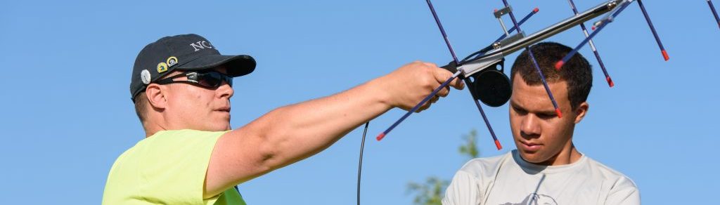
 Registration opens Monday, January 19, 12:01 AM Eastern Daylight Time (0501 UTC), for the Level III Emergency Communications on-line course (EC-003). Registration remains open through the January 24-25 weekend or until all available seats have been filled–whichever comes first. Class begins Tuesday, February 3.
 January 18th, and on the third Sunday of each month at 2030, thanks to BARC Emergency Response Team leader Blake Haskell, K1BTH. Click the “Voice Nets” link to the left for more details.
 Hello to all….
 The December, 2003 EMA traffic net and Public Service Honor Roll totals have been posted to
 W1AI writes:
 We request that you gather signal reports from the list of repeaters listed below. It should be fun, and take about a half hour.
 Members of the Southboro Rod and Gun Club ARC set up and operated a special events station “K1M” in Hopkinton in conjunction with the 2003 BAA “Boston” Marathon.
 Many of you spotted that embarrassing typographical error in my outgoing email to the ARRL Members List describing the Morse code survey. Lest everyone come away with the impression that their Section Manager is an ignoramus, I actually do know the difference between “partition” and “petition.” 😉
 NC1N writes on the framinghamara-l: