“Marconi Work Party”

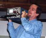
Marconi work partyK1VV writes:

We were at Coast Guard Beach all day on Sunday the 12th … final work on the antennas … jacked up the H.F. masts … installed the 160 & 80 meter dipoles … set up the R8 and 2 meter antennas …… networking computers .. IRLP … Satellite …. Packet …

Watch the W1AA web page for more photos to be posted over the next few days …. http://personal.tmlp.com/k1vv/w1aa/w1aa_1001.htm . Most will be on page 8 ….

Bob Doherty K1VV

HF Nets now part of Monthly RACES Net – From N1CPE

Hello and Happy New Year to All!

I’d like to announce formally that we have been and plan to continue to operate HF nets in conjunction with our monthly First Monday RACES nets across the state.

These Nets convene at 7pm local time on or about 3.943 MHz, and 7.245 MHz LSB on the first Mondays of every month for those stations or communities that wish to test their HF equipment regularly. In addition these frequencies may be activated during RACES or ARES activations in Massachusetts.

At times, noise and other conditions may interfere with these nets. Our team of HF Net control stations will do their best to convene the nets, and pass any official or other traffic as needed.

Thanks to our team of HF net control stations: Marc WA1R, Chatmon WA1FIR, Steve W3EVE and Jerry AA2T.

Tomorrow night, January 6 at 7pm these nets will convene, as will local VHF nets at their appointed times.

73,

-Tom Kinahan N1CPE

Winter ARES Exercise Call for Players

ARES logo
***** Winter Exercise Scheduled for Saturday February, 8, 2003 *****
***** Announcing a Call for Players from the ARES community,
and from Clubs in the Section *****
***** Proposed Play for the Exercise *****

Happy New Year to all of you, and I hope that the year brings happiness and prosperity to you and your family.

The ARES leadership has scheduled a Winter Quarter exercise for Saturday February 8, 2003. The exercise will be an EOC to EOC emergency communications exercise using a similar approach as the November exercise, but implementing improvements suggested in critique sessions. We will also use a major winter storm scenario to add realism and purpose.Due to the time of the year, the field component prominent in the November SET will not be exercised. Additionally, the relatively quick follow on was in response to many of you who suggested doing a similar exercise as soon as possible.

ARES members, ARESMAT teams, Club Emergency response teams, town and city RACES officers, and individuals are invited to play in this exercise. Official RACES participation is not expected, but always welcome.

** Concept **

Teams and clubs are asked to set up a physical EOC and operators for the exercise. Ideally, several of these will be set up in each district. Due to the time of year, all exercise activities will be carried out in these locations. Obviously, EOC’s must be heated and lighted, and available for amateur use that day. Public Service Agencies are welcome to participate to any extent they wish. Please remember that most EMA personnel may not choose to participate because as it is a Saturday. They are, however, most welcome to participate if they so desire.

The exercise will consist of establishing contact with other EOC’s within and without your district, and then passing various traffic. Most traffic will be from simulated agency officials in each EOC, and some will consist of urgent traffic. We will “pick up” where we left off in November. Most importantly, we will strive to improve our ability to establish communications, set up effective net controls, and efficiently pass NTS traffic. We will implement many of the suggestions you forwarded such as revising the frequency plans with more local emphasis, setting up more planned activities during the day (i.e. “envelopes” or timed activities), and allowing use of some repeater assets. There was some discussion about adding more complexity and extending the exercise period, but no decision has been made as of yet.

** Schedule **

Please discuss participation with your clubs and interested individuals as soon as possible during the month. If you have any suggestions, please forward them as soon as you can. If you would like your DEC or me to answer questions at your meeting, please don’t hesitate to ask.

The DEC’s and I meet a week from Saturday on January 11 to finalize plans. An exercise plan will then be available about a week later. The district frequency plan will appear separately about a week before the exercise.

I will send an update shortly after the staff meeting on the 11th. Let’s work together toward a successful exercise!

s/Michael P. Neilsen

Michael P. Neilsen, W1MPN
Section Emergency Coordinator
Eastern Massachusetts Section
Pager: 1-800-759-8888 PIN 1155084
Admin: w1mpn (symbol for at) arrl.net
978-562-5662 Primary/Voice Mail
978-389-0558 FAX/ EFax Voice Mail

Coastal Flood Warning

COASTAL FLOOD WARNING
NATIONAL WEATHER SERVICE TAUNTON MA
505 AM EST SAT JAN 04 2003

…A COASTAL FLOOD WARNING HAS BEEN ISSUED FOR EAST COASTAL MASSACHUSETTS…

FOR EAST COASTAL MASSACHUSETTS THIS INCLUDES GLOUCESTER HARBOR…BOSTON
HARBOR…SCITUATE…PROVINCETOWN…CHATHAM OUTER HARBOR.

GALE FORCE NORTHEAST WINDS CONTINUE EARLY THIS MORNING. THE PERSISTANT EAST TO NORTHEAST WINDS HAVE CAUSED THE OCEAN WATERS TO PILED UP ALONG THE EAST COAST OF MASSACHUSETTS AND TIDES THIS MORNING ARE RUNNING UP TO TWO AND ONE HALF FOOT ABOVE NORMAL. TIDES WILL CONTINUE TO RUN FROM TWO TO TWO AND ONE HALF FEET ABOVE NORMAL THROUGH TODAYS MID DAY HIGH TIDE. THE ABOVE NORMAL TIDE COMBINED WITH 15
FOOT WAVES CRASHING ONSHORE…WILL LIKELY RESULT IN MINOR COASTAL FLOODING. A FEW OF THE MORE VULNERABLE LOCATIONS COULD EXPERIENCE MODERATE FLOODING.

THE FOLLOWING IS LIST OF THE MOST LIKELY LOCATIONS TO EXPERIENCE COASTAL FLOODING.

&&

STORM TIDE FORECASTS FOR THE FOLLOWING LOCATIONS ARE IN FEET MEAN LOWER LOW
WATER. TIME OF HIGH TIDE HAS BEEN ROUNDED TO THE NEAREST HOUR.
SITE FLOOD TIME OF FORECAST
STAGE HIGH TIDE STORM TIDE

EAST COASTAL MASSACHUSETTS
GLOUCESTER HARBOR 11.5 12 PM SAT 11.9
BOSTON HARBOR 13.5 12 PM SAT 13.5
SCITUATE 12.5 12 PM SAT 12.6
PROVINCETOWN 12.0 12 PM SAT 12.4
CHATHAM OUTER HARBOR 9.0 12 PM SAT 9.5

OTHER LOCATIONS ALONG THE EAST COAST OF MASSACHUSETTS THAT
COULD EXPERIENCE MINOR COASTAL FLOODING OR SPLASH OVER.

NEWBURYPORT 10.5 12 PM SAT 9.6
MARBLEHEAD 12.8 12 PM SAT 12.6
PLYMOUTH 14.3 12 PM SAT 13.3
SANDWICH 12.0 12 PM SAT 11.0

A COASTAL FLOOD WARNING MEANS THAT THE COASTAL FLOODING IS IMMINENT. ANYONE
WITH INTERESTS ALONG THE COAST INCLUDED IN THIS WARNING MUST TAKE ACTION NOW TO
PROTECT PROPERTY. THE COMBINATION OF LARGE SURF AND HIGH TIDES WILL RESULT IN
FLOODING OF ROADWAYS AND ALTERNATE ROUTES MAY BE NEEDED.

$$

Winter Storm Warning, Again!

URGENT – WINTER WEATHER MESSAGE
NATIONAL WEATHER SERVICE TAUNTON MA
618 PM EST FRI JAN 3 2003

CTZ002-003-MAZ002>005-008>012-NHZ011-012-040441-
CHESHIRE NH-EASTERN FRANKLIN MA-EASTERN HAMPDEN MA-
EASTERN HAMPSHIRE MA-HARTFORD CT-HILLSBOROUGH NH-
NORTHERN WORCESTER MA-SOUTHERN WORCESTER MA-TOLLAND CT-
WESTERN FRANKLIN MA-WESTERN HAMPDEN MA-WESTERN HAMPSHIRE MA-
WESTERN MIDDLESEX MA-
618 PM EST FRI JAN 3 2003

..WINTER STORM WARNING THROUGH SAT AFTERNOON FOR S. NEW HAMPSHIRE THE WEST & CENTRAL PORTION OF MASSACHUSETTS & NORTH
CENTRAL CONNECTICUT…

A MAJOR WINTER STORM IS IN PROGRESS ACROSS INTERIOR S. NEW ENGLAND.

THE FIRST BAND OF HEAVY SNOW DUMPED BETWEEN 3 & 8 INCHES OF SNOW IN ABOUT 4 HOURS THIS AFTERNOON.

THE NEXT BATCH OF HEAVY SNOW IS ON ITS WAY & WILL POUND THE AREA BETWEEN 730 PM & 330 AM. TEN TO 20 INCHES IS FORECAST TO COVER MUCH OF THE WARNING AREA BY MORNING WITH HEAVIEST FROM THE
MONADNOCKS INTO THE NW HALF OF MASSACHUSETTS.

STORM TOTALS OF 10 TO POSSIBLY 15 INCHES ARE EXPECTED FROM LOWELL TO SPRINGFIELD & NORTHAMPTON IN MASSACHUSETTS DOWN INTO THE NW CORNER OF HARTFORD COUNTY.

THE MIXED PRECIPITATION ZONE FROM HARTFORD TO STURBRIDGE &
WORCESTER WILL SEE SNOW CHANGE TO SLEET FOR A TIME BETWEEN 8 PM &
11 PM. THIS WILL LIMIT AMOUNTS TO SOMEWHERE BETWEEN 6 & 12 INCHES
TONIGHT ALONG & JUST NORTH OF THIS INTERSTATE 84 CORRIDOR.

AMOUNTS IN S. HARTFORD COUNTY & S. TOLLAND COUNTY
SHOULD REMAIN BETWEEN 5 & 7 INCHES…AS SLEET & FREEZING RAIN
BECOME PREDOMINANT THIS EVENING.

INCREASING WINDS WILL CAUSE BLOWING & DRIFTING SNOW…ALONG WITH
LOW VISIBILITIES. SCATTERED POWER OUTAGES ARE EXPECTED TOWARD
MIDNIGHT AS WINDS STRENGTHEN & COMBINE WITH ICE OR WET SNOW
ACCUMULATION TO BREAK SOME TREE BRANCHES.

BACKLASH SNOW TOMORROW WILL BRING AN ADDITIONAL 1 TO 5 INCHES BUT
THE WORST OF THIS STORM IS OCCURRING TONIGHT.

CONSIDER POSTPONING TRAVEL UNTIL CONDITIONS IMPROVE SOMETIME
TOMORROW. IF YOU MUST BE OUT ON THE ROADS…ALLOW PLENTY OF TIME TO
REACH YOUR DESTINATION.

$$

CTZ004-MAZ006-007-013>016-RIZ001-040443-
EASTERN ESSEX MA-EASTERN NORFOLK MA-NORTHWEST PROVIDENCE RI-
SOUTHEAST MIDDLESEX MA-SUFFOLK MA-WESTERN ESSEX MA-
WESTERN NORFOLK MA-WINDHAM CT-
618 PM EST FRI JAN 3 2003

..WINTER STORM WARNING THROUGH SAT AFTERNOON…

AN INTENSIFYING NOREASTER HAS BROUGHT A SHORT PERIOD OF HEAVY SNOW
TO NE CONNECTICUT & THE HILLS OF NW RHODE ISLAND
WITH 2 TO 4 INCHES THERE. THE IMMEDIATE BOSTON AREA HAS YET TO SEE
SUBSTANTIAL SNOW BUT THAT SHOULD CHANGE FOR A FEW HOURS LATE THIS
EVENING.

THE WARM OCEAN AIR MAY KEEP AMOUNTS LESS THAN FORECAST IN BOSTON &
CAPE ANN BUT PRECIPITATION IS EXPECTED TO CHANGE BACK TO A PERIOD OF
HEAVY WET SNOW THIS EVENING BEFORE CHANGING TO SLEET OR RAIN
OVERNIGHT.

SOME BACKLASH SNOW IS EXPECTED TOMORROW SO THAT STORM TOTALS SHOULD
BE SOMEWHERE BETWEEN 4 & 8 INCHES IN THE REGION FROM BOSTON TO
WOONSOCKET & WILLIMANTIC.

MOTORISTS ARE URGED TO PAY SPECIAL ATTENTION TO THE CHANGING ROAD
CONDITIONS…AND BE AWARE OF SLIPPERY ROADS DUE TO THE WIDE VARIETY
OF WEATHER IN THE AREA.

$$

MAZ017>019-RIZ002>004-040443-
EASTERN KENT RI-EASTERN PLYMOUTH MA-NORTHERN BRISTOL MA-
SOUTHEAST PROVIDENCE RI-WESTERN KENT RI-WESTERN PLYMOUTH MA-
618 PM EST FRI JAN 3 2003

..WINTER WEATHER ADVISORY THIS EVENING FOR THE PROVIDENCE AREA INTO
SOUTHEAST MASSACHUSETTS…

PRECIPITATION MAY CHANGE BACK TO SNOW OR SLEET AGAIN FOR A COUPLE OF
HOURS THIS EVENING BRINGING A QUICK 1 TO 4 INCHES SLUSHY
ACCUMULATION.

IF IT DOESNT CHANGE BACK TO SNOW BY 10 PM…THEN SNOWFALL WILL BE
LESS THAN FORECAST. THE MOST LIKELY AREA TO RECEIVE ADVERSE WINTRY
WEATHER THIS EVENING IS IMMEDIATE N. & WESTERN SUBURBS OF
PROVIDENCE TO NEAR BROCKTON & HINGHAM.

A WINTER WEATHER ADVISORY IS ISSUED FOR A VARIETY OF WINTER WEATHER
CONDITIONS…INCLUDING SNOW OR SLEET ACCUMULATING NEAR 4 INCHES…OR
COMBINED WITH SOME FREEZING RAIN.

$$
DRAG


To make changes to your email profile or to unsubscribe
Go to….
http://www.emergencyemailnetwork.com
or…
http://www.emergencye.com

High Wind Warning and Flood Advisory Coastal Areas

WWUS71 KBOX 032040
NPWBOX

URGENT – WEATHER MESSAGE
NATIONAL WEATHER SERVICE TAUNTON MA
338 PM EST FRI JAN 3 2003

MAZ007-015-016-019-040229-
EASTERN ESSEX MA-EASTERN NORFOLK MA-EASTERN PLYMOUTH MA-SUFFOLK MA-
338 PM EST FRI JAN 3 2003

…HIGH WIND WARNING FROM 9 PM TO 5 AM SATURDAY MORNING FOR EASTERN COASTAL MASSACHUSETTS REMAINS IN EFFECT…

A DEVELOPING NOREASTER WILL BRING SEVERAL HOURS OF SUSTAINED WINDS NEAR 40 MPH…WITH GUSTS TO 50 TO 60 MPH…TO PORTIONS OF THE EASTERN MASSACHUSETTS COAST TONIGHT.

THIS WARNING INCLUDES THE CITY OF BOSTON…ALONG WITH THE TOWNS OF NEWBURYPORT…GLOUCESTER…MARBLEHEAD…REVERE…HINGHAM…MARSHFIELD AND PLYMOUTH.

THE STRONGEST WIND IS LIKELY TO OCCUR BETWEEN 9 PM AND 4 AM.

THE WIND COMBINED WITH WET SNOW CHANGING TO HEAVY SLEET OR RAIN IS LIKELY TO CAUSE SCATTERED POWER OUTAGES DURING THE NIGHT.

STRONG AND GUSTY WINDS WILL MAKE IT DIFFICULT TO DRIVE…ESPECIALLY
HIGH PROFILE VEHICLES SUCH AS VANS…RECREATIONAL VEHICLES AND
TRACTOR TRAILERS. BE CAREFUL WHEN DRIVING OVER BRIDGES OR OVERPASSES.

$$

MAZ004>006-012>014-017-018-020>024-RIZ001>007-040229-
BARNSTABLE MA-BRISTOL RI-DUKES MA-EASTERN KENT RI-NANTUCKET MA-
NEWPORT RI-NORTHERN BRISTOL MA-NORTHERN WORCESTER MA-
NORTHWEST PROVIDENCE RI-SOUTHEAST MIDDLESEX MA-
SOUTHEAST PROVIDENCE RI-SOUTHERN BRISTOL MA-SOUTHERN PLYMOUTH MA-
SOUTHERN WORCESTER MA-WASHINGTON RI-WESTERN ESSEX MA-WESTERN KENT RI-
WESTERN MIDDLESEX MA-WESTERN NORFOLK MA-WESTERN PLYMOUTH MA-
338 PM EST FRI JAN 3 2003

…WIND ADVISORY THIS EVENING THROUGH EARLY SATURDAY MORNING FOR
EASTERN AND CENTRAL MASSACHUSETTS AND ALL OF RHODE ISLAND REMAINS IN
EFFECT…

A DEVELOPING NOREASTER WILL BRING SEVERAL HOURS OF SUSTAINED
NORTHEAST WINDS BETWEEN 25 AND 35 MPH WITH SCATTERED GUSTS OF 45 MPH.

THE NORTHEAST WIND COMBINED WITH HEAVY WET SNOW FROM THE MERRIMACK
VALLEY TO WORCESTER COUNTY AND INTERIOR EASTERN MASSACHUSETTS IS
LIKELY TO CAUSE SCATTERED POWER OUTAGES.

THE STRONGEST WIND ALONG THE SOUTH COAST IS EXPECTED BETWEEN 8 PM
AND MIDNIGHT WHERE IT WILL BE RAINING HEAVILY…AND ELSEWHERE
BETWEEN MIDNIGHT AND 5 AM WHERE OCCASIONALLY HEAVY SNOW MAY BE MIXED
WITH SLEET.

TRAVEL TONIGHT IS GOING TO BE VERY DIFFICULT ESPECIALLY FROM BOSTONS
WESTERN SUBURBS TO WORCESTER AND LOWELL.

ANY BOATERS OR FISHERMEN MIGHT CONSIDER POSTPONING THEIR OUTINGS DUE
TO THE HIGH WINDS…OR PLEASE USE EXTREME CAUTION ON THE WATERS.

$$

NOCERA


SKYWARN Ops Possible

—–Original Message—–
From: weather@ndws.com [mailto:weather@ndws.com]On Behalf Of
rmacedo@rcn.com
Sent: Friday, January 03, 2003 10:12
To: Mike Neilsen
Subject: [coordinators-box] Possible Formal SKYWARN Activation With
Ops???? {01}

Hello to all…

Latest AFD from NWS Taunton may prompt formal SKYWARN Activation with Ops
at NWS Taunton due to the high wind warning and coastal flood watch. Again,
it might be a staggered operation with ops late this afternoon and tonight
and then reconvene operations Saturday Morning into early afternoon. If
current AFD plans hold, will call NWS to determine our plan.

Winter Exercise Call for Players

***** Winter Exercise Scheduled for Saturday February, 8, 2003 *****
***** Announcing a Call for Players from the ARES community,
and from Clubs in the Section *****
***** Proposed Play for the Exercise *****

Happy New Year to all of you, and I hope that the year brings happiness and prosperity to you and your family.

The ARES leadership has scheduled a Winter Quarter exercise for Saturday February 8, 2003. The exercise will be an EOC to EOC emergency communications exercise using a similar approach as the November exercise, but implementing improvements suggested in critique sessions. We will also use a major winter storm scenario to add realism and purpose. Due to the time of the year, the field component prominent in the November SET will not be exercised. Additionally, the relatively quick follow on was in response to many of you who suggested doing a similar exercise as soon as possible.

ARES members, ARESMAT teams, Club Emergency response teams, town and city RACES officers, and individuals are invited to play in this exercise. Official RACES participation is not expected, but always welcome.

** Concept ** Teams and clubs are asked to set up a physical EOC and operators for the exercise. Ideally, several of these will be set up in each district. Due to the time of year, all exercise activities will be carried out in these locations. Obviously, EOC’s must be heated and lighted, and available for amateur use that day. Public Service Agencies are welcome to participate to any extent they wish. Please remember that most EMA personnel may not choose to participate because as it is a Saturday. They are, however, most welcome to participate if they so desire.

The exercise will consist of establishing contact with other EOC’s within and without your district, and then passing various traffic. Most traffic will be from simulated agency officials in each EOC, and some will consist of urgent traffic. We will “pick up” where we left off in November. Most importantly, we will strive to improve our ability to establish communications, set up effective net controls, and efficiently pass NTS traffic. We will implement many of the suggestions you forwarded such as revising the frequency plans with more local emphasis, setting up more planned activities during the day (i.e. “envelopes” or timed activities), and allowing use of some repeater assets. There was some discussion about adding more complexity and extending the exercise period, but no decision has been made as of yet.

** Schedule ** Please discuss participation with your clubs and interested individuals as soon as possible during the month. If you have any suggestions, please forward them as soon as you can. If you would like your DEC or me to answer questions at your meeting, please don’t hesitate to ask.

The DEC’s and I meet a week from Saturday on January 11 to finalize plans. An exercise plan will then be available about a week later. The district frequency plan will appear separately about a week before the exercise.

I will send an update shortly after the staff meeting on the 11th. Let’s work together toward a successful exercise!

s/Michael P. Neilsen

Michael P. Neilsen, W1MPN
Section Emergency Coordinator
Eastern Massachusetts Section
Pager: 1-800-759-8888 PIN 1155084
Admin: w1mpn (symbol for at) arrl.net
978-562-5662 Primary/Voice Mail
978-389-0558 FAX/ EFax Voice Mail

WPI WA License Class Begins January 9, 2003

WPI Wireless AssnThe Worcester Polytechnic Institute Wireless Association is offering a Ham Radio class to help you prepare for the examination to earn your beginner-level Ham Radio license. Join us and learn what Amateur Radio is all about!

When:

Wednesday & Thursday evenings from 6:30 to 8:30PM
from Thursday, January 9th, 2003 until
Thursday, February 20th, 2003

Where:

WPI’s Kaven Hall

Cost:

$25 for textbook and materials

Contact:

John Ruggiero, WPI Wireless Association
Phone: (508) 831-5446
E-Mail: hamclass@wpi.edu

Please Register by January 3, 2003!

73’s
Rob
KB1GNC
http://kb1gnc.vze.com

New Domain Name for ARES EMa ARRL Site

I’m pleased to report that the League’s internet service provider, Interbridge.net, has agreed to assign a distinct subdomain name for the EMa ARRL ARES web site. Beginning today, this site can be accessed via the address,

http://ares.ema.arrl.org

In addition, the old address,

http://ema.arrl.org/ares

will continue to be supported.

Why did we implement this change? Because it more accurately describes the site from a hierarchical perspective.

73,

Phil Temples, K9HI

ARRL Section Manager,
Eastern Massachusetts Section
and “web host”

“IRLP Comes to the New Bedford Area”

SEMARA logoSoutheastern Mass. ARA club member Larry Lygren, W1DBX has installed a simplex mode IRLP node at his home in New Bedford. Larry’s system is comprised of a Yaesu FT-2600M 2-meter transceiver running 60 watts into a Diamond X500NA antenna. The computer is a donation from the Saint Joseph / Saint Theresa School of New Bedford. It is an “open” system for all hams to use.

IRLP is a world-wide system that allows one to talk to fellow hams around the world. For example, you can actually talk to a mobile station in New Zealand using your handheld! Another feature is the use of reflectors that allow several nodes to be tied together. This permits several nodes to talk to each other over the same link. Ham in several states could engage in a multi-way QSO with hams in Japan and Germany – a worldwide roundtable.

The system uses the Linux operating system because of its superb networking characteristics and robust fail-safe design. This new system has proven itself and IRLP has expanded from a cross-Canada system to a worldwide system.

First time users of IRLP should download and read the “IRLP Introduction” and “IRLP FAQ” pages at http://www.irlp.net. A full list of all nodes on the system is also available on the site.

—Thanks, SEMARA Zero Beat

SEC Announcement – Mobilization Not Needed

****** EMa ARES MOBILIZATION NOT NEEDED *****

Hello to all….

With the exception of some high winds remaining for Cape and Islands and SE coastal areas, the storm has passed out to sea and NWS has allowed all Winter Storm Warnings to expire. There are some pockets of power outages, but utility crews report that they are confident service will be restored shortly. There appears to be little damage to the communications infrastructure.

Thank you all for taking the time to prepare yourselves for a possible need, and monitoring the situation during your family celebrations.

Happy New Year!

s/Michael P. Neilsen
Michael P. Neilsen, W1MPN
Section Emergency Coordinator
Eastern Massachusetts Section
Pager: 1-800-759-8888 PIN 1155084
Admin: w1mpn (symbol for at) arrl.net
978-562-5662 Primary/Voice Mail
978-389-0558 FAX/ EFax Voice Mail

SEC UPDATE – Possible Moblization

****** NOTIFICATION OF POSSIBLE EMa ARES MOBILIZATION ******
***** MAJOR WINTER STORM TO IMPACT AREA *****
**** PLEASE CONTINUE YOUR PREPARATORY EFFORTS *****

Good Morning to all and Merry Christmas to you and your families…

I am requesting that you consider yourselves on 24 hour standby for possible activation, and that you continue your preparation efforts at a somewhat higher intensity at this time. I will update again by 1800 local time. ARES folks in the areas mentioned in the areas of the high wind watch should be particularly watchful of the situation. Please refer to my earlier message (1754 12/24/02) for a discussion on some preparatory elements. I have also attached a text formatted copy of the frequency list, in response to requests from some of you last night.

National Weather is maintaining Winter Storm Warning for most of our area for a major winter storm. Additionally, a high wind advisory has now been issued confirming concerns last night for very strong winds commencing later today, and lasting through tonight and part of tomorrow. Additionally “blizzard like” conditions may exist meaning visibilities will be substantially reduced due to blowing and drifting snow, making driving very hazardous. Please note, however, that an official Blizzard Warning has NOT been issued. Other stringent criteria must be met first before NWS would issue one.

Several net controls have checked in, but more are needed. Please indicate your availability, especially if you have just returned from your travels/visits and are only becoming aware of the need now.

Enjoy the rest of your day! More later. Please watch for Rob’s weather/SKYWARN messages in the interim.

s/Michael P. Neilsen
Michael P. Neilsen, W1MPN
Section Emergency Coordinator
Eastern Massachusetts Section
Pager: 1-800-759-8888 PIN 1155084
Admin: w1mpn (symbol for at) arrl.net
978-562-5662 Primary/Voice Mail
978-389-0558 FAX/ EFax Voice Mail

===== NWS Messages Follow ==========

WWUS71 KBOX 251033
NPWBOX

URGENT – WEATHER MESSAGE
NATIONAL WEATHER SERVICE TAUNTON MA
459 AM EST WED DEC 25 2002

MAZ007-015-016-019-022>024-251559-
BARNSTABLE MA-DUKES MA-EASTERN ESSEX MA-EASTERN NORFOLK MA-
EASTERN PLYMOUTH MA-NANTUCKET MA-SUFFOLK MA-
459 AM EST WED DEC 25 2002

…HIGH WIND WATCH FOR TONIGHT…

NORTHEAST WINDS OF 30 TO 40 MPH MAY REACH 50 TO 60 MPH AT TIMES IN
GUSTS OVER COASTAL SECTIONS OF EASTERN MASSACHUSETTS. THE STRONG
WINDS WILL START AROUND 5 PM AND WILL LIKELY CONTINUE UNTIL AFTER
MIDNIGHT.

THE FORECAST WATCH AREA INCLUDES THE ENTIRE EAST COAST OF
MASSACHUSETTS SOUTH OF THE MERRIMACK RIVER…TO CAPE ANN…TO
BOSTON…TO PLYMOUTH SOUTH ACROSS CAPE COD TO MARTHAS VINEYARD AND
NANTUCKET.

IF THESE HIGH WINDS MATERIALIZE…AND IF HEAVY SNOW IS FALLING AT
THE SAME TIME…THEN IT WOULD RESULT IN NEAR BLIZZARD CONDITIONS.
TRAVEL IS NOT RECOMMENDED DURING BLIZZARD CONDITIONS.

A HIGH WIND WATCH MEANS THAT THE POTENTIAL EXISTS FOR STRONG DAMAGING
WINDS TO DEVELOP IN THE MENTIONED AREAS. THESE STRONG WINDS CAN CAUSE
TREES AND POWER LINES TO FALL AS WELL AS CAUSING PROPERTY DAMAGE. IF
A HIGH WIND WARNING IS ISSUED…STAY INSIDE…AND AWAY FROM WINDOWS.

STAY TUNED TO NOAA WEATHER RADIO OR YOUR FAVORITE MEDIA SOURCE FOR
LATER STATEMENTS OR POSSIBLE UPGRADES. YOU CAN ALSO VISIT THE WEB
AT WEATHER.GOV.

$$
DMH/GAF

WWUS41 KBOX 251124
WSWBOX

URGENT – WINTER WEATHER MESSAGE
NATIONAL WEATHER SERVICE TAUNTON MA
622 AM EST WED DEC 25 2002

CTZ002>004-MAZ002>018-NHZ011-012-RIZ001>004-251651-
CHESHIRE NH-EASTERN ESSEX MA-EASTERN FRANKLIN MA-EASTERN HAMPDEN MA-
EASTERN HAMPSHIRE MA-EASTERN KENT RI-EASTERN NORFOLK MA-HARTFORD CT-
HILLSBOROUGH NH-NORTHERN BRISTOL MA-NORTHERN WORCESTER MA-
NORTHWEST PROVIDENCE RI-SOUTHEAST MIDDLESEX MA-
SOUTHEAST PROVIDENCE RI-SOUTHERN WORCESTER MA-SUFFOLK MA-TOLLAND CT-
WESTERN ESSEX MA-WESTERN FRANKLIN MA-WESTERN HAMPDEN MA-
WESTERN HAMPSHIRE MA-WESTERN KENT RI-WESTERN MIDDLESEX MA-
WESTERN NORFOLK MA-WESTERN PLYMOUTH MA-WINDHAM CT-
622 AM EST WED DEC 25 2002

…WINTER STORM WARNING REMAINS IN EFFECT THROUGH TONIGHT FOR MUCH
OF SOUTHERN NEW ENGLAND…

A MAJOR WINTER STORM IS EXPECTED TO DUMP 15 TO 20 INCHES OF SNOW
ACROSS NORTHWEST MASSACHUSETTS AND SOUTHWEST NEW HAMPSHIRE. 12 TO
18 INCHES ARE FORECAST FOR NORTHEAST MASSACHUSETTS. GENERALLY 10
TO 15 INCHES ARE FORECAST FROM HARTFORD COUNTY CONNECTICUT
NORTHEASTWARD THROUGH SOUTHERN WORCESTER COUNTY AND NORTHWEST RHODE
ISLAND TO JUST OUTSIDE THE CITY OF BOSTON. IN BOSTON…WHERE RAIN
OR SLEET MAY MIX IN FOR A TIME…8 TO 14 INCHES ARE PREDICTED.
LESSER AMOUNTS…FROM 5 TO 10 INCHES ARE FORECAST FROM PROVIDENCE
RHODE ISLAND TO BROCKTON MASSACHUSETTS.

THE SNOW WILL BE HEAVIEST FROM MID AFTERNOON THROUGH ABOUT
MIDNIGHT. WINDS ARE EXPECTED TO INCREASE TO 20 TO 30 MPH WITH GUSTS
TO 4O TO 45 MPH POSSIBLE ACROSS THE REGION LATE THIS AFTERNOON.
THIS WILL CAUSE BLOWING AND DRIFTING OF THE SNOW…ESPECIALLY IN
NORTHWESTERN AREAS WHERE THE SNOW WILL BE FLUFFIER. FARTHER TO THE
SOUTHEAST…FROM NORTHEAST CONNECTICUT TO THE BOSTON AREA…A HEAVY
WET SNOW IS ANTICIPATED…WITH TEMPERATURES NEAR OR POSSIBLY EVEN A
DEGREE OR TWO ABOVE FREEZING THIS AFTERNOON.

A HIGH WIND WATCH HAS BEEN ISSUED FOR EAST COASTAL MASSACHUSETTS FOR
TONIGHT. THE POTENTIAL EXISTS FOR NORTHEAST TO NORTH WINDS OF 30 TO
40 MPH WITH GUSTS TO 50 TO 60 MPH THERE. IF THESE HIGH WINDS
MATERIALIZE AND HEAVY SNOW FALLS IN CONJUNCTION WITH THEM…NEAR
BLIZZARD CONDITIONS COULD RESULT.

TRAVEL IS NOT ADVISED. IN FACT…BY TONIGHT…SOME SECONDARY ROADS
COULD BECOME IMPASSABLE.

STAY TUNED TO NOAA WEATHER RADIO OR YOUR FAVORITE LOCAL MEDIA OUTLET
FOR THE LATEST INFORMATION ON THIS STORM AND FOR THE POTENTIAL
BLIZZARD THREAT FOR TONIGHT. YOU CAN ALSO VISIT THE WEB AT
WWW.WEATHER.GOV.

==== End NWS Messages ========
1

SEC Annoucement

****** NOTIFICATION OF POSSIBLE EMa ARES MOBILIZATION ******
***** MAJOR WINTER STORM TO IMPACT AREA *****
**** PLEASE COMMENCE PREPARATORY EFFORTS ONLY *****

Hello to all and Merry Christmas to you and your families…

IMPORTANT: I am requesting that ARES team leaders (including new teams from
the 11/9 exercise), and NCS skilled members contact me ASAP as to your
availability and probable location (i.e. you may be away from home with
family/friends). Please respond by direct email, or call at numbers noted
below in my signature.

A major winter storm is predicted to hit the EMa Section area with possibly
significant impact on travel and our community. Of particular concern, are
high winds forecast to develop during and after the snow event, which could
in turn damage the electrical distribution, telephone, and cable
distribution systems. There is some additional risk to the “cellular” tower
infrastructure in our section as well, further degrading the communications
infrastructure. Moreover, if towers and similar structures can be impacted,
so can public safety and EMA communications.

In view of us all commencing a major holiday celebration, and the
seriousness of the threat, I must ask all of you to consider yourselves on
36 hour standby for mobilization. Before I discuss the likely scenario to
trigger a mobilization, I would like to cover the activities you should
undertake now in order to be ready, IF we will be needed.

1. Secure your homes and family, and review your personal needs for a
mobilization. As you know from your ECC class and our Workshop, be sure you
have medicines, clothing, water, and other food and personal supplies. Much
like the oxygen mask from overhead in the plane, you can only help others
after you have helped yourself.

2. Charge batteries, test equipment, review your go-kits and program your
radios if necessary. We will be using familiar repeater frequencies. More
below.

3. I will update you all again tomorrow morning. If there is no message
because of technical difficulties, consider yourselves on 24 hour standby.
If the situation allows a stand down, I will notify you right away.

4. Keep “plugged-in” by email, especially to Rob’s KD1CY weather alert
messages. Monitor the wx radio frequencies and the broadcast media. Watch
for possible hype and mania with the latter, however. Most importantly,
ENJOY YOUR HOLIDAY! This message is only to encourage you to think a little
about getting ready while you have your holiday celebrations with friends
and family.

The factor we are watching the closest is the high wind scenario during
which the snow that falls is wet. In high winds, it will be like blowing
wet plaster around. It is believed the vulnerabilities mentioned above will
be realized. You can watch for these factors to help you gauge how close we
will be getting to experiencing problems.

I have attached a frequency schedule of SKYWARN and RACES/ARES frequencies.
Please plan on using the RACES/ARES frequencies for ARES operations, as the
SKYWARN frequencies will be fully utilized. Please note the following
important exception: ARES will use the MMRA network in order to free up the
Waltham and PART repeaters for SKYWARN. Please visit www.mmra.org to get
frequencies, PL’s, and locations of repeaters in their network. We will
also use the Paxton repeater for coordination with Western Mass ARES as
needed on a shared basis with SKYWARN.

HF support is also requested during any mobilization. Please coordinate
with W3EVE, WQ1O, and N1CPE, with copy to W1MPN your capabilities and sked.

Let me say again, this is only a notification at this time. Please…enjoy
your celebration and the “White Christmas”. My best to you and your
families.

s/ Michael P. Neilsen
Michael P. Neilsen, W1MPN
Section Emergency Coordinator
Eastern Massachusetts Section
Pager: 1-800-759-8888 PIN 1155084
Admin: w1mpn (symbol for at) arrl.net
978-562-5662 Primary/Voice Mail
978-389-0558 FAX/ EFax Voice Mail

SKYWARN – Statement from NWS Taunton

Bulletin from the KA1JJM Emwin Feed:
WWUS41 KBOX 242018
WSWBOX

URGENT – WINTER WEATHER MESSAGE
NATIONAL WEATHER SERVICE TAUNTON MA
310 PM EST TUE DEC 24 2002

A MAJOR WINTER STORM IS EXPECTED TO IMPACT SOUTHERN NEW ENGLAND DURING CHRISTMAS DAY AND NIGHT. THE STORM IS EXPECTED TO MOVE FROM THE SOUTHEAST U.S. TO THE VIRGINIA COAST BY DAYBREAK WEDNESDAY… THEN TRACK NEAR THE SOUTHERN NEW ENGLAND COASTAL WATERS WEDNESDAY EVENING.

A SLIGHT CHANGE IN THE STORM TRACK COULD SHIFT THE SNOWFALL TOTALS.

TO AVOID TRAVEL DURING THIS WINTER STORM AS IT IMPACTS SOUTHERN NEW ENGLAND…THE BEST TIME TO COMPLETE TRAVEL WOULD BE CHRISTMAS EVE OR EARLY MORNING CHRISTMAS DAY.

MAZ002>005-008-009-NHZ011-012-250046-
CHESHIRE NH-EASTERN FRANKLIN MA-HILLSBOROUGH NH-
NORTHERN WORCESTER MA-WESTERN FRANKLIN MA-WESTERN HAMPDEN MA-
WESTERN HAMPSHIRE MA-WESTERN MIDDLESEX MA-
310 PM EST TUE DEC 24 2002

…WINTER STORM WARNING FOR WEDNESDAY THROUGH WEDNESDAY NIGHT…

THIS WARNING INCLUDES SOUTHWEST NEW HAMPSHIRE…NORTH CENTRAL MASSACHUSETTS AND THE EAST SLOPES OF THE BERKSHIRES IN MASSACHUSETTS. SNOW IS EXPECTED TO SPREAD INTO THIS AREA BY MID MORNING. SNOW WILL BE HEAVY AT TIMES…ESPECIALLY WEDNESDAY AFTERNOON. THE SNOW IS EXPECTED TO END LATER WEDNESDAY NIGHT.

STORM TOTAL ACCUMULATIONS OF 10 TO 20 INCHES ARE FORECAST.

IN ADDITION NORTHEAST WINDS WILL INCREASE TO 15 TO 25 MPH WITH GUSTS TO 35 MPH ACROSS THE HIGHER ELEVATIONS BY WEDNESDAY EVENING. THIS WILL FREQUENTLY CREATE VISIBILITY RESTRICTIONS LESS THAN ONE HALF
MILE…ALONG WITH SOME BLOWING AND DRIFTING SNOW.

HEAVY SNOW WILL ACCUMULATE ON ROADWAYS AND SIGNIFICANTLY HAMPER TRAVEL. SOME SECONDARY ROADS MAY BE IMPASSABLE. THOSE THAT HAVE TO BE OUT ON THE ROADS WILL NEED TO USE EXTREME CAUTION AND ALLOW PLENTY OF
EXTRA TIME.
$$

MAZ006-007-014>016-250047-
EASTERN ESSEX MA-EASTERN NORFOLK MA-SOUTHEAST MIDDLESEX MA-
SUFFOLK MA-WESTERN ESSEX MA-
310 PM EST TUE DEC 24 2002

…WINTER STORM WARNING FOR WEDNESDAY THROUGH WEDNESDAY NIGHT…

THIS WARNING INCLUDES NORTHEAST COASTAL MASSACHUSETTS INCLUDING THE IMMEDIATE BOSTON AREA. SNOW…POSSIBLY MIXING WITH SLEET OR RAIN AT TIMES…WILL MOVE INTO THE AREA AROUND MID MORNING WEDNESDAY. THE
PRECIPITATION IS EXPECTED TO BE HEAVY AT TIMES…ESPECIALLY DURING WEDNESDAY AFTERNOON AND EARLY EVENING. THE PRECIPITATION IS FORECAST
TO END AS SNOW LATE WEDNESDAY NIGHT.

STORM TOTAL ACCUMULATIONS OF 5 TO 10 INCHES ARE FORECAST.

IN ADDITION NORTHEAST WINDS WILL INCREASE TO 20 TO 30 MPH BY WEDNESDAY EVENING. THIS WILL FREQUENTLY CREATE VISIBILITY RESTRICTIONS LESS THAN ONE HALF MILE.

HEAVY SNOW WILL ACCUMULATE ON ROADWAYS AND SIGNIFICANTLY HAMPER TRAVEL. THOSE THAT HAVE TO BE OUT ON THE ROADS WILL NEED TO USE EXTREME CAUTION AND ALLOW PLENTY OF EXTRA TIME.
$$

CTZ004-MAZ013-RIZ001-250047-
NORTHWEST PROVIDENCE RI-WESTERN NORFOLK MA-WINDHAM CT-
310 PM EST TUE DEC 24 2002

…WINTER STORM WARNING FOR WEDNESDAY THROUGH WEDNESDAY NIGHT…

THIS WARNING INCLUDES NORTHWEST RHODE ISLAND…FAR NORTHEAST CONNECTICUT…AND SUBURBS SOUTH OF BOSTON. SNOW…MIXED WITH SLEET OR RAIN AT TIMES…WILL MOVE INTO THE AREA BY MID MORNING WEDNESDAY.
THE PRECIPITATION IS EXPECTED TO BE HEAVY AT TIMES…ESPECIALLY DURING WEDNESDAY AFTERNOON AND EARLY EVENING. THE PRECIPITATION IS FORECAST TO END AS SNOW LATE WEDNESDAY NIGHT.

STORM TOTAL ACCUMULATIONS OF 5 TO 10 INCHES ARE FORECAST.

IN ADDITION NORTHEAST WINDS WILL INCREASE TO 20 TO 30 MPH BY WEDNESDAY EVENING. THIS WILL FREQUENTLY CREATE VISIBILITY RESTRICTIONS LESS THAN ONE HALF MILE.

HEAVY SNOW WILL ACCUMULATE ON ROADWAYS AND SIGNIFICANTLY HAMPER TRAVEL. THOSE THAT HAVE TO BE OUT ON THE ROADS WILL NEED TO USE EXTREME CAUTION AND ALLOW PLENTY OF EXTRA TIME.
$$

MAZ017-018-RIZ002>004-250047-
EASTERN KENT RI-NORTHERN BRISTOL MA-SOUTHEAST PROVIDENCE RI-
WESTERN KENT RI-WESTERN PLYMOUTH MA-
310 PM EST TUE DEC 24 2002

…WINTER STORM WARNING FOR WEDNESDAY THROUGH WEDNESDAY NIGHT…

THIS WARNING INCLUDES NORTHEAST AND CENTRAL RHODE ISLAND…AND NORTHERN BRISTOL AND WESTERN PLYMOUTH COUNTIES IN MASSACHUSETTS. SNOW…MIXED WITH SLEET AND RAIN AT TIMES…IS FORECAST TO SPREAD INTO THE AREA AROUND MID MORNING WEDNESDAY. THE PRECIPITATION IS EXPECTED TO BE HEAVY AT TIMES…ESPECIALLY WEDNESDAY AFTERNOON AND EARLY EVENING. THE PRECIPITATION IS FORECAST TO END AS SNOW LATE
WEDNESDAY NIGHT.

STORM TOTAL ACCUMULATIONS OF 4 TO 8 INCHES ARE FORECAST.

IN ADDITION NORTHEAST WINDS WILL INCREASE TO 20 TO 30 MPH BY WEDNESDAY EVENING. THIS WILL FREQUENTLY CREATE VISIBILITY RESTRICTIONS LESS THAN ONE HALF MILE.

CONDITIONS CAN DETERIORATE RAPIDLY IN WINTER WEATHER SITUATIONS. SLOW DOWN AND ALLOW EXTRA TIME WHEN TRAVELING. IF YOU MUST TRAVEL BE SURE TO ALLOW PLENTY OF EXTRA TIME.
$$

MAZ019-250048-
EASTERN PLYMOUTH MA-
310 PM EST TUE DEC 24 2002

…WINTER WEATHER ADVISORY FOR MIDDAY WEDNESDAY THROUGH WEDNESDAY
NIGHT…

THIS ADVISORY INCLUDES EASTERN PLYMOUTH COUNTY. A MIXTURE OF SNOW…SLEET…AND RAIN IS FORECAST TO MOVE INTO THE ADVISORY AREA AROUND MID MORNING WEDNESDAY. THE PRECIPITATION MAY BE HEAVY AT TIMES WEDNESDAY AFTERNOON AND EVENING. THE MIXED PRECIPITATION IS
EXPECTED TO END LATE WEDNESDAY NIGHT.

A 3 TO 6 INCH SNOW AND SLEET ACCUMULATION IS FORECAST.

IN ADDITION NORTHEAST WINDS WILL INCREASE TO 20 TO 30 MPH WITH GUSTS TO 40 MPH BY WEDNESDAY EVENING. THIS WILL FREQUENTLY CREATE VISIBILITY RESTRICTIONS LESS THAN ONE HALF MILE.

STAY TUNED TO NOAA WEATHER RADIO…OR YOUR FAVORITE MEDIA OUTLET…
FOR THE LATEST INFORMATION ON THIS DEVELOPING WEATHER SITUATION.

$$

NBELK/STRAUSS

WWWW
1

VRC Field Organization Recommendations

ARRL FlagHello Section Managers,

The ARRL Volunteer Resources Committee asked me to forward the following message. Best wishes to you for this Holiday Season.

Steve, WV1X

[more] To: ARRL Section Managers
From: VRC

During the past 12 months, the Volunteer Resources Committee has held many discussions about emergency communications and traffic handling. These discussions included the review of excellent responses to questionnaires, forwarded by Steve Ewald, from Section Managers, their Field appointees and from NTS officials. At a VRC meeting in early November the committee’s discussion continually returned to the following: professionalism, reliability, discipline, skills, training. The VRC concluded with the following recommendations:

* SMs develop in their Field volunteers at all levels increased professionalism so as to meet more effectively the needs of served agencies

* SECs and STMs, earn Level 1, 2, and 3 certification as soon as possible

* DECs and NMs earn at least Level 1 and 2 certification as soon as possible

* ECs and OES appointees earn at least Level l certification as soon as possible

* SECs, and STMs strongly encourage all ARES and NTS members to earn Level l certification in order to prepare them for possible future disasters and in order to prepare them to become future leadership officials.

* SECs make effective use of OES appointees — the guidelines for this Field appointment are left somewhat open to allow the SEC flexibility in order to meet the needs of the particular Section

* SMs, in collaboration with their SECs and STMs, should be encouraged to study, on a continuing basis, the training needs of their Sections and the effectiveness of training programs in place, in order to heighten the state of readiness of Amateur communicators within their Sections.

73 and best Season’s Greetings
From the VRC