Latest Advisory on Isabel

SKYWARN Logo

(Hurricane Isabel Coordination Message #8)

Hello to all…

….Hurricane Isabel Expected to Make Landfall in North Carolina around
Midday Today and is Pounding a Large Portion of the Mid-Atlantic Coast with
Tropical Storm and Hurricane force conditions….
….Large Eye of Isabel seen on Morehead City, North Carolina Radar….
….Hurricane Isabel’s expected track remains through Central Pennsylvania
into Western New York after landfall. Track must be watched for any eastward
deviation….
….Tropical Storm Warnings Have Been Expanded to cover all of New Jersey,
the New York City area into Long Island, New York. A shift in track of 150
miles could bring Tropical Storm Warnings to part of the Southern New
England Coastline and needs to be monitored….
….Wind Advisory May Be Required for Much of Southern New England late
tonight and Friday….
….Hazardous Weather Outlook Cites Potential for SKYWARN Activation
beginning possibly early Friday Morning….
….SKYWARN Coordinators and Spotters Should Prepare for some form of
SKYWARN Activation Beginning Friday Morning. ARES/RACES Groups Should
Monitor in case Tropical Storm Conditions Affect Portions of the Area….Hurricane Isabel is pounding the North Carolina-Virginia and Mid-Atlantic
Coastline with hurricane force and tropical storm force conditions. The
large eye of Isabel can be seen on Morehead City, North Carolina making slow
progress Northwest to North-Northwest. Inital motion at this time is at
325-330 degrees. There has been only a slight bend more westerly so far. If
a further bend west does not occur and a northward turn were to start
earlier than expected, tropical storm force conditions could affect some
parts of the Southern New England Coastline and should continue to be
monitored.

At this time, Southern New England is expected to see conditions just short
of Tropical Storm force conditions. Winds will be sustained at 20-30 MPH
with wind gusts to “Tropical Storm” or Gale force of around 45 to perhaps 50
MPH. A Wind Advisory is expected to be posted for portions of Southern New
England later today as the evolution of Isabel unfolds and the track of her
feeder bands and strongest winds are understood. These winds could cause
sporadic pockets of wind damage across the region. Tropical Heavy Downpours
are also expected across portions of Southern New England with 1-2″ of rain
possible. Localized areas of 3″ of rain or more may occur in parts of
Southern New England. This amount of rain would be enough to cause flooding
of urban and poor drainage area. It would take 4″ of rain in less than a 6
hour period to cause small river and stream flooding. Larger stem river
flooding is not expected at this time. There is also a small chance of
strong thunderstorms. Any strong thunderstorms that manage to develop would
have the ability to rotate and bring stronger winds down to the surface and
could cause isolated wind damage. It is noted that the Storm Prediction
Center has placed Eastern Pennsylvania, New York City, New Jersey and
Delaware in a slight risk for Severe Weather and has placed Southern New
England in a general risk for thunderstorms with a 5% probability of
isolated severe weather.

Once again, a track deviation of 150 Miles further east could bring stronger
conditions to the region. Therefore, all SKYWARN Spotters and Coordinators
should monitor the situation and activation is possible as early as early
Friday Morning. ARES/RACES Groups should monitor in case tropical storm
force conditions affect parts of the area or localized greater impact
occurs.

The Hurricane Watch Net has reactivated on 14.325 MHz along with National
Hurricane Center Operations for traffic into and out of the affected area.
The latest Hurricane Watch Net Activation Plan is listed at the link below:

http://www.hwn.org/activationplans.shtml

Information on SATERN assistance for the affected area can be found at the
following link per the Hurricane Watch Net Web Site:

http://www.satern.org/

Echolink and IRLP are being utilized by the National Hurricane Center and
ARES and SKYWARN Operators in the affected area. You can click on the
following link to listen to it from the IRLP side or listen on reflector
9210 (Please do NOT transmit or interrupt stations in the affected area):

http://www.irlp.net/

If you have Echolink or an Echolink node in your area, the “WX-Talk” node is
being utilized for communications into and out of the affected area. Once
again, do NOT tramsit or interrupt stations in the affected area.

The next coordination message should be posted no later than 11:30 PM. The
last coordination message may this mesage, tonight or tomorrow morning
depending on how extensive an Activation of SKYWARN occurs and if Ops are
required at NWS Taunton. Below is the NWS Taunton Hazardous Weather Outlook,
Special Weather Statement and Area Forecast Discsussion, along with the
latest 8 AM National Hurricane Center Advisory:

FLUS41 KBOX 181055
HWOBOX
CTZ002>004-MAZ002>024-026-NHZ011-012-015-RIZ001>008-191100-

HAZARDOUS WEATHER OUTLOOK
NATIONAL WEATHER SERVICE TAUNTON MA
655 AM EDT THU SEP 18 2003

THIS HAZARDOUS WEATHER OUTLOOK IS FOR SOUTHWEST NEW HAMPSHIRE…
MASSACHUSETTS EAST OF BERKSHIRE COUNTY…NORTHEAST CONNECTICUT AND
RHODE ISLAND.

.DAY ONE…TODAY
A HIGH SURF ADVISORY (INCLUDING RIP TIDE POTENTIAL) IS POSTED FOR
VULNERABLE PORTIONS OF THE SOUTH COASTS OF MASSACHUSETTS AND RHODE
ISLAND INCLUDING THE CAPE AND ISLANDS. INCREASING WINDS AND
POTENTIALLY DANGEROUS SEAS WILL OCCUR TONIGHT OVER THE COASTAL
WATERS SOUTH OF NEW ENGLAND. HURRICANE ISABEL WILL MAKE LANDFALL
AROUND MIDDAY TODAY NEAR THE OUTER BANKS OF NORTH CAROLINA AND MOVE
TO NEAR OR JUST WEST OF WASHINGTON TONIGHT.

.DAYS TWO THROUGH SEVEN…

CONSULT THE LATEST GUIDANCE AND INFORMATION FROM THE TROPICAL
PREDICTION CENTER REGARDING HURRICANE ISABEL. HURRICANE ISABEL WILL
GRADUALLY WEAKEN AND BECOME EXTRATROPICAL FRIDAY…AS IT HEADS
NORTH THROUGH CENTRAL PENNSYLVANIA AND WESTERN NEW YORK. SEVERAL
POTENTIAL HAZARDS EXIST FOR SOUTHERN NEW ENGLAND.

SEAS/SURF…
WINDS MAY INCREASE TO NEAR GALE FORCE…AND POTENTIALLY DANGEROUS
SEAS WILL OCCUR LATE TONIGHT INTO FRIDAY. SEAS WILL BUILD TO BETWEEN
15 AND 20 FEET OVER THE SOUTH COASTAL WATERS BY EARLY FRIDAY
MORNING…AND TO AROUND 10 FEET EAST OF CAPE ANN DURING FRIDAY. HIGH
SURF MAY CAUSE MINOR SPLASHOVER ON THE MOST VULNERABLE OF SHORELINES
AT THE TIMES OF HIGH TIDE ON FRIDAY…AND WILL CONTINUE TO CAUSE
DANGEROUS RIP TIDES THROUGH FRIDAY. THE HIGH SURF ADVISORY MAY
HAVE TO BE EXTENDED LATE TONIGHT OR FRIDAY TO THAT PORTION OF
BOSTONS SOUTH SHORE FROM HULL TO DUXBURY…AS WELL AS THE CAPE ANN
AREA. THE ROUGH SEAS MAY STRESS ANY WEAK MOORINGS. BEACH EROSION IS
LIKELY LATE TONIGHT INTO FRIDAY ALONG SUSCEPTIBLE SOUTH AND SOUTHEAST
FACING SHORELINES ON MARTHAS VINEYARD…NANTUCKET AND THE SOUTH COAST
OF RHODE ISLAND AND MASSACHUSETTS.

WIND OVER LAND…
FOR THE LAND AREA…GALE FORCE (TROPICAL STORM FORCE) WIND GUSTS ARE
LIKELY…ESPECIALLY ACROSS HIGH TERRAIN AND EXPOSED SOUTH COAST
LOCATIONS VERY LATE TONIGHT AND FRIDAY. THIS MAY REQUIRE A WIND
ADVISORY TO BE ISSUED LATER. SUSTAINED WINDS NEAR 30 MPH AND GUSTS
TO AROUND 45 MPH MAY AFFECT SOUTH COASTAL AREAS LATE TONIGHT AND
SPREAD ACROSS OTHER LOCATIONS IN SOUTHERN NEW ENGLAND DURING
FRIDAY MORNING. THESE WINDS COULD PRODUCE POCKETS OF BROKEN TREE
LIMBS.

THERE IS A SMALL CHANCE OF ISOLATED STRONG THUNDERSTORMS
ON FRIDAY MORNING.

RAINFALL…
RAINFALL OF 1 TO 1.5 INCHES IS EXPECTED OVER MUCH OF SOUTHERN NEW
ENGLAND…WITH POCKETS OF 2 TO 3 INCHES POSSIBLE…ESPECIALLY
OVER THE EAST SLOPES OF THE BERKSHIRES…THE WORCESTER HILLS…AND
NORTHWEST RHODE ISLAND. LOCAL POOR DRAINAGE FLOODING IS POSSIBLE
LATE TONIGHT AND FRIDAY. SMALL STREAM FLOODING IS NOT EXPECTED…
UNLESS MORE THAN 4 INCHES FALLS IN LESS THAN A SIX HOUR PERIOD.
MAIN STEM RIVER FLOODING IS UNLIKELY IN SOUTHERN NEW ENGLAND.
DRY WEATHER AND SLOWLY SUBSIDING SEAS WILL FOLLOW THIS WEEKEND.

.SPOTTER CALL TO ACTION STATEMENT…

SPOTTER ACTIVATION IS NOT ANTICIPATED TODAY…BUT MAY BE NECESSARY
AS SOON AS EARLY FRIDAY MORNING.

$$

THOMPSON

WWUS81 KBOX 180927
SPSBOX
CTZ002>004-MAZ002>024-026-NHZ011-012-015-RIZ001>008-181630-

SPECIAL WEATHER STATEMENT
NATIONAL WEATHER SERVICE TAUNTON MA
525 AM EDT THU SEP 18 2003

…GUSTY WINDS AND HEAVY RAIN ARE EXPECTED LATE TONIGHT AND FRIDAY
IN ADDITION TO CONTINUED HIGH SURF ALONG THE SOUTH COAST…

HURRICANE ISABEL IS FORECAST TO MOVE ONSHORE IN NORTH CAROLINA
AROUND MIDDAY TODAY…THEN WEAKEN AS IT HEADS ACROSS CENTRAL
PENNSYLVANIA AND WESTERN NEW YORK ON FRIDAY. ALTHOUGH SOUTHERN NEW
ENGLAND WILL BE ON THE EASTERN FRINGES OF THE STORM…ISABEL OR ITS
REMNANTS WILL STILL BRING STRONG WINDS…HEAVY RAIN AND HIGH SURF TO
OUR REGION LATE TONIGHT AND FRIDAY.

…HIGH SURF…
A HIGH SURF ADVISORY CONTINUES THROUGH FRIDAY FOR SOUTH COASTAL
RHODE ISLAND AND MASSACHUSETTS…INCLUDING CAPE COD AND THE
ISLANDS. IT MAY BE EXPANDED TO ALSO INCLUDE VULNERABLE BEACHES ALONG
THE EASTERN MASSACHUSETTS COAST TONIGHT OR FRIDAY. INCREASING WINDS
LATE TONIGHT INTO FRIDAY MAY BRING SEAS AS HIGH AS 15 TO 20 FEET ON
THE SOUTH COASTAL WATERS…AND AS HIGH AS 7 TO 10 FEET OFF THE EAST
COAST OF MASSACHUSETTS.

THE HIGH SEAS WILL PRODUCE 5 TO 10 FOOT BREAKERS AND DANGEROUS RIP
TIDES ON THE MORE SUSCEPTIBLE BEACHES ON THE SOUTHERN NEW ENGLAND
COAST THROUGH FRIDAY…CREATING A VERY TREACHEROUS SITUATION FOR ANY
OCEAN SWIMMERS. THE ASTRONOMICAL TIDES ARE NOT PARTICULARLY HIGH
NOR IS A STORM SURGE OF MORE THAN 1 OR 2 FEET LIKELY. EVEN SO…
A CONTINUING ONSLAUGHT OF LARGE BREAKERS MAY CAUSE MINOR SPLASHOVER
IN THE MOST VULNERABLE PORTIONS OF THE SOUTH COAST DURING THE TIMES
OF HIGH TIDE ON FRIDAY. BEACH EROSION WILL LIKELY OCCUR AS WELL
ALONG SOME SOUTH AND SOUTHEAST FACING SHORES…ESPECIALLY ON MARTHAS
VINEYARD AND NANTUCKET.

…WIND…
THE STRONGEST WINDS ARE EXPECTED LATE TONIGHT INTO FRIDAY…AS
EAST WINDS SHIFT TO THE SOUTH. SUSTAINED WINDS SHOULD PEAK BETWEEN
20 AND 30 MPH…WITH THE POSSIBILITY OF GUSTS AS HIGH AS 45 OR
EVEN 50 MPH. THE WINDS SHOULD BE HIGHEST IN SOUTHEAST NEW ENGLAND…
AND IN THE EXPOSED HIGHER TERRAIN ACROSS THE INTERIOR. WINDS WILL
GRADUALLY DIMINISH FRIDAY NIGHT.

…RAINFALL…
THE HEAVIEST RAIN IS LIKELY TO FALL ACROSS THE EAST SLOPES OF THE
BERKSHIRES…THE HILLS OF WORCESTER COUNTY AND NORTHWEST RHODE
ISLAND…AND PORTIONS OF THE MERRIMACK VALLEY. RAINFALL TOTALS OF
1 TO 2 INCHES ARE EXPECTED IN THESE AREAS WITH LOCALLY AS MUCH AS
3 INCHES BY FRIDAY NIGHT. LESSER AMOUNTS ARE EXPECTED ELSEWHERE.
WHILE FLOODING OF RIVERS AND STREAMS IS NOT FORECAST AT THIS TIME…
HEAVY RAIN MAY LEAD TO MINOR FLOODING OF LOW LYING AND POOR
DRAINAGE AREAS.

STAY TUNED TO NOAA WEATHER RADIO…OR YOUR LOCAL MEDIA FOR UPDATED
INFORMATION ON THIS WEATHER SITUATION.

$$

THOMPSON

FXUS61 KBOX 180726
AFDBOX

AREA FORECAST DISCUSSION
NATIONAL WEATHER SERVICE TAUNTON MA
300 AM EDT THU SEP 18 2003

.SHORT TERM…
TODAY AND TONIGHT
LITTLE CHANGE TO THE FORECAST. CHANGES HAVE BEEN MORE REFINEMENT
BASED ON CURRENT CONDITIONS A LITTLE COOLER THAN PREVIOUS FORECAST.
ALSO LOWERED THE POPS A LITTLE TODAY…BUT HAVE CHC TO LIKELY IN
TNT. PATCHY FOG EARLY THIS MORNING…THEN COASTAL FOG AGAIN TNT.

MARINE…MARINE SMALL CRAFT ADVISORIES FOR SEAS ON THE OPEN
WATERS AS WELL AS THE SOUNDS SOUTH OF NEW ENGLAND. WINDS
INCREASING TONIGHT WILL RESULT IN THE POSSIBILITY OF SMALL CRAFT
ADVISORIES FOR WINDS MOST WATERS STARTING TONIGHT.

AVIATION…GENERALLY VFR CONDITIONS THROUGH TODAY…PATCHY GROUND
FOG MAY RESTRICT CONDITIONS TO IFR IN A FEW LOCALITIES THIS EARLY
MORNING. HOWEVER CONDITIONS WILL LIKELY IMPROVE RAPIDLY AFTER
SUNRISE. IFR CONDITIONS REDEVELOP OVERNIGHT TONIGHT IN RAIN AND
FOG WITH GUSTY WINDS SURFACE AND ALOFT.

&&

.LONG TERM…
FRIDAY THROUGH WEDNESDAY

MAIN FOCUS THIS SHIFT IS ON IMPACT FROM ISABEL PASSING TO OUR W.
MODELS CONTINUE TO SHOW CLOSE CONVERGENCE AND GREAT
CONSISTENCY FROM RUN TO RUN ON TRACK OF ISABEL…NOT TYPICALLY
SEEN WITH TROPICAL CYCLONES. CONTINUE TO HAVE RELATIVELY HIGH
CONFIDENCE IN SYNOPTIC PATTERN IN ASSOCIATION WITH ISABEL. MAIN
UNCERTAINTIES CONTAINED IN DETAILS…ESPECIALLY WITH REGARD TO
TIMING OF RAIN AND QPF. BELIEVE PRIOR FORECAST HAS GOOD HANDLE IN
MOST RESPECTS AND DO NOT PLAN ON ANY MAJOR REVISIONS. AGREE WITH
PRIOR THINKING OF 1 TO 2 INCHES OVER LARGE PART OF FORECAST AREA…
WITH LOCALLY UP TO 3 INCHES POSSIBLE IN FAVORABLE UPSLOPE AREAS…
ESPECIALLY E SLOPES OF BERKSHIRES. WILL CONTINUE MENTION OF WIND
GUSTS AROUND 45 MPH FOR LATE TONIGHT AND FRI…ESPECIALLY S COAST
AND HIGHER/EXPOSED TERRAIN IN CENTRAL AND WESTERN SECTIONS.
ANTICIPATE THAT WIND ADVISORY WILL LIKELY NEED TO BE ISSUED
SOMETIME DURING THE NEXT SHIFT.

SAT LOOKS TO BE DRY WITH AID OF DOWNSLOPING FLOW…AND SURFACE HIGH
OVER REGION GIVES HIGH CONFIDENCE FOR DRY WEATHER SUN AND MON.

RATHER SIGNIFICANT MERIDIONAL EXTENT TO SHORT WAVE TROF TUE/TUE NIGHT
WITH POTENTIAL SURFACE WAVE ON FRONT. UPPER TROF LOOKS NEUTRAL
WITH HINT OF NEGATIVE TILT POTENTIAL ON BOTH GFS AND GEM. WILL
CONTINUE CHANCE FOR SHOWERS IN THAT TIME FRAME.

MARINE…ANTICIPATE HIGH SURF/RIP TIDE ADVISORY WILL NEED TO BE
CONSIDERED FOR VULNERABLE LOCATIONS ON S SHORE FROM HULL TO DUXBURY
AND NORTH SHORE BY LATE TONIGHT OR EARLY FRI. WINDS AND SEAS FROM
PREVIOUS FORECAST LOOKS REASONABLE AND AGAIN NO MAJOR CHANGES
EXPECTED. TIDE MAY RUN 1 TO 2 FT ABOVE NORMAL ALONG S
COAST…BUT IN A NEAP TIDE PERIOD WITH THE FRI MORNING HIGH TIDE
PARTICULARLY LOW. EVEN SO…MIGHT SEE SOME SPLASHOVER AT TIME OF
FRI HIGH TIDES ALONG VERY EXPOSED AND VULNERABLE S/SE FACING
SHORELINES ALONG S COAST AND ISLANDS. MAIN ISSUE SHOULD BE ROUGH
SEAS…VERY LARGE BREAKERS… AND MAJOR RIP TIDES. WILL ALSO NOTE IN
HWO POTENTIAL FOR BEACH EROSION ALONG SOME S/SE FACING SHORE LINES
ALONG S COAST AND ISLANDS.

HYDRO…LOCAL FLOODING OF POOR DRAINAGE AREAS DUE TO TROPICAL
DOWNPOURS POSSIBLE. ALTHOUGH MAY SEE SLUG OF 1 TO 2 INCH
RAINFALL WITH LOCALLY UP TO AROUND 3 INCHES…MORE EXTENSIVE SMALL
STREAM OR MAIN STEM FLOODING APPEARS UNLIKELY AT THIS TIME. FLASH
FLOOD GUIDANCE INDICATES 4.0-4.5 INCHES NEEDED IN 6 HOURS AS
THRESHOLD FOR HIGHER TERRAIN AREAS IN CENTRAL AND WESTERN ZONES. IF
ANY PORTION OF OUR FORECAST AREA MAY BE A TAD MORE VULNERABLE THAN
OTHERS…PROBABLY WOULD BE WESTERN HARTFORD COUNTY.

&&

.BOX WATCHES/WARNINGS/ADVISORIES…
CT…NONE.
MA…HIGH SURF ADVISORY ALONG SOUTHERN COAST TO CAPE COD.
NH…NONE.
RI…HIGH SURF ADVISORY ALONG COAST.
MARINE…GALES MAY BE REQUIRED FRI MONTAUK POINT TO NANTUCKET AS WELL
AS BLOCK ISLAND AND RHODE ISLAND SOUNDS
SCA FOR SEAS ALL WATERS EXCEPT CAPE COD BAY-NARRAGANSETT
BAY-BOS HARBOR
SCA MAY BE REQUIRED THU NARRAGANSETT BAY
SCA MAY BE REQUIRED THU NIGHT CAPE COD BAY AND BOS HARBOR
$$

LONG TERM…THOMPSON

WTNT33 KNHC 181144
TCPAT3
BULLETIN
HURRICANE ISABEL INTERMEDIATE ADVISORY NUMBER 49A
NWS TPC/NATIONAL HURRICANE CENTER MIAMI FL
8 AM EDT THU SEP 18 2003

…ISABEL CONTINUES TOWARD THE OUTER BANKS…WINDS DECREASE
SLIGHTLY…

A HURRICANE WARNING REMAINS IN EFFECT FROM CAPE FEAR NORTH CAROLINA
TO CHINCOTEAGUE VIRGINIA…INCLUDING PAMLICO AND ALBEMARLE
SOUNDS…AND THE CHESAPEAKE BAY SOUTH OF SMITH POINT. A HURRICANE
WARNING MEANS THAT HURRICANE CONDITIONS ARE EXPECTED WITHIN THE
WARNING AREA…GENERALLY WITHIN 24 HOURS.

ALL PREPARATIONS TO PROTECT LIFE AND PROPERTY SHOULD BE RUSHED TO
COMPLETION IN THE HURRICANE WARNING AREA.

A TROPICAL STORM WARNING REMAINS IN EFFECT NORTH OF CHINCOTEAGUE TO
MORICHES INLET NEW YORK…INCLUDING DELAWARE BAY. A TROPICAL STORM
WARNING REMAINS IN EFFECT SOUTH OF CAPE FEAR TO SOUTH SANTEE RIVER
SOUTH CAROLINA…FOR THE CHESAPEAKE BAY FROM SMITH POINT
NORTHWARD…AND FOR THE TIDAL POTOMAC.

AT 8 AM EDT…1200Z…THE CENTER OF HURRICANE ISABEL WAS LOCATED
NEAR LATITUDE 33.7 NORTH…LONGITUDE 75.2 WEST OR ABOUT 110 MILES
SOUTH-SOUTHEAST OF CAPE HATTERAS NORTH CAROLINA. THIS IS ALSO
ABOUT 95 MILES SOUTHEAST OF CAPE LOOKOUT NORTH CAROLINA.

ISABEL IS MOVING TOWARD THE NORTHWEST NEAR 15 MPH…AND THIS GENERAL
MOTION IS EXPECTED TO CONTINUE FOR THE NEXT 24 HOURS. ON THE
FORECAST TRACK…THE CENTER OF ISABEL IS EXPECTED TO MAKE LANDFALL
IN EASTERN NORTH CAROLINA EARLY THIS AFTERNOON. HOWEVER…
CONDITIONS ARE DETERIORATING OVER A LARGE AREA WELL BEFORE THE
CENTER REACHES THE COAST. HURRICANE CONDITIONS ARE BEGINING TO
SPREAD ONTO THE COAST IN THE HURRICANE WARNING AREA. WIND GUSTS TO
HURRICANE-FORCE COULD ALSO EXTEND INLAND UP TO 150 MILES ALONG THE
PATH OF ISABEL.

MAXIMUM SUSTAINED WINDS ARE NEAR 100 MPH…WITH HIGHER GUSTS. THIS
IS JUST ABOVE THE CATEGORY TWO WIND SPEED THRESHOLD OF THE
SAFFIR-SIMPSON HURRICANE SCALE. ONLY SMALL CHANGES IN STRENGTH ARE
LIKELY PRIOR TO LANDFALL…AND WEAKENING IS EXPECTED AFTER
LANDFALL.

HURRICANE FORCE WINDS EXTEND OUTWARD UP TO 115 MILES FROM THE
CENTER…AND TROPICAL STORM FORCE WINDS EXTEND OUTWARD UP TO 345
MILES.

A GUST OF 63 MPH WAS RECENTLY OBSERVED AT ATLANTIC BEACH NORTH
CAROLINA. A GUST OF 60 MPH WAS OBSERVED AT ELIZABETH CITY NORTH
CAROLINA.

THE MOST RECENT MINIMUM CENTRAL PRESSURE MEASURED BY A HURRICANE
HUNTER AIRCRAFT WAS 957 MB…28.26 INCHES.

STORM SURGE FLOODING OF 5 TO 8 FEET ABOVE NORMAL TIDE LEVELS…
ALONG WITH EXTREMELY LARGE AND DANGEROUS BATTERING WAVES…IS
EXPECTED NEAR AND TO THE NORTH OF WHERE THE CENTER CROSSES THE
COAST. STORM SURGE FLOODING OF 4 TO 8 FT ABOVE NORMAL TIDE LEVELS
IS EXPECTED IN CHESAPEAKE BAY AND THE TIDAL PORTIONS OF ADJACENT
RIVERS.

STORM TOTAL RAINFALLS OF 6 TO 10 INCHES…WITH LOCALLY HIGHER
AMOUNTS…ARE LIKELY IN ASSOCIATION WITH ISABEL.

THERE IS A THREAT OF ISOLATED TORNADOES OVER EASTERN NORTH
CAROLINA AND SOUTHEASTERN VIRGINIA TODAY

REPEATING THE 8 AM EDT POSITION…33.7 N… 75.2 W. MOVEMENT
TOWARD…NORTHWEST NEAR 15 MPH. MAXIMUM SUSTAINED
WINDS…100 MPH. MINIMUM CENTRAL PRESSURE… 957 MB.

FOR STORM INFORMATION SPECIFIC TO YOUR AREA…PLEASE MONITOR
PRODUCTS ISSUED BY YOUR LOCAL WEATHER OFFICE AND STATEMENTS FROM
LOCAL EMERGENCY MANAGEMENT OFFICIALS.

THE NEXT ADVISORY WILL BE ISSUED BY THE NATIONAL
HURRICANE CENTER AT 11 AM EDT.

FORECASTER FRANKLIN

Respectfully Submitted,

Robert Macedo (KD1CY)
ARES SKYWARN Coordinator
Southeast Massachusetts ARES District Emergency Coordinator
SEMARA ARES Emergency Coordinator
Pager #: (508) 354-3142
Home Phone #: (508) 994-1875 (After 6 PM)
Home/Data #: (508) 997-4503 (After 6 PM)
Work Phone #: 1-800-445-2588 Ext.: 72929 (8 AM-5 PM)
Email Address: rmacedo@rcn.com
http://users.rcn.com/rmacedo

Hurricane Isabel: New England Impact?

Hurricane Isabel trackMike Neilsen, W1MPN writes:

“A run straight at us has not been ruled out as of yet, and a strike east of NYC (which is not a big change of direction from where it is now), could bring very undesirable effects into our area. Please don’t let down from your vigilance or preparations for this storm until Rob or I give an all clear.” [Full story]

Hurricane Watch Net Activation

HWN LogoFrom K5MP:

As a “heads up” on Hurricane Isabel, if the storm continues on present course and speed, we could see land fall as early as early Thursday morning somewhere on the shores of North Carolina. Isabel is a very dangerous storm, forecast at CAT 3 at land fall, and continuing through the Chesapeake Bay with winds in excess of 100mph.

Our plan is to activate the Hurricane Watch Net on 14.325 MHz at 1400 UTC on
Wednesday and to be there through the duration of the storm. Our primary objective on Wednesday will be to 1) disseminate the Public Advisory
information on a regular basis as those bulletins become available from the
National Hurricane Center (NHC), and 2) to collect a list of amateur radio
stations in the forecast path of the storm who can report their observed or
measured weather data to us for conveyance into the hurricane forecasters in
the NHC via WX4NHC, the amateur radio station at the Miami center.

As the hurricane achieves initial land fall, the HWN will focus specifically
on storm reports into and out of the immediate affected area and into the
forecast path of the storm. It is essential that Health and Welfare traffic
be directed to other net frequencies set up specifically for that purpose.
I have been advised that the Salvation Army net (SATERN) plans to begin full
H&W support beginning Thursday morning, 1400 UTC on 14.265 MHz. As in the
past, it is expected that localized emergency nets will also be in
operation. I’m not aware at this time of those specific plans.

Here is a suggested Internet resource for bulletins and graphic plots of the
hurricane forecast track.

The Hurricane Watch Net web site is at www.hwn.org. On our main page, click
on “Isabel” in the Active Storm table. On the next page, in the column
under the Isabel heading can be found the current Public Advisory, Marine
Advisory, Discussion used by the forecasters, and at the bottom tag
“Graphics” is the plot of the forecast track.

Thanks,

Mike Pilgrim, K5MP
Manager
Hurricane Watch Net

Please reply to mpilgrim@bellsouth.net

SEC Traffic (Priority)

***** EMa ARES Leadership Action Plan *****
***** Please initiate at approximately 1400 today *****

Hello to all….

Hurricane IsabelThe present forecast is a nominal solution, even though the present consolidated prediction has the storm hitting land in the Carolinas and moving well inland away from us. Still, a run straight at us has not been ruled out as of yet, and a strike east of NYC (which is not a big change of direction from where it is now), could bring very undesirable effects into our area. Please don’t let down from your vigilance or preparations for this storm until Rob or I give an all clear.

Here is the action plan. Thanks to Frank WQ1O for putting pen to paper on this. [Comments within brackets are that of the author of this message for clarity and continuity]. Please press on the “read more” link.

(USN COAMPS Model Valid 12Z Thurs 18 Sep 03)We had some prelim items before entering 72 hours, we are virtually past that now, [but it was] mostly a check of leadership availability, including ECs [and key] ARES members. Note: this is just availability, not a standby or alert

We are almost near the 72 hour trigger, [which is slated to] start at 9-15….1400 local. [We]need to begin with coordination emails sent by Rob to Skywarn list..general [Done]. DECs should begin situational awareness updates mostly for information purposes…leading to preparedness. No mention of assignments or deployment, as it would raise premature wantings to step too far ahead..DECs need to contact their ECs or any other ARES member to see if any requests have come from EM directors or ANY served agency member that compression of timeline can occur if speed estimates change comments on 72 hour preps? [I] forgot to mention that the chain of info works both ways, [as] you need to make sure that requests and info goes both up and down the chain to ensure uniform knowledge.

At 48hours you should begin your calldown to your ECs and down to the members [and] log any discrepancies or issues. MAKE IMMEDIATE preps to secure your own property! You can’t help anyone if your worried about the thing you did not get done for personal readiness! Coordination messages should continue from skywarn to their general list. The skywarn messages are CRITICAL to decision making.

We will go on to 36 hours. [You should] begin the] second call down to ARES EC and the membership lists. You may find that people that were not available in the first call down are now available. The opposite is also true. In a drama like this…plans can change quickly. You need to have as close to real time avail. lists as possible. It also gives those vital #s that Mike needs for Situation reporting. This is the next step, [to] initiate comms with other DECs and the SEC. If we don’t, we are likely to miss something major in the process. [We] also [want to] stress the EC-DEC up and down chain of reporting on served agency requests and possible sources of otherwise unknown info from EMs..

24 hour preparations. Initiate a FULL statue [status] report from the DEC level to Mike (SEC). [The] SEC MUST know what weaknesses exist in order to make decisions. Send as many as you feel the need to do. Often is BETTER! Also..if time permits, a meeting of leadership can be called on IM, in person, or via conference call.

For EC’s and EMA reps to ARES: Please report your status ASAP to your DEC upon reading this.

For DEC’s: Please forward a preliminary report upon receipt of this notice.

IMPORTANT: Future updates will appear first on our website, then by email if time and conditions allow.

FOR ALL: Please complete home preparations now, and review contact and mobilization policies posted on our website (listed below by my name).

I look forward to working with you in the following days. Best to you and your families. 73,

s/Michael P. Neilsen
Michael P. Neilsen, W1MPN, EMa SEC
978.562.5662 Voice
978.389.0558 FAX/Secondary Voice
http://ares.ema.arrl.org
w1mpn@ema.ares.org

SEMARA Flea: “Perfect Weather, Good Sales”

Southeastern MA ARA flea, 9/14/03Tim Smith, N1TI writes:

“Despite the bad weather forecast the weather turned out to be perfect. We were a little down on the number of tailgaters but the general attendance was good. The tailgaters that did make it reported good sales and most stayed until after the grand prize drawings at noon. Special thanks to many of the Falmouth ARA members that attended and tailgated as well as man others in the area. Kudos to the Southeastern MA ARA members who worked long and hard to organize, setup and run the event.” Photo by Tim Smith. [More photos]

Hurricane Isabel Preparations

Hurricane IsabelIn view of the possibility that the U.S. East Coast could be impacted by Hurricane Isabel sometime this week, please indicate your availability to help with your DEC, and/or SKYWARN coordinator, KD1CY as soon as possible. Please be sure to update those officials with your phone and email changes since the last time you spoke.

“A Half Marathon, But A Whole Load of Fun”

BAA logoBob Salow, WA1IDA writes:

It was so good for the past two years that the BAA Half Marathon is now in the category of “Third Annual.” The event got huge acclaim – largely because of the skills and experience of the organizers and support staff (we are definitely a part of that). The Half is run almost entirely in Boston (2% in Brookline), with local, national and international athletes.

We have been asked again this year to support communications for this event doing our usual medical, water and administrative tasks. We definitely need your help. Time is short.The Half Marathon will be held on SUNDAY, 12 OCTOBER 2003. Time and other details are below. The course (as beautiful as you can get in Boston) is along the length of the “Emerald Necklace.” The out-and-back route starts and finishes at Clemente Field in the Fenway. It follows the Riverway, Jamaicaway, and Arborway to the Franklin Park Zoo for a turnaround and return on almost the same route. Last year’s trial of going through Fenway Park will not be used this year.

The weather is likely to be cool and the 13.1-mile course should not be a strain on the athletes. Water and medical stations are spaced appropriately. There are also assignments at several hazardous points. Our duties on the course will be to support these locations, but we also serve as observers of the runners, spectators and local residents (some of their streets are to be closed). Most stations serve both outbound and inbound runners. At Clemente Field, we have a number of fixed and roving medical assignments.

If you are assigned to a station on the course, and presuming you drive, you are encouraged to go directly to the assigned location. A ham course Supervisor will deliver your identity (long sleeve) shirt. If you are willing to drive directly to your station on the course, I will send you a Vehicle Permit for display. Those assigned to course stations must be on site at 0715 so the Supervisor can meet you briefly and move on.

Hams assigned to posts at Clemente Field must be present at 0700 for a briefing. Keep in mind that parking in the Fenway is limited, so allow time to find a space or take the T.

The entire event should be over before 1130, and all roads will be (progressively) opened. This schedule is what is known now. Better details later.

The area is T accessible from several directions. Parking (at that hour ) may be possible on local streets, or at the Landmark Center (formerly the Sears store) on Park Drive at Brookline Ave. I believe there is a charge for the Landmark parking.

Because the entire course is so compact, very few repeaters need be used. Our present plan is to use both 2-meters and 70-cm, both bands with CTCSS.

WE NEED YOU TO VOLUNTEER. As in the past, we are committed to reliable, professional performance, and the requirements below lead to this goal. Please note them and sign up quickly. Each ham must have his or her own radio and accessories – no sharing of equipment can be permitted during the event. Each ham must be self sufficient for the entire period, as we cannot assure partnered assignments.

1. For the duration of this event you are considered a member of the Boston Amateur Radio Club (BARC) and a BAA volunteer. BARC carries a liability insurance policy.

2. To assist in identification and security, you must wear a badge with your name and call sign. Your volunteer credential will be a special long-sleeve shirt provided at the beginning of the day.

3. Our communications support is provided only by licensed Amateur Radio operators, Technician class or above. Be sure to have your valid license (or a good photocopy) with you.

4. Because of the radio traffic congestion, you should have a full size antenna (that is, better than a minimal “rubber duck”) and a battery supply sufficient to run at your maximum power if necessary. While you will mostly listen and rarely transmit, the best guide is for 10 hours of battery capability. The ambient noise level may be high, so an inexpensive headset (not just an ear plug) is strongly recommended.

5. To present ourselves as professional and proficient, you must be neatly dressed. The bright orange “Emergency Communications” cap is essential for identification. Local residents and the media will be watching.

6. Expect the media. If you are interviewed, state that you are an Amateur Radio operator, and give only a very brief statement about what your assignment is. Then refer the interviewer to our public relations staff (call Net Control for direction). Please do not offer prolonged descriptions of the joys of ham radio.

NOTE:

More hams are needed. Please spread the word in your local club and to your on-the-air friends! Anyone interested should contact me directly. We also need you to understand that although we must call for more hams, final staffing needs may not match the number of ham volunteers. Therefore, a very small possibility exists that we still may not be able to give everyone an assignment.

Instead of formal briefings, those who volunteer will receive a later email with the assignment, a detailed description of the assignment site and other information.

If you can give this event your help, please contact me as soon as possible. We also need to know if your radio has 2-meters with CTCSS and if you have the 70-cm band. If you have any questions about participation, do not hesitate to contact me at once.

When you reply, please include the following information:

– Your best email address for last minute information.
– Can you open an MS Word attachment?
– Are you planning to drive, and, if assigned on the course, would you drive there directly?

If you have already informed me that you are available, please reply to this message anyway.

Phone: 508.650.9440
E-mail: wa1ida@arrl.net

73,
Bob Salow, WA1IDA

© 2003 BARC, WA1IDA – S/030911

Ed Weiss, W1NXC Honored as Herb S. Brier Award Recipient

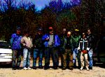
Ed Weiss, W1NXC, Herb S. Brier Award recipientEd Weiss, W1NXC received the prestigious Herb S. Brier Instructor of the Year Award this past Thursday night at the Framingham ARA’s “Night Out” Dinner at the Pacific Buffet in Framingham. Presenting the award and gift certificate were ARRL New England Division Director Tom Frenaye, K1KI and Eastern Massachusetts Section Manager Phil Temples, K9HI. Many of the club members in attendance stood up and gave testimony to Ed’s ceaseless and unwavering commitment to volunteer teaching of Amateur Radio material spanning many years.

Photo courtesy http://www.fara.org. More photos under Photo Gallery.

Billerica ARS “Yankee Doodle Day” Amateur Radio Exhibit

Billerica flagKen, WO1N writes:

Art, NF1A and I will be manning a BARS info booth on Saturday, September 13th, all day at the Billerica Yankee Doodle Day Town Celebration.

We will have an operating HF station and will be passing out achievement certificates to the youngsters who successfully send their names via CW on a Code Practice Oscillator.

While we’ve got this down to pretty much a two-man show, we would appreciate it if you could stop by and help out with “Booth Duty” to give us the opportunity for the occasional break. Even a half an hour would be great. While our spouses generally help out, the more the merrier.

As mentioned, Art and I will be there around 8:00 to begin set up. We will be at spot 22, the same spot we have been at for the past four years. It is located on the back side of the Billerica High School, across from the Hallenberg Ice Skating rink.

We will be monitoring 147.12 and look forward to hearing from you.

Ken
WO1N

Genesis ARS’ “Airport Fun Days” Exhibit

Genesis ARS' 'Airport Fun Days' ham exhibitDoing its part to spread public awareness about Amateur Radio, the Genesis ARS staffed a display table and demonstration station at Plymouth’s “Airport Fun Days” on August 31. The exhibit featured a colorful banner with the club’s name. GARS members report that they gained valuable insight into how to “do it better in the future.”

Several GARS members also assisted with communications in “The Run for the Rock” Road Race.

Thanks, Genesis ARS “Monthly Update” September, 2003

Head of the Charles Regatta Assistance Requested

Head of the Charles
Jeff Arnold writes:

I still need about two dozen more people to work this year’s Head of the Charles Regatta

October 17, 18, 19

Friday noon -6
Saturday 7am-6pm
Sunday 7am-5pm

I need 2 more person on land for Friday
I need 4 land people and 3 boats for Saturday
I need 9 land people and 5 boats for Sunday

If you can work more than one day that would be great.

If you already sent me your info, you are all set.
I will post the assignments shortly.
Thanks once again
Jeff

**************************************************
Jeffrey Arnold

RWJeffA@comcast.net
N1FWV@amsat.org
http://home.comcast.net/~rwjeffa/
**************************************************

New Section Managers Train in Newington

W1AW tower and antennas

Approximately 15 new Section Managers from across the United States attended a Section Manager’s Workshop September 5-7 in Newington, Connecticut. The Section Managers heard talks from Headquarters employees regarding the various services offered by the ARRL, ranging from Field Services and Training to Certification and Continuing Education to Marketing and Public Relations. The SMs also received a large quantity of useful materials and handouts.

The weekend event included time for discussions about problem-solving and informal social networking, as well as an opportunity to tour ARRL Headquarters and operate W1AW. The SM Workshop is a regular event; it is held annually in Newington, Connecticut at ARRL Headquarters.

Also attending were New England Vice Director Mike Raisbeck, K1TWF of Chelmsford, and Eastern Massachusetts Section Manager Phil Temples, K9HI of Watertown. Temples, a three-term Section Manager, was invited by the workshop organizers to participate and to share his experiences as a veteran Section Manager.


[Photo gallery]

N1IV Nominated for Phil McGan PR Award

Jim Duarte, N1IVJim Duarte, N1IV, has been nominated for the ARRL’s prestigious Philip J. McGan Memorial Silver Antenna Award. The McGan award is given annually to the individual who demonstrates volunteer public relations success on behalf of Amateur Radio at the local, state or national level, and will live up to the high standard of achievement exemplified by the late Philip J. McGan.

[I am pleased that the Sturdy Memorial Hospital ARC has nominated Jim Duarte, N1IV for this prestigious award. Jim has been a superb and consistent performer in the area of public relations on behalf of SMH ARC. He currently serves as Eastern Massachusetts Public Information Coordinator. Jim was instrumental in our securing this year’s Massachusetts Amateur Radio Day proclamation.

As a friend and former co-worker of Phil McGan, I can think of no better candidate deserving of this honor than N1IV. -K9HI]

WGBH Ice Cream FunFest Communications 9/13/03

WGBH Ice Cream FunfestBob Salow, WA1IDA writes:

The WGBH Ice Cream FunFest will be held on Saturday, 13 September 2003. Note that this year it is only on Saturday! For many years the Boston Amateur Radio Club has responded to their request for communications to assist and protect the 7000 (now 10,000 are expected) visitors at the WGBH (Public TV and FM) annual Ice Cream FunFest. It is held outside their studios on
Western Avenue in Brighton.

To those who have participated in past years, I can assure you that your service received their greatest praise. To you and any newcomers, your help is needed even more this year to assist with crowd and parking management and emergency needs. Our operation begins at 0900 and should be over before 1500.

The area is compact enough to use 2-meter hand-helds on simplex. Helpful is an antenna better than the rubber duck that came with your radio, as well as battery capacity to last the day.

Not only is this a visible ham public service, but we (and all their visitors) get to sample the wares of the ten ice cream providers FREE. Eat all you can, but don’t get sick!

WGBH is also kind enough to allow BARC booth space to promote and demonstrate ham radio to the visitors of all ages. Every year this proves to be a great opportunity to introduce ham radio to the public. You can be of help here, too.

Time is short and your help is needed. Please contact me as quickly as possible. If you have any questions, don’t hesitate to ask.

Bob Salow, WA1IDA
wa1ida@arrl.net
508.650.9440

Cape Cod, MS Challenge Walk Ham Volunteers Needed

MS logoRick Cantin, AA1TI wrote:

The National Multiple Sclerosis Society is looking for Ham Radio Operators to help with the MS Challenge Walk on Cape Cod September 12th, 13th and 14th.

The MS Challenge Walk, presented by Biogen/MS ActiveSource, is more than physical endurance, more than a test of mental strength. It is a life-changing event, a celebration of human spirit. Those who accept the challenge believe that one long journey over three days will ultimately shorten the road to the cure for multiple sclerosis.

For more information about the walk please follow this URL: http://www.perfectdaypublicity.com/challengewalk/newEngland/

To volunteer, please contact:

Brenda Barbour
Director of Volunteers
National Multiple Sclerosis Society
Central New England Chapter
101 A First Ave., Suite 6
Waltham, MA 02451
800-493-9255 x 135
781-890-4990 x 135
781-890-2089 – fax
www.msnewengland.org

U.S.S. Salem RC On For FISTS “Coast-to-Coast” Operating Event

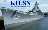
straight keyPi, K1RV wrote:

Hello to all other FISTS Club stations!

As stated before, the USS Salem Radio Club – K1USN (FISTS # 9239) plans to be active all day on Sunday September 14th from onboard the USS Salem. We are planning to operate several stations and will be using a variety of straight keys, paddles and bugs during the day. We intend to also fire up some of the USS Salem vintage radio gear on 7058 (±)! We hope to have lots of members participate onboard.We are hoping to have some good participation from other Clubs as well. We are fortunate to have K1VV – Whitey as one of our USS Salem members. He has recently been putting together some fantastic video CD and DVD presentations. He has done them for the Marconi 100th Anniversary event ( KM1CC ), New England Steam and Wireless Museum ( Rhode Island ), W1NZR Field Day ( Ft. Burnside, RI ) and has just completed a presentation about the recent International Lighthouse Weekend activities at N1P ( Ned’s Point ) and N1L ( Boston ) Lighthouses.

These are SUPER for promoting Ham Radio to the general public as well as for presentations at Club meetings. He is now working on a video presentation focusing on FISTS and the C2C weekend! He will be onboard the USS Salem taking photos and conducting interviews. He has requested that all of the participating FISTS Club stations send him two photos ( only two because his dial-up server will be swamped! ) accompanied by the names/callsigns of those in the photos. You could also send a brief summary of comments and highlights from your operation. Whitey’s e-mail address is k1vv@tmlp.com

If you have anything additional to send such as more photos, etc. please send them via snail mail to his Callbook address.

The final product video CD should be something that will be a useful and valuable resource for FISTS. I’ve already spoken with Nancy-WZ8C and she will get the first copy. We discussed having her get someone from FISTS to work with her to make additional copies to distribute to FISTS Clubs and individual members. This FISTS Promotional video can be distributed freely and copied by FISTS members making sure to give artistic credit to K1VV!

In light of the recent WARC regulation changes regarding elimination of the Morse requirement; we FISTS members need to do our part to find a new way to attract people to WANT to use CW and carry on the legacy.

73, Pi – K1RV FISTS # 7012

k1rv@hamtestonline.com

http://www.hamtestonline.com

Ham Radio Balloon Over New England Today

ham radio balloon/beaconTed T. Wright tedwright@csi.com wrote:

Everything is flight ready in Michigan, and Robert is monitoring the forecasts from different models. Just now he informed me that the models indicate favorable conditions TOMORROW (Friday 8/29/03), if they hold and the surface weather doesn’t prevent a morning launch. However, I fully expect this to change before tonight; that’s just the nature of this particular flight.

UPDATE: HamBONE/GPA-SD2 may fly on FRIDAY AUGUST 29!!! http://frodo.bruderhof.com/hambone/sd2.htm

HamBONE-GPA SD2 Solar tetroon from Michigan

Robert Rochte KC8UCH of the Grosse Pointe Academy in Michigan plans to fly a “Sky Diamond” tetrahedral zero-pressure solar floater carrying one of my beacons, adapted from the HamBONE-LD series. This is our first cooperative flight, and with the right conditions it could set a new record for distance or duration, or both. Solar balloons typically fly through the day and descend slowly after sunset.

We plan to launch the balloon from near Detroit, MI at about 9:00 local time, and ballast it to achieve a float altitude around 35,000 feet, where strong upper level winds will push it east across several states. This should give many people a chance to hear the 10 meter CW signal within about 250 miles of the balloon’s flight path. Likely areas within the radio footprint include northern Ohio and Pennsylvania, New York and New England, as well as southern Ontario, Canada. Tapes or transcripts of any portion of the flight telemetry will be very much appreciated, since no single ground station will be in range of the balloon for the whole duration of the flight. Contact the tracking center using the email address included in the
telemetry.

Recovery of the beacon is not planned, and of course the landing area cannot be predicted with any accuracy. If you hear telemetry from this beacon with increasing altimeter readings, please try to DF the signal using the nulls on the sides of a beam. Since the beacon batteries will last considerably longer than the flight (at least 4 days), there is a slight chance that recovery will be possible. That is, if it doesn’t land in the Atlantic!

The payload package includes:

* An 8-bit microcontroller (PIC 16C715)
* A barometric altimeter (MPX100A/LM358M)
* An outside temperature sensor (DS1721S)
* An insolation sensor (CdS cell in a ping-pong ball diffuser)
* Battery voltage monitor
* CW Beacon on 28.636 MHz (crystal oscillator)
* Vertically polarized 10m dipole antenna
* Eight AA Li-Fe batteries for 12V @ 2500 mAh

Telemetry format (sent every 2 minutes) :

DE KA2QPG BLN GPA/SD2 UP 14H34M A 033 T NEG 55C L 204 B 8.7V
EMAIL PT AT RIFTON.COM AR

where:

UP = flight time in hours and minutes
A = altimeter (absolute pressure, 0 – 255)
T = outside temperature (-99 – 99 degrees C)
L = light level (0 – 255, uncalibrated)
B = battery voltage (0.0 – 9.9 volts)

The remaining time in the 2-minute cycle will have a Morse “dit” and a beep of the piezo sounder every 4 seconds.

“What Is All That Stuff?”

eye-catching MIT Radio Society flyerFrom the “What-Is-All-This-Stuff-Department”: A recent walk through the Walker Memorial Building on the MIT campus revealed this attention-grabbing sign posted on the door of the MIT Radio Society.

A new academic school year begins soon at MIT and other college campuses throughout Eastern Massachusetts. That means the return of many younger hams along with renewed activity at the school clubs!